Skip to product information
1 of 1

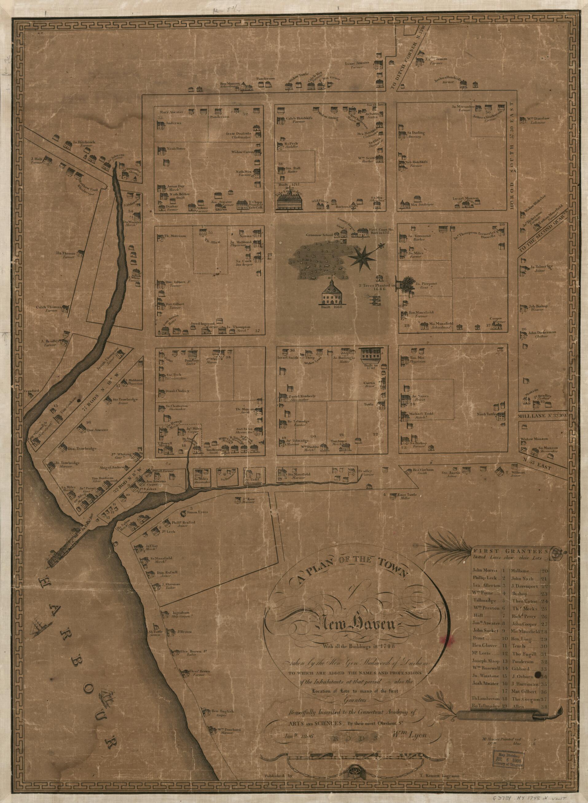
A Plan of the Town of New Haven : With All the Buildings In 1748 Taken by the Hon. Gen. Wadsworth of Durham to Which Are Added the Names and Professions of the Inhabitants at That Period : Also the Location of Lots to Many of the First Grantees 1806

Regular price
$97.95
Regular price
$147.95
Sale price
$97.95
Map Description
Old map of Connecticut, New Haven, United States.

Created by Connecticut Academy of Arts and Sciences, Thomas Kensett, Wm. (William) Lyon, James Wadsworth in 1806.
  • Pictorial historical map that shows historic buildings, historic trees, and ships.
  • Oriented with north toward the upper right.
  • Includes historical notes and index to lots of first grantees with names of grantees indicated.
  • Copy This map has some imperfections: worn, torn, darkened, annotated in pen-and-ink and pencil on verso, mounted on cloth backing. We'll do our best to restore the image before printing.

Map Tags

1806

Connecticut

Connecticut Academy Of Arts And Sciences

Historic Buildings

History

James Wadsworth

Landowners

Map

Maps

New Haven

New Haven (Conn.)

Real Property

Thomas Kensett

United States

Wm. (William) Lyon

Fine Art Quality Printed on heavyweight (230 gsm) archival paper with a classic matte finish
Professionally Restored For the best presentation, your map will be carefully retouched by our experienced team
Free Shipping Orders of $75 or more ship for free and arrive in 3-5 business days
Proudly Made in the USA All of our maps are custom printed to order in Portland, Maine
Help with Choosing a Map Size
Secure Checkout
Lifetime Warranty
Money-Back Guarantee
This old map of A Plan of the Town of New Haven : With All the Buildings In 1748 Taken by the Hon. Gen. Wadsworth of Durham to Which Are Added the Names and Professions of the Inhabitants at That Period : Also the Location of Lots to Many of the First Gr