
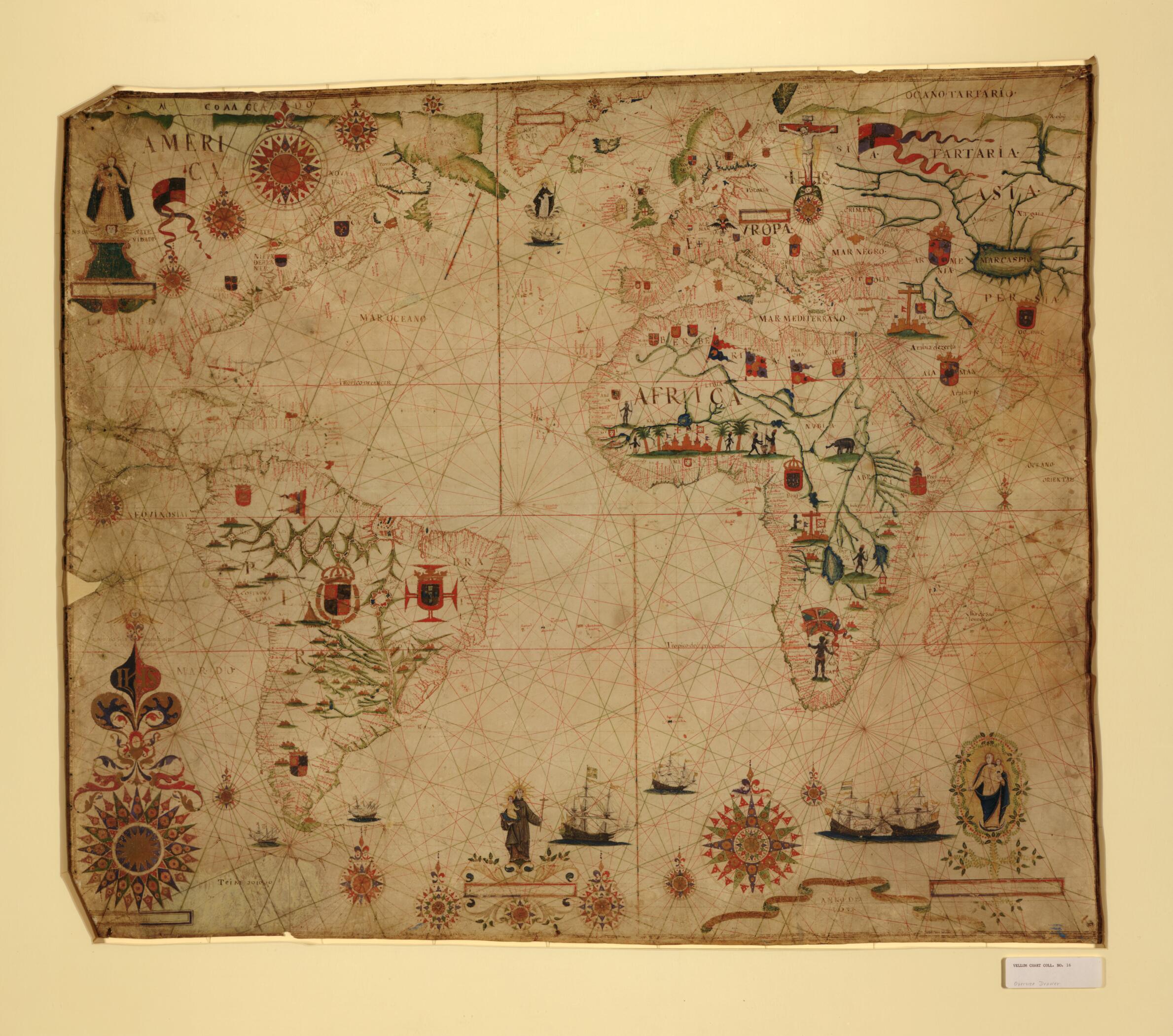
A Portolan Chart of the Atlantic Ocean and Adjacent Continents 1633
- Regular price
-
$171.95 - Regular price
-
$166.95 - Sale price
-
$171.95
Buy one map, get any other map in our collection for 50% OFF! Add to cart to see discount.
Couldn't load pickup availability
About This Map
Discover the timeless beauty of our fine art quality printed reproduction of this antique map. Perfect for history enthusiasts, collectors, and interior decorators.
Restored with meticulous attention to detail by our team with over a decade of experience, this stunning reproduction captures the intricate artistry and historical significance of the original map.
Whether you're a collector or seeking a unique decor piece, this archival-quality map reproduction is a timeless addition to any space. Order now to bring history to life!
Old manuscript map / portolan chart / early map of Africa, Asia, Atlantic Ocean, Europe, North America, South America.Created by Pascoal Roiz in 1633.
- Also shows the southeast Pacific Ocean, the southwest Indian Ocean, as well as the continents of South America, Africa, Europe, and portions of North America and Asia.
- Relief shown pictorially.
- Title supplied by cataloger.
- Pen-and-ink and watercolor, matted and mounted between panels of transparent Lucite plexiglass; the panels are riveted on a rigid frame (102 cm. x 118 cm.).
- Includes pictures of a fort, circle of compass roses, flags, insignia, coast-of-arms, and religious figures.
- Mended horizontal tears across left edge section, some losses along edges, discoloration throughout, with spotting along west side. Blue paint in lower right corner.
- For the best legibility, order your map in the original size or larger. Most maps have intricate detail and small text that is best appreciated when the print size hasn't been reduced.
- Sizes labeled "Fits a Standard Frame" will drop right into any frame that you purchase in that size. The sizes that we offer are commonly available online and at most retail stores.
- Our standard sizes are recommendations based on the aspect ratio of the original map, but still may require some added "white space" in one dimension to fit.
- Non-standard sizes will require custom framing, and we suggest taking your print to the frame shop of your choice after you receive it for the best results.
- Custom sizes are available, simply contact us for a quote.
Below is an approximation of the scale of a few standard sizes, and how they might appear in your space.

