
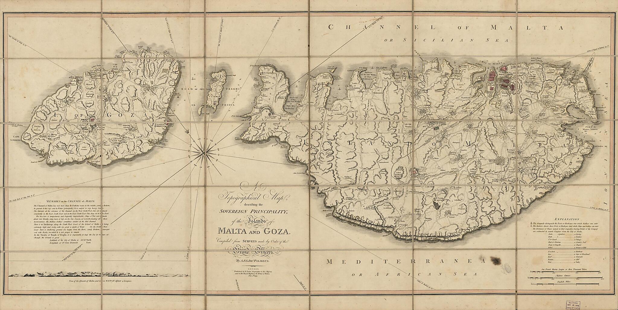
A Topographical Map Describing the Principality of the Islands of Malta and Goza in 1799
- Regular price
-
$93.95 - Regular price
-
$88.95 - Sale price
-
$93.95
Buy one map, get any other map in our collection for 50% OFF! Add to cart to see discount.
Couldn't load pickup availability
About This Map
Discover the timeless beauty of our fine art quality printed reproduction of this antique map. Perfect for history enthusiasts, collectors, and interior decorators.
Restored with meticulous attention to detail by our team with over a decade of experience, this stunning reproduction captures the intricate artistry and historical significance of the original map.
Whether you're a collector or seeking a unique decor piece, this archival-quality map reproduction is a timeless addition to any space. Order now to bring history to life!
Old topographic map / physical map / early map / bird's eye view of Gozo Island, Malta.Created by William Faden, A. F. Gervais De Palmeus in 1799.
- Topographic map showing field/fence/wall lines in rural areas.
- Relief shown by hachures and rock drawings (coastlines).
- Oriented with north toward the upper left.
- Handwritten Millard Fillmore signature is not present on recto or verso.
- When affixed to the cloth backing the map sheet was sectioned to 30 panels to enable folding.
- This map has some imperfections: use-worn, oil-stained at left of legend, lead-pencil annotation near the stain, foxed on cloth backing (verso). We'll do our best to restore the image before printing.
- Includes text, notes, elevation "View of the islands of Malta and Goza W.N.W.1/4W. distant 4 leagues", and elaborate 16-line compass rose extending over entire map area.
- On one of the cover panels on verso: No. 55 Malta 1799 [ink inscription] -- 6 Ctr [ink inscription on oval adhesive label].
Map Subjects
Early Maps
Early Works To 1800
Geography
Gozo Island
Gozo Island (Malta)
Malta
Physical Maps
Topographic Maps
Views
Eye Views
Bird's Eye Views
William Faden
A. F. Gervais De Palmeus
1799
- For the best legibility, order your map in the original size or larger. Most maps have intricate detail and small text that is best appreciated when the print size hasn't been reduced.
- Sizes labeled "Fits a Standard Frame" will drop right into any frame that you purchase in that size. The sizes that we offer are commonly available online and at most retail stores.
- Our standard sizes are recommendations based on the aspect ratio of the original map, but still may require some added "white space" in one dimension to fit.
- Non-standard sizes will require custom framing, and we suggest taking your print to the frame shop of your choice after you receive it for the best results.
- Custom sizes are available, simply contact us for a quote.
Below is an approximation of the scale of a few standard sizes, and how they might appear in your space.
