
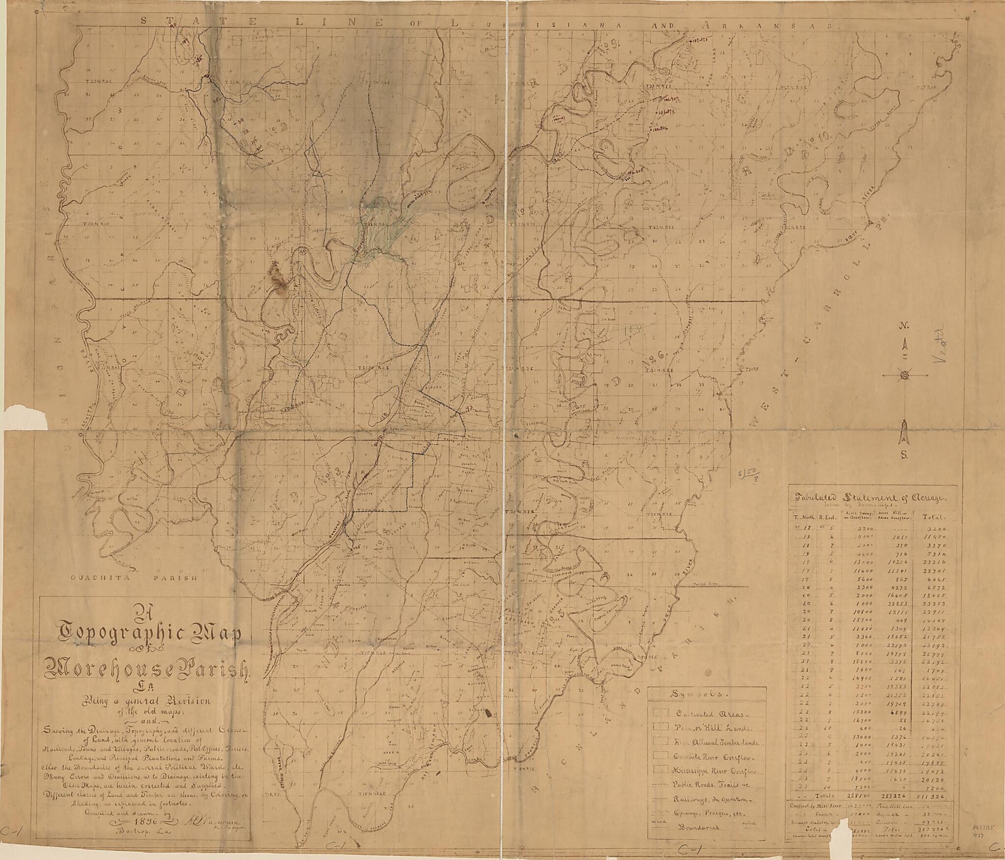
A Topographical Map of Morehouse Parish, La. : Being a General Revision of Old Maps 1896
- Regular price
-
$111.95 - Regular price
-
$106.95 - Sale price
-
$111.95
Buy one map, get any other map in our collection for 50% OFF! Add to cart to see discount.
Couldn't load pickup availability
About This Map
Discover the timeless beauty of our fine art quality printed reproduction of this antique map. Perfect for history enthusiasts, collectors, and interior decorators.
Restored with meticulous attention to detail by our team with over a decade of experience, this stunning reproduction captures the intricate artistry and historical significance of the original map.
Whether you're a collector or seeking a unique decor piece, this archival-quality map reproduction is a timeless addition to any space. Order now to bring history to life!
Old topographic map / cadastral map of Louisiana, Morehouse Parish, United States.Created by A. E. Washburn in 1896.
- Shows names of some residents.
- "Showing the drainage, topography, and different classes of land, with general location of railroads, towns and villages, public-roads, post offices, ferries, landings, and pricipal plantations and farms. Also the boundaries of several political wards ... shading explained in footnotes."
- Annotated in green pencil and blue and black in.
- Copy This map has some imperfections: mounted on cloth back, losses along the edges and folded in half. We'll do our best to restore the image before printing.
- Includes tabulated statement of acreage taken by townships.
- Land Ownership Map
Map Subjects
Cadastral Maps
Landowners
Louisiana
Morehouse Parish
Morehouse Parish (La.)
Physical Geography
Topographic Maps
United States
Topographic Maps
Cadastral Maps
A. E. Washburn
1896
- For the best legibility, order your map in the original size or larger. Most maps have intricate detail and small text that is best appreciated when the print size hasn't been reduced.
- Sizes labeled "Fits a Standard Frame" will drop right into any frame that you purchase in that size. The sizes that we offer are commonly available online and at most retail stores.
- Our standard sizes are recommendations based on the aspect ratio of the original map, but still may require some added "white space" in one dimension to fit.
- Non-standard sizes will require custom framing, and we suggest taking your print to the frame shop of your choice after you receive it for the best results.
- Custom sizes are available, simply contact us for a quote.
Below is an approximation of the scale of a few standard sizes, and how they might appear in your space.

