1
/
of
1
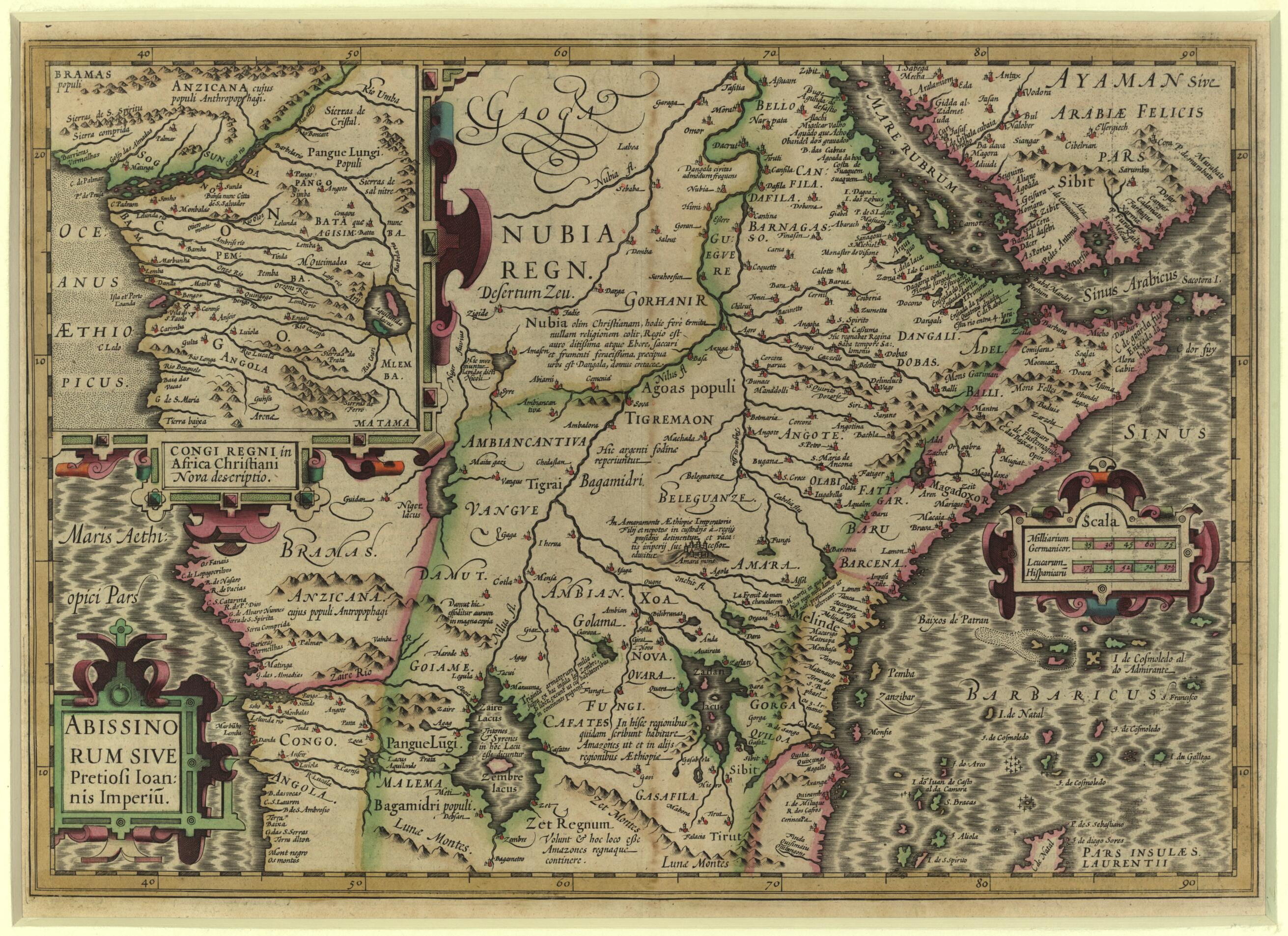
Abyssinia, Or the Empire of Prester John. (Abissinorum Sive Pretiosi Ioannis Imperiu) 1619
- Regular price
-
$56.95 - Regular price
-
$82.95 - Sale price
-
$56.95
Couldn't load pickup availability
90-Day Satisfaction Guarantee & Free Returns
About This Map
Discover the timeless beauty of our fine art quality printed reproduction of this antique map. Perfect for history enthusiasts, collectors, and interior decorators.
Restored with meticulous attention to detail by our team with over a decade of experience, this stunning reproduction captures the intricate artistry and historical significance of the original map.
Whether you're a collector or seeking a unique decor piece, this archival-quality map reproduction is a timeless addition to any space. Order now to bring history to life!
1612) was a Flemish cartographer and publisher of maps and a central figure in the golden age of Dutch cartography. He was responsible for publishing the maps of Gerhard Mercator (1512-94), the single most important cartographer of the age of discovery, after he bought the plates to Mercator's atlas from his grandsons. Hondius then worked with his brother-in-law, the engraver Pieter van der Keere, to add about 40 new maps to Mercator's atlas to create what became known as the Mercator-Hondius Atlas, published in Amsterdam in 1606. The Hondius publishing house remained one of the most important businesses active in the European map trade until the early 1630s. This map depicts the realm of the legendary Christian emperor Prester John in Abyssinia (present-day Ethiopia). The legend emerged during the 12th century-Prester John may have been a real person, a "Presbyter John" during the Crusades-and concerned parts of the world that seemed exotic and were not well known or understood at the time. The story was an object of much speculation from the Middle Ages up to the early modern period. The map abounds in the fantasies of the time about the interior of Africa. In addition to the empire of Prester John, the map shows the lands of the Amazons throughout the southern regions and a nearby lake named Zaire inhabited by Tritons and Sirens. Cannibals threaten the then recently Christianized kingdom of the Congo on the Atlantic coast of Africa. The Atlantic is here called the Oceanus Aethiopicus (Ethiopian Ocean), and the coast is shown in more detail in the inset map-possibly derived from a 1591 map of the Congo by Filippo Pigafetta (1533-1604), itself derived from the reports of the Portuguese explorer Duarte Lopez, who reached the Congo in 1578 and stayed for some years. The inset bears a title cartouche that reads "Congi Regni in Africa Christiani Nova description" (Christian Kingdom of the Congo, new description). The map also depicts part of Arabia, up to Gidda (Jeddah) on the Red Sea, including Mecha (Mecca) somewhat north of its true position, the area of the Straits of Bab el-Mandeb and along the coast of Yemen and east to the area of Zufar in present-day Oman. The Gulf of Aden is here named the Sinus Arabicus (Arabian Gulf). Many details are speculative, with an exaggerated number of rivers and Lakes Tanganyika and Victoria much smaller than they should be. The map has scales in German miles and Spanish leagues. Relief is shown pictorially.Created by Jodocus Hondius, Gerhard Mercator in 1619.
- Title devised, in English, by Library staff.
- Original resource extent: 1 map : color ; 34 x 49 centimeters.
- Reference extracted from World Digital Library: Glenn Van den Bosch, "Maps on the Legend of Prester John," Brussels International Map Collectors' Circle (BIMCC) Newsletter, number 29, September 2007. http://www.bimcc.org/uploads/newsletters/nl29.pdf. External
- Original resource at: Qatar National Library.
- Content in Latin.
- Description based on data extracted from World Digital Library, which may be extracted from partner institutions.
Map Tags
1619
Gerhard Mercator
Jodocus Hondius
Map
Maps
Prester John (Legendary Character)
Secure Checkout
Lifetime Warranty
Money-Back Guarantee

Map Sizing Information
- For the best legibility, order your map in the original size or larger. Most maps have intricate detail and small text that is best appreciated when the print size hasn't been reduced.
- Sizes labeled "Fits a Standard Frame" will drop right into any frame that you purchase in that size. The sizes that we offer are commonly available online and at most retail stores.
- Our standard sizes are recommendations based on the aspect ratio of the original map, but still may require some added "white space" in one dimension to fit.
- Non-standard sizes will require custom framing, and we suggest taking your print to the frame shop of your choice after you receive it for the best results.
- Custom sizes are available, simply contact us for a quote.
Below is an approximation of the scale of a few standard sizes, and how they might appear in your space.


