
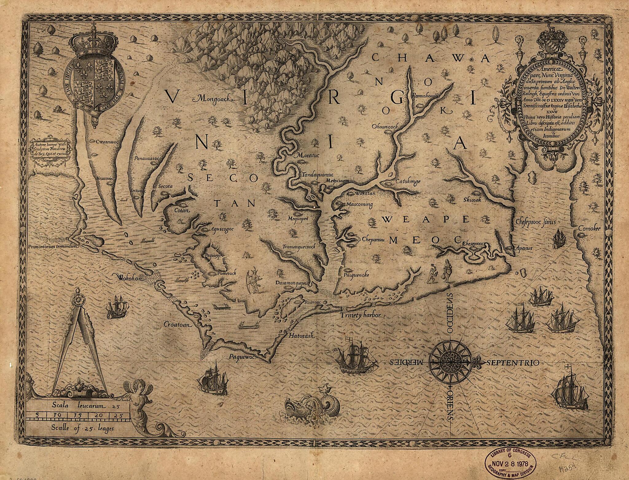
Americæ Pars, Nunc Virginia Dicta : Primum Ab Anglis Inuenta, Sumtibus Dn. Walteri Raleigh, Equestris Ordinis Viri, Anno Dn̄i. MDLXXXV Regni Vero Sereniss. Nostræ Reginæ Elisabethæ XXVII, Hujus Vero Historia Peculiari Libro Descripta Est, Additis...
- Regular price
-
$49.95 - Regular price
-
$34.95 - Sale price
-
$49.95
Buy one map, get any other map in our collection for 50% OFF! Add to cart to see discount.
Couldn't load pickup availability
About This Map
Discover the timeless beauty of our fine art quality printed reproduction of this antique map. Perfect for history enthusiasts, collectors, and interior decorators.
Restored with meticulous attention to detail by our team with over a decade of experience, this stunning reproduction captures the intricate artistry and historical significance of the original map.
Whether you're a collector or seeking a unique decor piece, this archival-quality map reproduction is a timeless addition to any space. Order now to bring history to life!
Old map of North Carolina, Roanoke Colony, United States, Virginia.Created by Theodor De Bry, Thomas Harriot, John White in 1590.
- Scale ca. 1:1,700,000.
- Has watermark.
- Oriented with north to the right.
- Relief shown pictorially and by hachures.
- Pictorial map.
- Covers coastal region from Cape Fear to Chesapeake Bay.
- From Thomas Hariot's A briefe and true report of the new found land of Virginia, 1590.
Map Subjects
Early Works To 1800
North Carolina
Roanoke Colony
United States
Virginia
Theodor De Bry
Thomas Harriot
John White
1590
- For the best legibility, order your map in the original size or larger. Most maps have intricate detail and small text that is best appreciated when the print size hasn't been reduced.
- Sizes labeled "Fits a Standard Frame" will drop right into any frame that you purchase in that size. The sizes that we offer are commonly available online and at most retail stores.
- Our standard sizes are recommendations based on the aspect ratio of the original map, but still may require some added "white space" in one dimension to fit.
- Non-standard sizes will require custom framing, and we suggest taking your print to the frame shop of your choice after you receive it for the best results.
- Custom sizes are available, simply contact us for a quote.
Below is an approximation of the scale of a few standard sizes, and how they might appear in your space.

