
Arabia 1856
- Regular price
-
$49.95 - Regular price
-
$34.95 - Sale price
-
$49.95
Buy one map, get any other map in our collection for 50% OFF! Add to cart to see discount.
Couldn't load pickup availability
About This Map
Discover the timeless beauty of our fine art quality printed reproduction of this antique map. Perfect for history enthusiasts, collectors, and interior decorators.
Restored with meticulous attention to detail by our team with over a decade of experience, this stunning reproduction captures the intricate artistry and historical significance of the original map.
Whether you're a collector or seeking a unique decor piece, this archival-quality map reproduction is a timeless addition to any space. Order now to bring history to life!
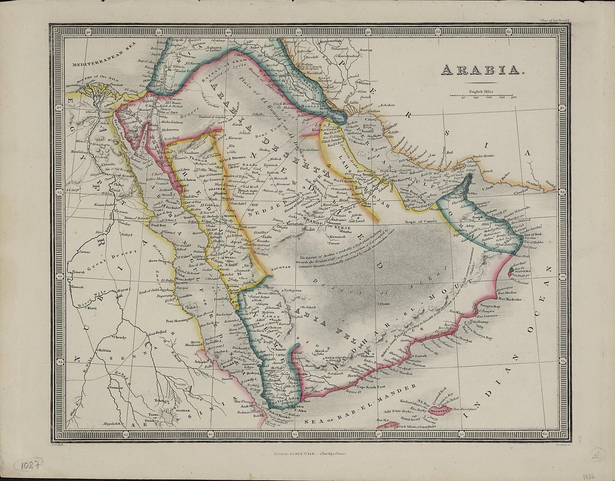
Old map of Bahrain, Djibouti, Egypt, Eritrea, Ethiopia, Iran, Islamic Republic of, Iraq, Israel, Jordan, Kuwait, Oman, Qatar, Saudi Arabia, Somalia, Sudan, United Arab Emirates, Yemen.1836) in 1824 and in successive editions by his son, James Wyld the younger (1812-87). Political divisions are indicated by colored lines and the scale is in English miles. Cities, towns, wells, and caravan routes to Mecca are shown. An annotation on the map reflects the limited state of European knowledge about geography of parts of the peninsula: "The interior of Arabia is probably a high plain inclining towards the Persian Gulf; a great proportion of it is occupied by extensive Deserts, occasionally seperated [sic] by small mountainous Oases." After studying at the Royal Military Academy at Woolwich, James Wyld the younger joined his father's mapmaking and publishing firm, which he eventually inherited. Wyld published numerous maps, many of which were intended to satisfy public interest in current events, such as the First Anglo-Afghan War, the California Gold Rush, and the Crimean War. Wyld's maps were of high quality, and he was appointed geographer to Queen Victoria and Prince Albert.
- Title devised, in English, by Library staff.
- Original resource extent: 1 map ; 21 x 26 centimeters.
- Reference extracted from World Digital Library: Elizabeth Baigent, "Wyld, James, the younger (1812--1887)," Oxford Dictionary of National Biography (Oxford: Oxford University Press, 2004).
- Original resource at: Qatar National Library.
- Content in English.
- Description based on data extracted from World Digital Library, which may be extracted from partner institutions.
Map Subjects
Arabian Gulf
Arabian Peninsula
Bahrain
Djibouti
Egypt
Eritrea
Ethiopia
Iran Islamic Republic Of
Iraq
Israel
Jordan
Kuwait
Oman
Persian Gulf
Qatar
Red Sea
Saudi Arabia
Somalia
Sudan
United Arab Emirates
Yemen
1856
- For the best legibility, order your map in the original size or larger. Most maps have intricate detail and small text that is best appreciated when the print size hasn't been reduced.
- Sizes labeled "Fits a Standard Frame" will drop right into any frame that you purchase in that size. The sizes that we offer are commonly available online and at most retail stores.
- Our standard sizes are recommendations based on the aspect ratio of the original map, but still may require some added "white space" in one dimension to fit.
- Non-standard sizes will require custom framing, and we suggest taking your print to the frame shop of your choice after you receive it for the best results.
- Custom sizes are available, simply contact us for a quote.
Below is an approximation of the scale of a few standard sizes, and how they might appear in your space.

