
1860
- Regular price
-
$202.95 - Regular price
-
$197.95 - Sale price
-
$202.95
Shipping calculated at checkout.
Buy one map, get any other map in our collection for 50% OFF! Add to cart to see discount.
Couldn't load pickup availability
About This Map
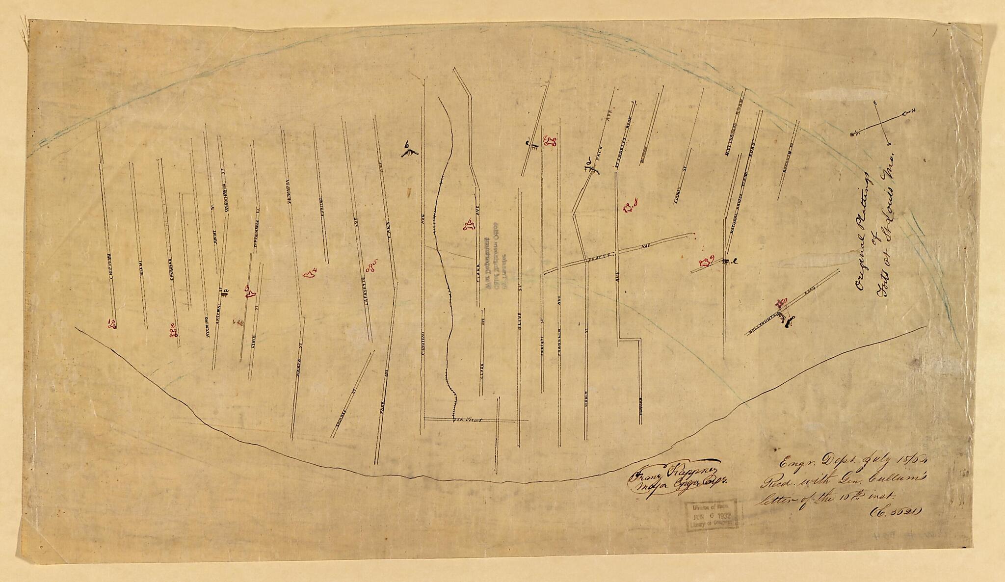
Old map of Missouri, Saint Louis, United States.
Created by United States. Army. Corps of Engineers in 1860.
Created by United States. Army. Corps of Engineers in 1860.
- "145.D"
- Detailed series of pen and ink drawings of the forts defending St. Louis.
- Orientation varies.
- "Engr. Dept. July 18/64. Recd. with Gen. Cullum's letter of the 16th inst. (C. 5621)."-- on most maps.
- Some of the maps are signed "Franz Kappner, Major, Engr. Corps" and "F. Hassendeubel, Col. com. Engineer Corps."
- Includes cross sections on some maps.
- Description derived from published civil war bibliography.
- Civil War Map
Map Subjects
Civil War
History
Maps Manuscript
Missouri
Saint Louis
Saint Louis (Mo.)
United States
United States. Army. Corps Of Engineers
1860
Map Sizing Information
- For the best legibility, order your map in the original size or larger. Most maps have intricate detail and small text that is best appreciated when the print size hasn't been reduced.
- Sizes labeled "Fits a Standard Frame" will drop right into any frame that you purchase in that size. The sizes that we offer are commonly available online and at most retail stores.
- Our standard sizes are recommendations based on the aspect ratio of the original map, but still may require some added "white space" in one dimension to fit.
- Non-standard sizes will require custom framing, and we suggest taking your print to the frame shop of your choice after you receive it for the best results.
- Custom sizes are available, simply contact us for a quote.
Below is an approximation of the scale of a few standard sizes, and how they might appear in your space.
