Skip to product information
1 of 1

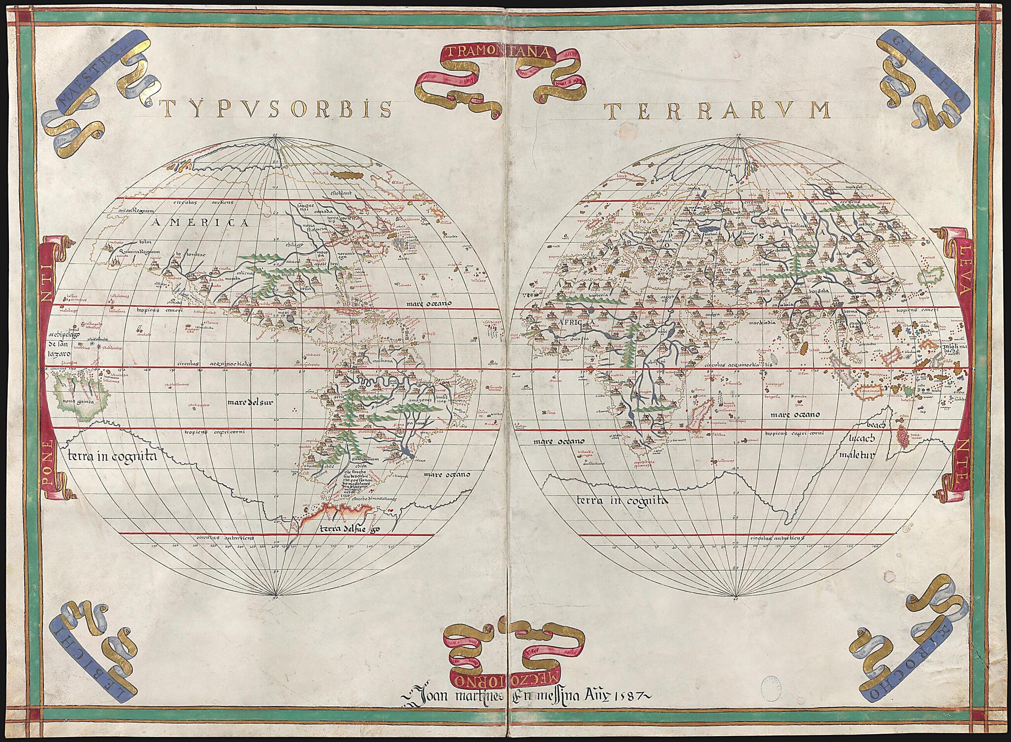
Atlas of Joan Martines. (Atlas De Joan Martines) 1587

Regular price
$34.95
Regular price
$53.95
Sale price
$34.95
Help with Choosing a Map Size

90-Day Satisfaction Guarantee & Free Returns

About This Map

Discover the timeless beauty of our fine art quality printed reproduction of this antique map. Perfect for history enthusiasts, collectors, and interior decorators.

Restored with meticulous attention to detail by our team with over a decade of experience, this stunning reproduction captures the intricate artistry and historical significance of the original map.

Whether you're a collector or seeking a unique decor piece, this archival-quality map reproduction is a timeless addition to any space. Order now to bring history to life!

names are given in Gothic letters, in red and black ink, and in Roman small capitals. There are six nautical charts, 11 regional maps, and two maps of the world, all luxuriously illuminated in colored-wash drawing, with panes of gold and silver. Most of the maps have a large compass rose showing 16 or 32 directions, and some of the maps depict ships sailing the seas.
Created by Joan Martines in 1587.
  • Title devised, in English, by Library staff.
  • Original resource extent: 19 maps ; 58 x 80 centimeters.
  • Original resource at: National Library of Spain.
  • Content in Spanish.
  • Description based on data extracted from World Digital Library, which may be extracted from partner institutions.

Map Subjects

Illuminations

Manuscript Maps

Nautical Charts

Portolan Charts

World Maps

Joan Martines

1587

Map Tags

1587

Illuminations

Joan Martines

Manuscript Maps

Map

Nautical Charts

Portolan Charts

World Maps

Secure Checkout
Lifetime Warranty
Money-Back Guarantee
This old map of Atlas of Joan Martines. (Atlas De Joan Martines) from 1587 was created by Joan Martines in 1587