
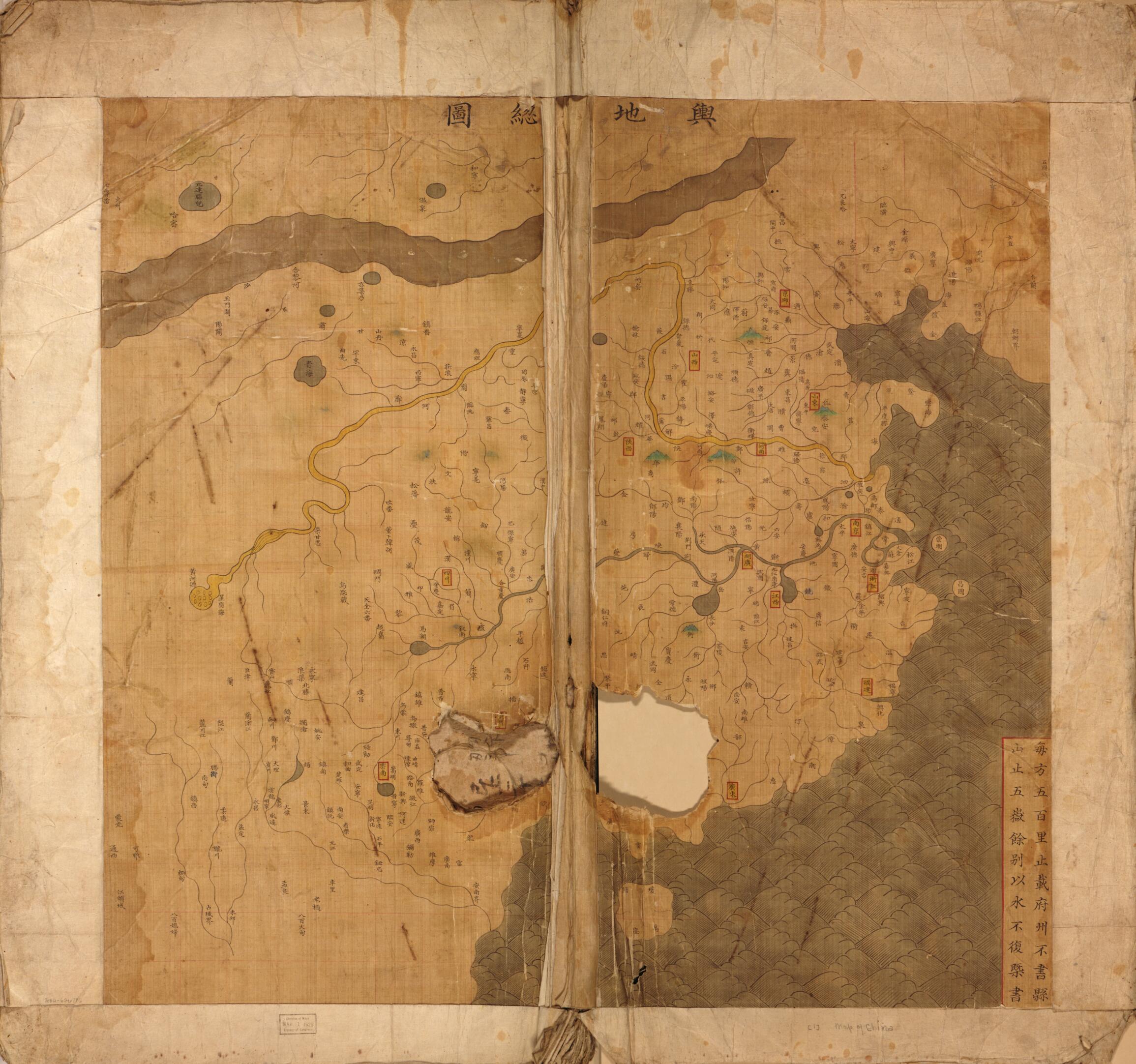
大明與地图, Atlas of the Ming Empire in 1547
- Regular price
-
$101.95 - Regular price
-
$96.95 - Sale price
-
$101.95
Shipping calculated at checkout.
Buy one map, get any other map in our collection for 50% OFF! Add to cart to see discount.
Couldn't load pickup availability
About This Map
Old map of China.
Created by Langdon Warner in 1547.
Created by Langdon Warner in 1547.
- Title supplied.
- Copy This map has some imperfections: acquired copy has holes on some pages. We'll do our best to restore the image before printing.
- Includes text.
- Gift; Warner purchase; 1929, no. 10.
- Previous call number: G2305 .D3 1566 Vault Shelf
- Shows 18 maps, includes 13 provinces, 2 zhili, and general maps during (嘉靖年間) Jianjing period. Taiwan is not shown, and Macau is not marked in this atlas.
- Covers Bei Zhili, Nan Zhili, Shandong, Liaodong, Shanxi, Henan, Shanxi, Gansu, Zhejiang, Jiangxi, Huguang, Sichuan, Fujian, Guangdong, Guangxi, Yunnan, and Guizhou. Taiwan is not shown, and Macau is not marked.
- "與地总图" uses Chinese grid system, each square represents 500 miles.
- "康熙按七年 (1668) 五月初上納,南陽县监” -- on back.
Map Sizing Information
- For the best legibility, order your map in the original size or larger. Most maps have intricate detail and small text that is best appreciated when the print size hasn't been reduced.
- Sizes labeled "Fits a Standard Frame" will drop right into any frame that you purchase in that size. The sizes that we offer are commonly available online and at most retail stores.
- Our standard sizes are recommendations based on the aspect ratio of the original map, but still may require some added "white space" in one dimension to fit.
- Non-standard sizes will require custom framing, and we suggest taking your print to the frame shop of your choice after you receive it for the best results.
- Custom sizes are available, simply contact us for a quote.
Below is an approximation of the scale of a few standard sizes, and how they might appear in your space.

