
Auction Sale to Close Estate of Mary P. Chrystie, Dec'd, 23 Building Plots, Also Harlem River Water Front, Near Morris Heights Stations, New York Central and New York & Northern Railroads : Wednesday, November 22d, 1893, at 12 O'clock Noon at No. 111 ...
- Regular price
-
$133.95 - Regular price
-
$128.95 - Sale price
-
$133.95
Buy one map, get any other map in our collection for 50% OFF! Add to cart to see discount.
Couldn't load pickup availability
About This Map
Discover the timeless beauty of our fine art quality printed reproduction of this antique map. Perfect for history enthusiasts, collectors, and interior decorators.
Restored with meticulous attention to detail by our team with over a decade of experience, this stunning reproduction captures the intricate artistry and historical significance of the original map.
Whether you're a collector or seeking a unique decor piece, this archival-quality map reproduction is a timeless addition to any space. Order now to bring history to life!
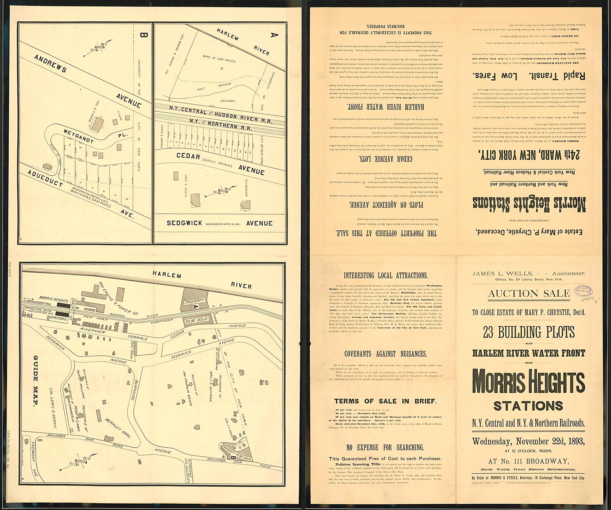
Old map of Morris Heights, New York, New York (State), United States.Created by Morris & Steele, James L. (James Lee) Wells in 1893.
- Street map showing properties to be sold, existing buildings (some with owners' names), and railroad stations.
- Title from panel.
- Within map border: Copyright 1893 by Jas. L. Wells.
- Superimposed name ititials in lower right corner: WL[?] or LW[?].
- Includes 2 ancillary cadastral maps (with lot lines, lot numbers, dimensions, buildings, owners' names) at scale ca. 1:800: A. [Harlem River tract] -- B. [Weygandt Place tract].
- Text and auction announcements on verso.
Map Subjects
Estate Sales
Landowners
Morris Heights
Morris Heights (New York N.Y.)
New York
New York (State)
Real Property
United States
Morris & Steele
James L. (James Lee) Wells
1893
- For the best legibility, order your map in the original size or larger. Most maps have intricate detail and small text that is best appreciated when the print size hasn't been reduced.
- Sizes labeled "Fits a Standard Frame" will drop right into any frame that you purchase in that size. The sizes that we offer are commonly available online and at most retail stores.
- Our standard sizes are recommendations based on the aspect ratio of the original map, but still may require some added "white space" in one dimension to fit.
- Non-standard sizes will require custom framing, and we suggest taking your print to the frame shop of your choice after you receive it for the best results.
- Custom sizes are available, simply contact us for a quote.
Below is an approximation of the scale of a few standard sizes, and how they might appear in your space.

