
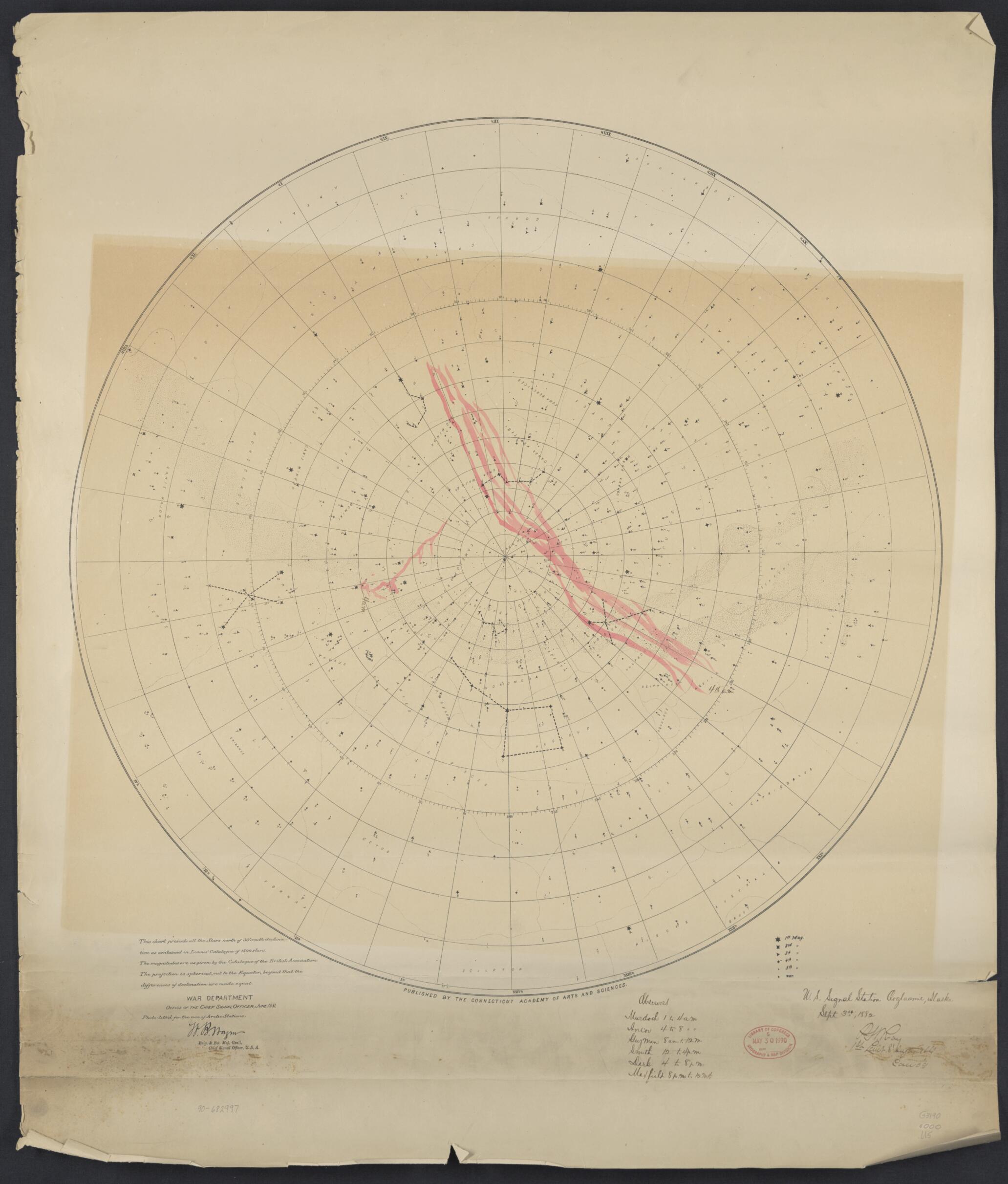
Aurora Charts, September & October 1882 : as Viewed from U.S. Signal Station, Ooglaamie, Alaska
- Regular price
-
$99.95 - Regular price
-
$94.95 - Sale price
-
$99.95
Buy one map, get any other map in our collection for 50% OFF! Add to cart to see discount.
Couldn't load pickup availability
About This Map
Discover the timeless beauty of our fine art quality printed reproduction of this antique map. Perfect for history enthusiasts, collectors, and interior decorators.
Restored with meticulous attention to detail by our team with over a decade of experience, this stunning reproduction captures the intricate artistry and historical significance of the original map.
Whether you're a collector or seeking a unique decor piece, this archival-quality map reproduction is a timeless addition to any space. Order now to bring history to life!
Old map of Alaska, United States.Created by Carnegie Institution of Washington. Department of Terrestrial Magnetism, Connecticut Academy of Arts and Sciences, United States. Army. Signal Corps in 1882.
- Title from ink annotation on cover.
- "This chart presents all the stars north of 30⁰ south declination as contained in Loomis' Catalogue of 1500 stars. The magnitudes are as given by the Catalogue of the British Association. The projection is spherical, out to the equator, beyond that the differences of declination are made equal."
- Gift of Carnegie Institution of Washington, Dept. of Terrestrial Magnetism.
- For the best legibility, order your map in the original size or larger. Most maps have intricate detail and small text that is best appreciated when the print size hasn't been reduced.
- Sizes labeled "Fits a Standard Frame" will drop right into any frame that you purchase in that size. The sizes that we offer are commonly available online and at most retail stores.
- Our standard sizes are recommendations based on the aspect ratio of the original map, but still may require some added "white space" in one dimension to fit.
- Non-standard sizes will require custom framing, and we suggest taking your print to the frame shop of your choice after you receive it for the best results.
- Custom sizes are available, simply contact us for a quote.
Below is an approximation of the scale of a few standard sizes, and how they might appear in your space.

