
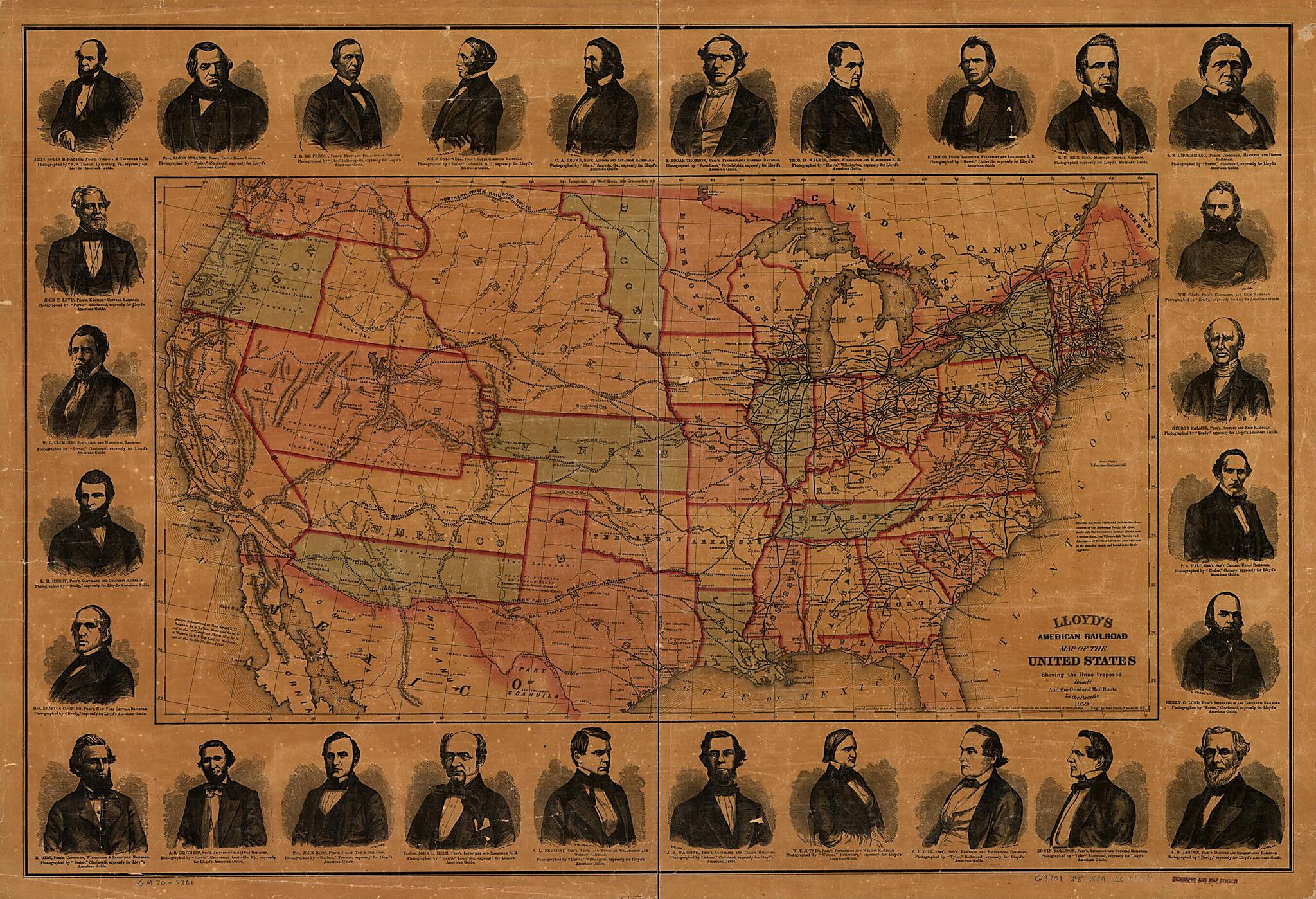
Lloyd's American Railroad Map of the United States, Showing the Three Proposed Roads and the Overland Mail Route to the Pacific 1859
- Regular price
-
$96.95 - Regular price
-
$91.95 - Sale price
-
$96.95
Buy one map, get any other map in our collection for 50% OFF! Add to cart to see discount.
Couldn't load pickup availability
About This Map
Discover the timeless beauty of our fine art quality printed reproduction of this antique map. Perfect for history enthusiasts, collectors, and interior decorators.
Restored with meticulous attention to detail by our team with over a decade of experience, this stunning reproduction captures the intricate artistry and historical significance of the original map.
Whether you're a collector or seeking a unique decor piece, this archival-quality map reproduction is a timeless addition to any space. Order now to bring history to life!
Outline map of the continental United States showing drainage, state boundaries, major cities, forts, finished and proposed railroads. [From published bibliography]Created by James T. Lloyd, Rae Smith in 1859.
- Scale ca. 1:6,500,000.
- Relief shown by hachures.
- Portraits of 28 railroad presidents are reproduced in the border, including: John Robin McDaniel, Jacob Strader, J. D. De Frees, John Caldwell, C. A. Brown, J. Edgar Thompson, Thos. D. Walker, E. Hobbs, R. N. Rice, S. S. L'Hommedieu, Wm. Case, George Palmer, P. A. Hall, Henry C. Lord, A. G. Jaudon, Edwin Robinson, E. H. Gill, W. T. Joynes, J. B. Warring, S. L. Fremont, John L. Helm, John Ross, A. S. Crothers, E. Gest, Erastus Corning, L. M. Hubby, W. H. Clements, John T. Levis,
- "Entered according to act of Congress in the year 1859 by J.T. Lloyd in the clerk's office of the District Court of the United States ..."
- "Drawn & engraved at Rae Smith's ... N.Y. from materials furnished to the 36th Congress, March 1859 by G.K. Warren, Lt. U.S. Top. Eng. for the passage of the Pacific Railroad bill."
- Includes portraits of 28 railroad presidents.
Map Subjects
Railroads
United States
James T. Lloyd
Rae Smith
1859
- For the best legibility, order your map in the original size or larger. Most maps have intricate detail and small text that is best appreciated when the print size hasn't been reduced.
- Sizes labeled "Fits a Standard Frame" will drop right into any frame that you purchase in that size. The sizes that we offer are commonly available online and at most retail stores.
- Our standard sizes are recommendations based on the aspect ratio of the original map, but still may require some added "white space" in one dimension to fit.
- Non-standard sizes will require custom framing, and we suggest taking your print to the frame shop of your choice after you receive it for the best results.
- Custom sizes are available, simply contact us for a quote.
Below is an approximation of the scale of a few standard sizes, and how they might appear in your space.
