
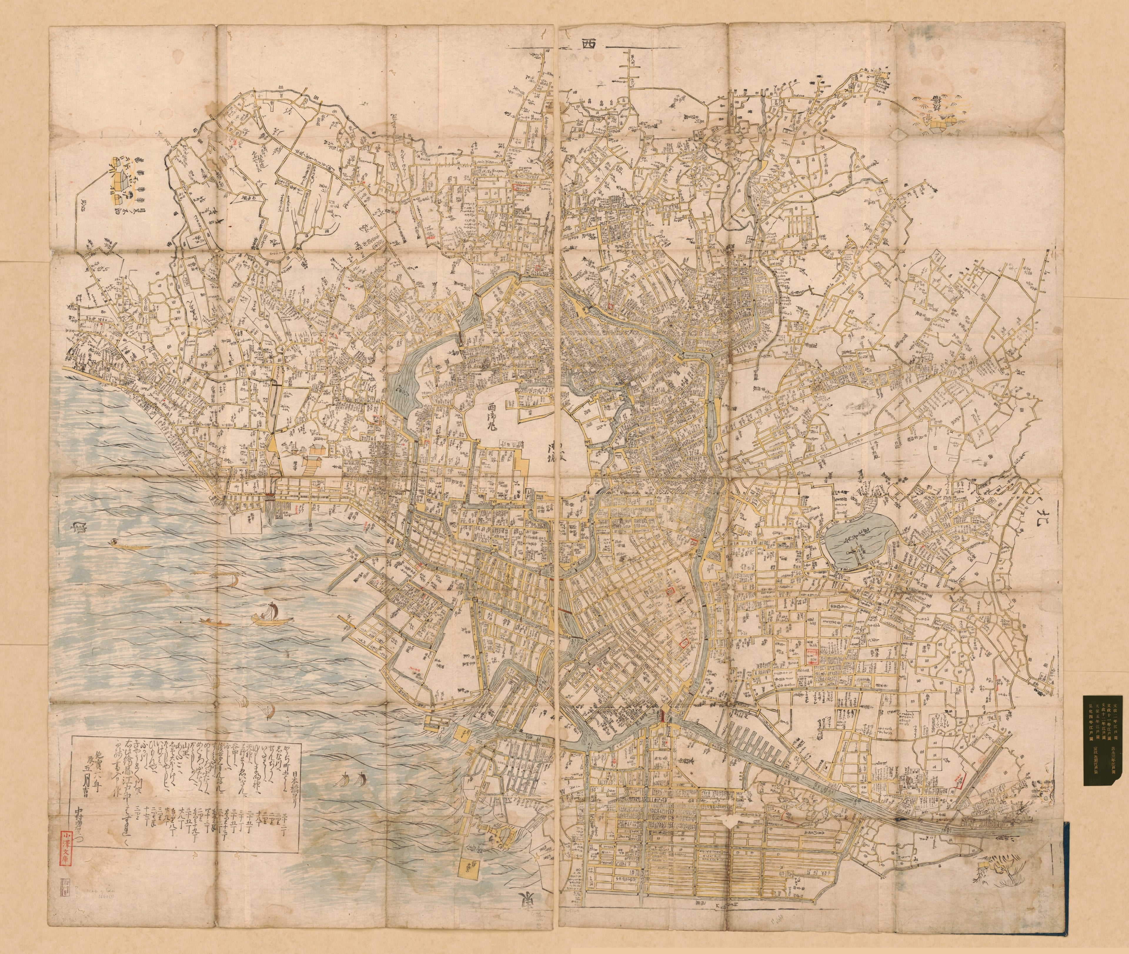
江戶大絵図, 絵入 / in 1676
- Regular price
-
$210.95 - Regular price
-
$205.95 - Sale price
-
$210.95
Shipping calculated at checkout.
Buy one map, get any other map in our collection for 50% OFF! Add to cart to see discount.
Couldn't load pickup availability
About This Map
Old early map of Japan, Tokyo.
Created by Ichiemon Nakamura in 1676.
Created by Ichiemon Nakamura in 1676.
- Scale approximately 1:10,000.
- Manuscript map in watercolor, hand colored, wood block print.
- Covers Edo Castle and the surrounding area.
- Cover title.
- Oriented with north to the right.
- Japanese.
- Cadastral map showing landowners.
- Publication date hand written in note,"延寶六年辰ノ五日吉日."
- Includes distance chart from Nihonbashi, "日本橋ヨリ・かうぢ町 ... 三十二丁."
- Identical map in Tokyo University Collection, publication date on the map, "延寶五丁巳九月吉辰日" Eihō 5 (1677) edition, wood printing, black and white.
Map Sizing Information
- For the best legibility, order your map in the original size or larger. Most maps have intricate detail and small text that is best appreciated when the print size hasn't been reduced.
- Sizes labeled "Fits a Standard Frame" will drop right into any frame that you purchase in that size. The sizes that we offer are commonly available online and at most retail stores.
- Our standard sizes are recommendations based on the aspect ratio of the original map, but still may require some added "white space" in one dimension to fit.
- Non-standard sizes will require custom framing, and we suggest taking your print to the frame shop of your choice after you receive it for the best results.
- Custom sizes are available, simply contact us for a quote.
Below is an approximation of the scale of a few standard sizes, and how they might appear in your space.

