
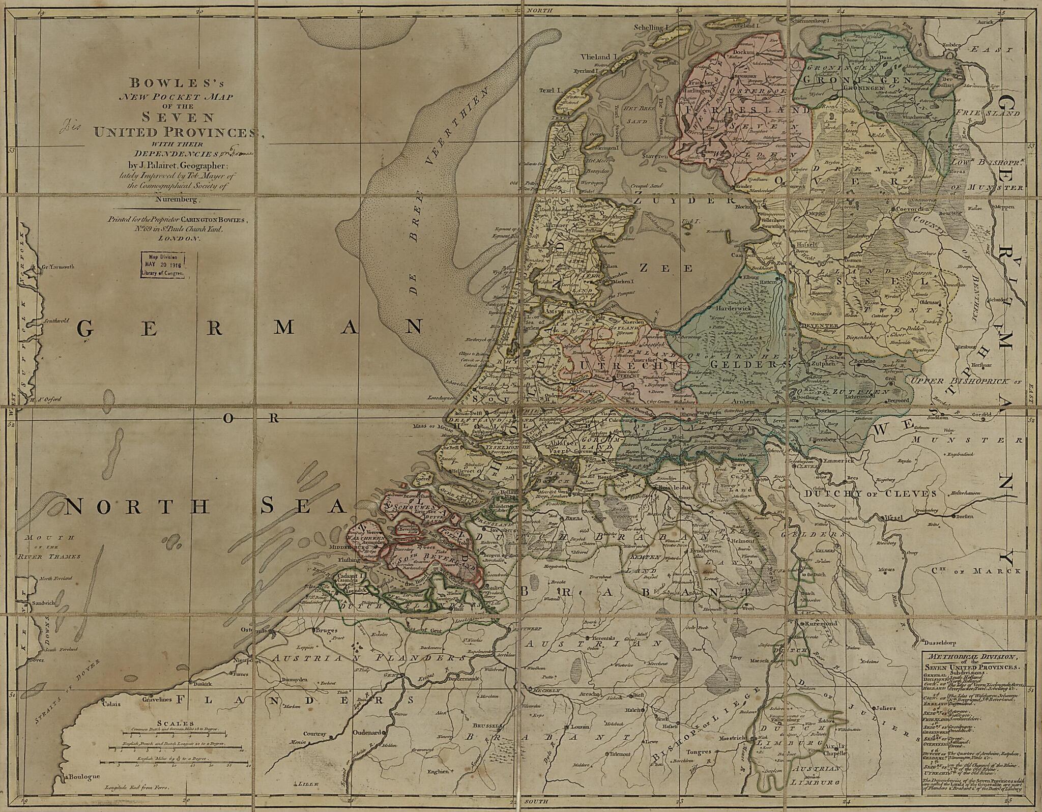
Bowles's New Pocket Map of the Seven United Provinces : With Their Dependencies 1785
- Regular price
-
$53.95 - Regular price
-
$48.95 - Sale price
-
$53.95
Buy one map, get any other map in our collection for 50% OFF! Add to cart to see discount.
Couldn't load pickup availability
About This Map
Discover the timeless beauty of our fine art quality printed reproduction of this antique map. Perfect for history enthusiasts, collectors, and interior decorators.
Restored with meticulous attention to detail by our team with over a decade of experience, this stunning reproduction captures the intricate artistry and historical significance of the original map.
Whether you're a collector or seeking a unique decor piece, this archival-quality map reproduction is a timeless addition to any space. Order now to bring history to life!
Old early map of Netherlands.Created by Carington Bowles, Millard Fillmore, Johann Tobias Mayer, Jean Palairet in 1785.
- General-content map of the Netherlands showing the seven constituent provinces.
- Hand colored to distinguish the areas and boundaries of the provinces.
- Prime meridian: Ferro.
- When affixed to the cloth backing the map sheet was sectioned to 16 panels to enable folding.
- There is no handwritten Millard Fillmore signature on recto or verso.
- This map has some imperfections: use-worn, lightly foxed, taped on cloth backing (verso) at fold lines, g&m acquisition rubber-stamping in map area at foot of title. We'll do our best to restore the image before printing.
- Includes table of "Methodical division of the Seven United Provinces" and 3 bar scales.
- Annotated in ink on cloth backing (verso): 132, Seven United Provinces, Holland, 3 (handwritten on small paper adhesive label).
Map Subjects
Administrative And Political Divisions
Early Maps
Early Works To 1800
Netherlands
Carington Bowles
Millard Fillmore
Johann Tobias Mayer
Jean Palairet
1785
- For the best legibility, order your map in the original size or larger. Most maps have intricate detail and small text that is best appreciated when the print size hasn't been reduced.
- Sizes labeled "Fits a Standard Frame" will drop right into any frame that you purchase in that size. The sizes that we offer are commonly available online and at most retail stores.
- Our standard sizes are recommendations based on the aspect ratio of the original map, but still may require some added "white space" in one dimension to fit.
- Non-standard sizes will require custom framing, and we suggest taking your print to the frame shop of your choice after you receive it for the best results.
- Custom sizes are available, simply contact us for a quote.
Below is an approximation of the scale of a few standard sizes, and how they might appear in your space.

