
Brazil 1851
- Regular price
-
$49.95 - Regular price
-
$34.95 - Sale price
-
$49.95
Buy one map, get any other map in our collection for 50% OFF! Add to cart to see discount.
Couldn't load pickup availability
About This Map
Discover the timeless beauty of our fine art quality printed reproduction of this antique map. Perfect for history enthusiasts, collectors, and interior decorators.
Restored with meticulous attention to detail by our team with over a decade of experience, this stunning reproduction captures the intricate artistry and historical significance of the original map.
Whether you're a collector or seeking a unique decor piece, this archival-quality map reproduction is a timeless addition to any space. Order now to bring history to life!
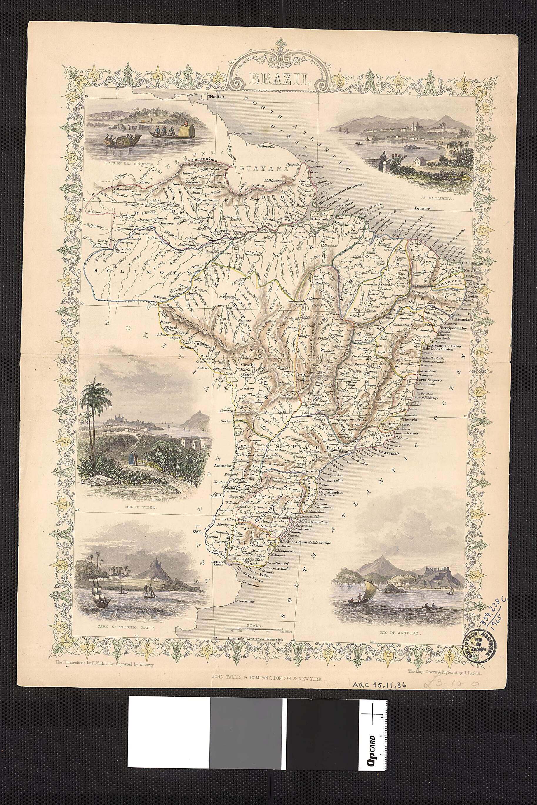
Old map of Brazil.drawn scenes inscribed on the map. John Tallis and Co. was a British mapmaking firm that operated from roughly 1835 to 1860. The map was drawn and engraved by cartographer John Rapkin. Tallis maps were known for their accurate designs and numerous place names and geographical details, as well as for the use of shaded areas to indicate topographical features. The fine craftsmanship of the map can be seen in the color illustrations in the four corners showing "Boats on the Rio Negro" (upper left), "St. Catharina" (upper right), "Monte Video" and "Cape St. Antonio, Bahia" (lower left), and "Rio de Janeiro" (lower right).
Created by W. Lacey, John Rapkin, H. Winkles in 1851.
- Title devised, in English, by Library staff.
- Original resource extent: 1 map : color ; 31 x 22 centimeters.
- Original resource at: National Library of Brazil.
- Content in English.
- Description based on data extracted from World Digital Library, which may be extracted from partner institutions.
Map Subjects
Brazil
W. Lacey
John Rapkin
H. Winkles
1851
- For the best legibility, order your map in the original size or larger. Most maps have intricate detail and small text that is best appreciated when the print size hasn't been reduced.
- Sizes labeled "Fits a Standard Frame" will drop right into any frame that you purchase in that size. The sizes that we offer are commonly available online and at most retail stores.
- Our standard sizes are recommendations based on the aspect ratio of the original map, but still may require some added "white space" in one dimension to fit.
- Non-standard sizes will require custom framing, and we suggest taking your print to the frame shop of your choice after you receive it for the best results.
- Custom sizes are available, simply contact us for a quote.
Below is an approximation of the scale of a few standard sizes, and how they might appear in your space.

