
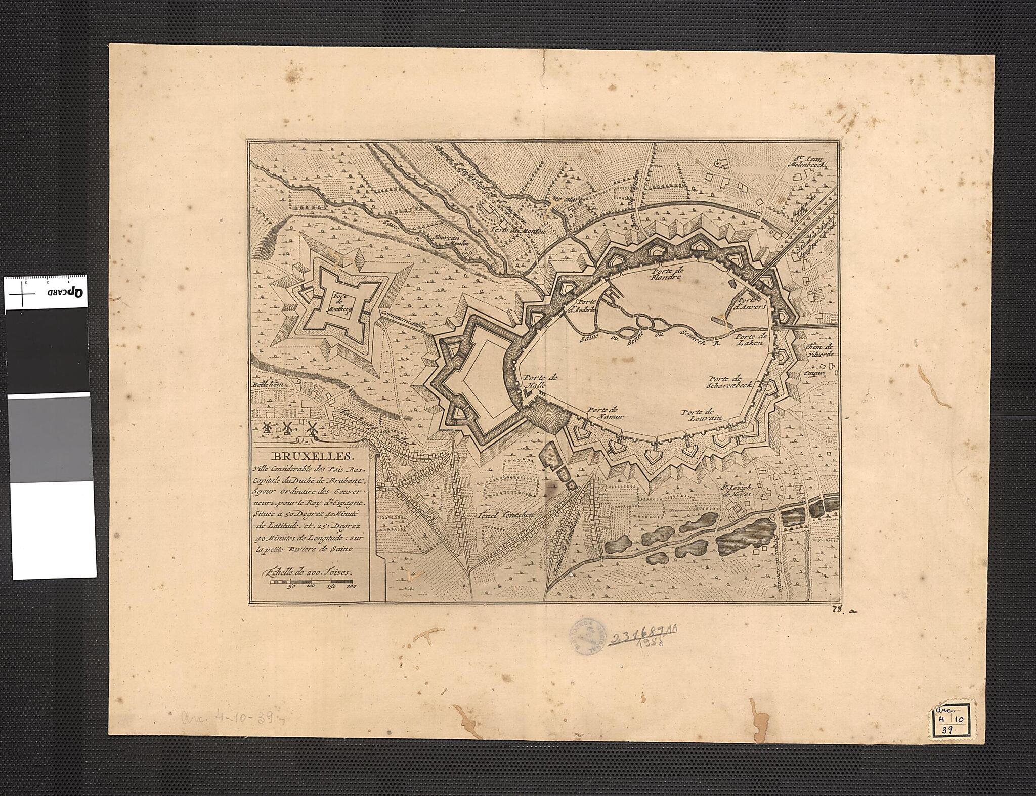
Brussels, Important City In the Netherlands, Capital of the Duchy of Brabant. (Bruxelles, Ville Considerable De Pais Bas, Capitale Du Duche De Brabant) 1700
- Regular price
-
$63.95 - Regular price
-
$58.95 - Sale price
-
$63.95
Buy one map, get any other map in our collection for 50% OFF! Add to cart to see discount.
Couldn't load pickup availability
About This Map
Discover the timeless beauty of our fine art quality printed reproduction of this antique map. Perfect for history enthusiasts, collectors, and interior decorators.
Restored with meticulous attention to detail by our team with over a decade of experience, this stunning reproduction captures the intricate artistry and historical significance of the original map.
Whether you're a collector or seeking a unique decor piece, this archival-quality map reproduction is a timeless addition to any space. Order now to bring history to life!
Old map of Belgium, Netherlands.18th century French map shows Brussels, at that time an important city in the Spanish Netherlands and the capital of the Duchy of Brabant. The map shows the borders of the city and the Senne River. The location of the city on the river made it an important commercial center for trade between France and the Germanic states. In 1695, Brussels was attacked by the army of Louis XIV, and suffered heavy damage. It remained under siege off and on until it was captured by the French in 1746. Brussels became the capital of Belgium when it became an independent country in 1830, and in 1958 was made the seat of the European Economic Community, the precursor to today's European Union.
- Title devised, in English, by Library staff.
- Original resource extent: 1 map ; 22 x 28 centimeters.
- Original resource at: National Library of Brazil.
- Content in French.
- Description based on data extracted from World Digital Library, which may be extracted from partner institutions.
Map Subjects
Belgium
Netherlands
1700
- For the best legibility, order your map in the original size or larger. Most maps have intricate detail and small text that is best appreciated when the print size hasn't been reduced.
- Sizes labeled "Fits a Standard Frame" will drop right into any frame that you purchase in that size. The sizes that we offer are commonly available online and at most retail stores.
- Our standard sizes are recommendations based on the aspect ratio of the original map, but still may require some added "white space" in one dimension to fit.
- Non-standard sizes will require custom framing, and we suggest taking your print to the frame shop of your choice after you receive it for the best results.
- Custom sizes are available, simply contact us for a quote.
Below is an approximation of the scale of a few standard sizes, and how they might appear in your space.

