
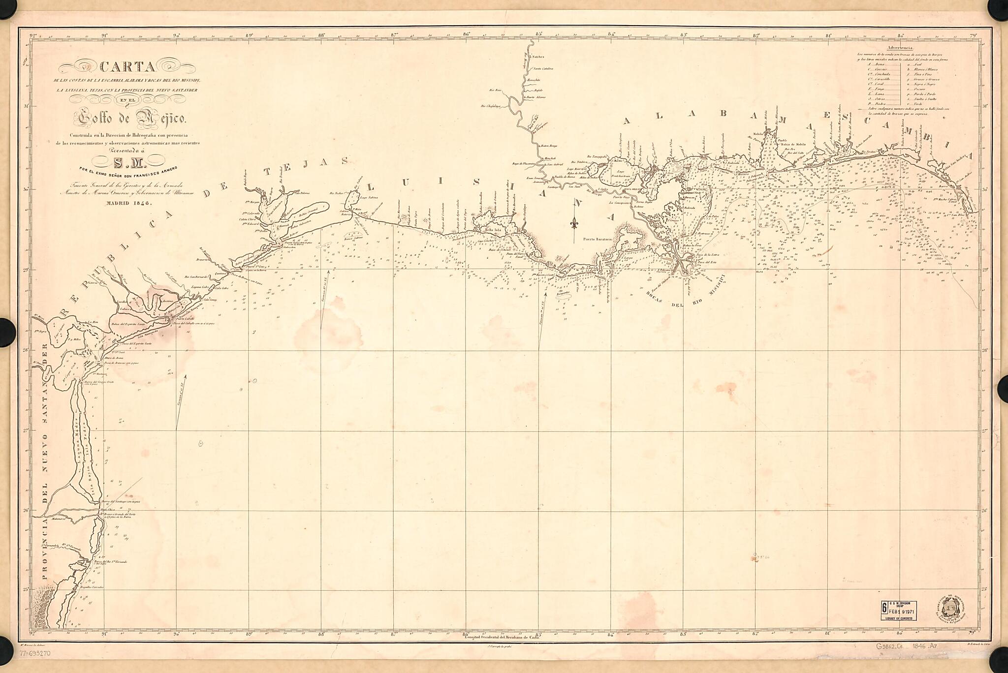
Carta De Las Costas De La Escambia, Alabama Y Bocas Del Rio Misisipi, La Luisiana, Tejas, Con La Provincia Del Nuevo Santander, En El Golfo De Mejico 1846
- Regular price
-
$109.95 - Regular price
-
$104.95 - Sale price
-
$109.95
Buy one map, get any other map in our collection for 50% OFF! Add to cart to see discount.
Couldn't load pickup availability
About This Map
Discover the timeless beauty of our fine art quality printed reproduction of this antique map. Perfect for history enthusiasts, collectors, and interior decorators.
Restored with meticulous attention to detail by our team with over a decade of experience, this stunning reproduction captures the intricate artistry and historical significance of the original map.
Whether you're a collector or seeking a unique decor piece, this archival-quality map reproduction is a timeless addition to any space. Order now to bring history to life!
Old map of Gulf Coast, Gulf of Mexico, Gulf States, Mexico, Gulf Of., United States.Created by Francisco Armero, J. Carrafa, Miguel Moreno, Spain. Dirección De Hidrografía in 1846.
- Scale not given.
- Reference meridian: Cádiz.
- Depths shown by soundings.
- Includes table of abbreviations.
Map Subjects
Coasts
Gulf Coast (U.S.)
Gulf States
Mexico Gulf Of
Nautical Charts
United States
Gulf Coast
Gulf Of Mexico
Mexico Gulf Of.
Francisco Armero
J. Carrafa
Miguel Moreno
Spain. Dirección De Hidrografía
1846
- For the best legibility, order your map in the original size or larger. Most maps have intricate detail and small text that is best appreciated when the print size hasn't been reduced.
- Sizes labeled "Fits a Standard Frame" will drop right into any frame that you purchase in that size. The sizes that we offer are commonly available online and at most retail stores.
- Our standard sizes are recommendations based on the aspect ratio of the original map, but still may require some added "white space" in one dimension to fit.
- Non-standard sizes will require custom framing, and we suggest taking your print to the frame shop of your choice after you receive it for the best results.
- Custom sizes are available, simply contact us for a quote.
Below is an approximation of the scale of a few standard sizes, and how they might appear in your space.
