
Carta General De La República Mexicana in 1863
- Regular price
-
$205.95 - Regular price
-
$200.95 - Sale price
-
$205.95
Buy one map, get any other map in our collection for 50% OFF! Add to cart to see discount.
Couldn't load pickup availability
About This Map
Discover the timeless beauty of our fine art quality printed reproduction of this antique map. Perfect for history enthusiasts, collectors, and interior decorators.
Restored with meticulous attention to detail by our team with over a decade of experience, this stunning reproduction captures the intricate artistry and historical significance of the original map.
Whether you're a collector or seeking a unique decor piece, this archival-quality map reproduction is a timeless addition to any space. Order now to bring history to life!
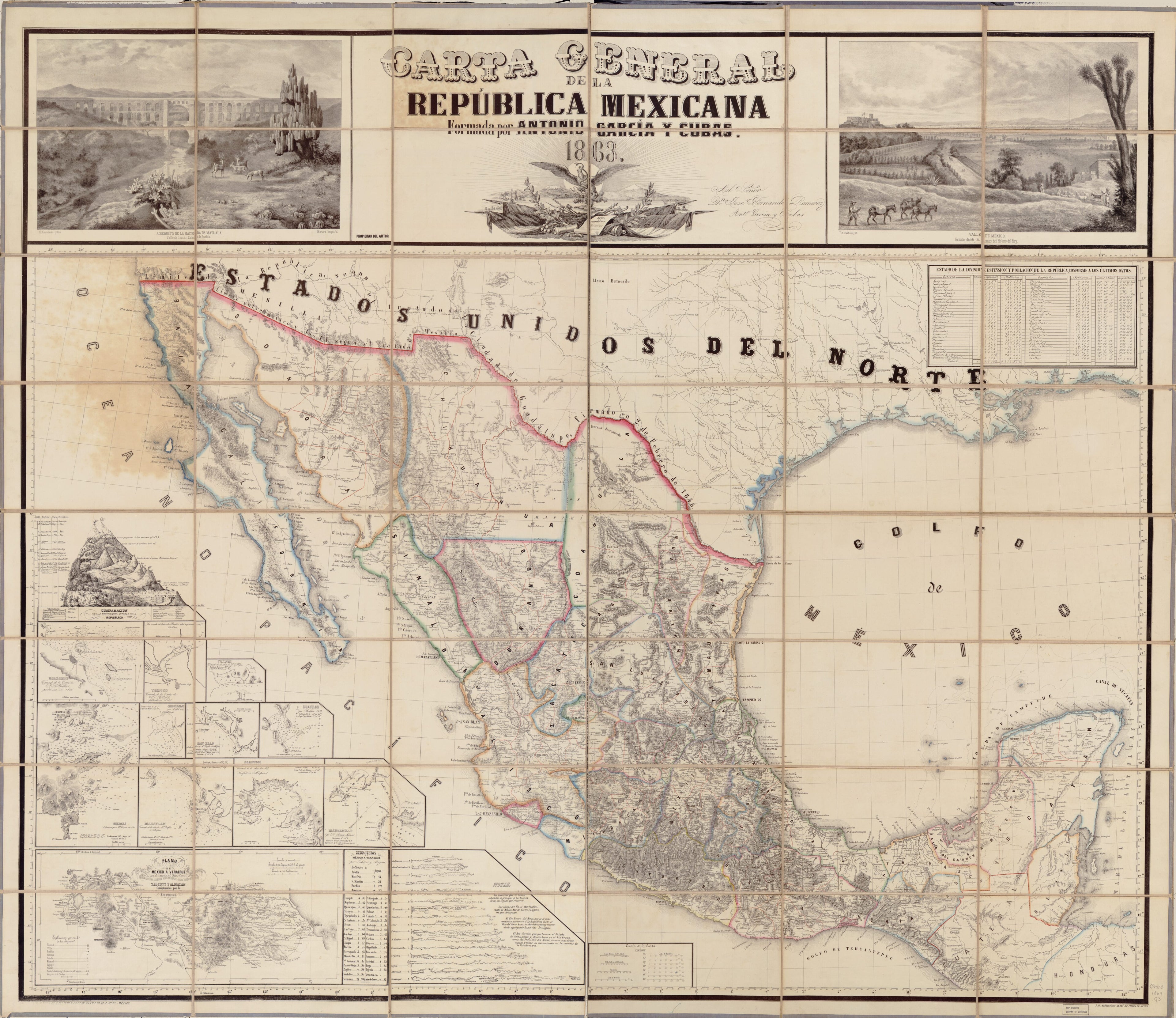
Old map of Mexico.Created by Antonio García Cubas in 1863.
- Relief shown by hachures.
- Prime meridian: [Mexico City]
- Includes "Plano de los caminos de México a Veracruz, con el trayecto del ferro carril, 1:1,000,000," 10 charts of ports, tables, diagrams, and illus., "Acueducto de la hacienda de Matlala, Valle de Izucar, Estado de Puebla" and "Valle de México, tomado desde las lomas del Molino del Rey."
- For the best legibility, order your map in the original size or larger. Most maps have intricate detail and small text that is best appreciated when the print size hasn't been reduced.
- Sizes labeled "Fits a Standard Frame" will drop right into any frame that you purchase in that size. The sizes that we offer are commonly available online and at most retail stores.
- Our standard sizes are recommendations based on the aspect ratio of the original map, but still may require some added "white space" in one dimension to fit.
- Non-standard sizes will require custom framing, and we suggest taking your print to the frame shop of your choice after you receive it for the best results.
- Custom sizes are available, simply contact us for a quote.
Below is an approximation of the scale of a few standard sizes, and how they might appear in your space.

