Skip to product information
1 of 1

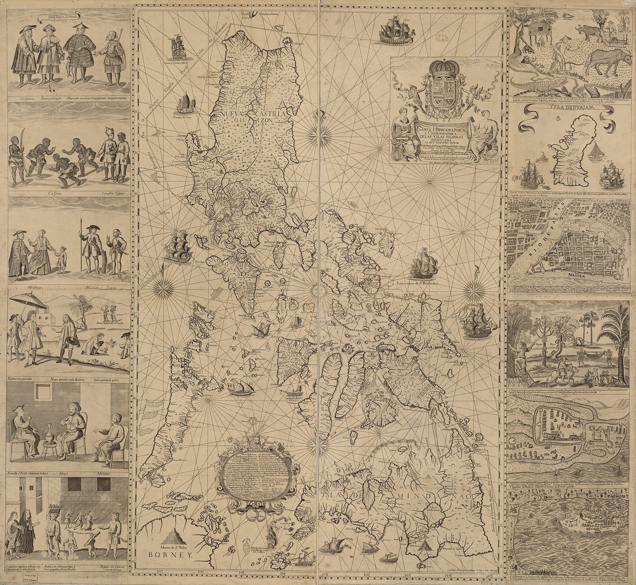
Carta Hydrographica Y Chorographica De Las Yslas Filipinas : Dedicada Al Rey Nuestro Señor Por El Mariscal D. Campo D. Fernando Valdes Tamon Cavallo Del Orden De Santiago De Govor. Y Capn 1734

Regular price
$209.95
Regular price
$251.95
Sale price
$209.95
Map Description
Old early map of Philippines.

Created by Nicolás De La Cruz Bagay, Pedro Murillo Velarde in 1734.
  • Relief shown pictorially.
  • Shows names of coastal towns and historical sailing routes.
  • In lower portion of map: Le esculpio Nicolas de la Cruz Bagay ... 1734.
  • Includes text, descriptive notes, ancillary maps of Guam, cities of Manila, Cavite, and Zamboanga, and illustrations depicting episodes from the daily life of different peoples on the islands.
  • Unnamed prime meridian.
  • Originally filed under file name ct003137, call number G8060 1734 .M Vault Oversize

Map Subjects

Early Maps

Early Works To 1800

Philippines

Nicolás De La Cruz Bagay

Pedro Murillo Velarde

1734

Map Tags

1734

Early Maps

Early Works To 1800

Map

Maps

Nicolás De La Cruz Bagay

Pedro Murillo Velarde

Philippines

Fine Art Quality Printed on heavyweight (230 gsm) archival paper with a classic matte finish
Professionally Restored For the best presentation, your map will be carefully retouched by our experienced team
Free Shipping Orders of $75 or more ship for free and arrive in 3-5 business days
Proudly Made in the USA All of our maps are custom printed to order in Portland, Maine
Help with Choosing a Map Size
Secure Checkout
Lifetime Warranty
Money-Back Guarantee
This old map of Carta Hydrographica Y Chorographica De Las Yslas Filipinas : Dedicada Al Rey Nuestro Señor Por El Mariscal D. Campo D. Fernando Valdes Tamon Cavallo Del Orden De Santiago De Govor. Y Capn from 1734 was created by Nicolás De La Cruz Baga