
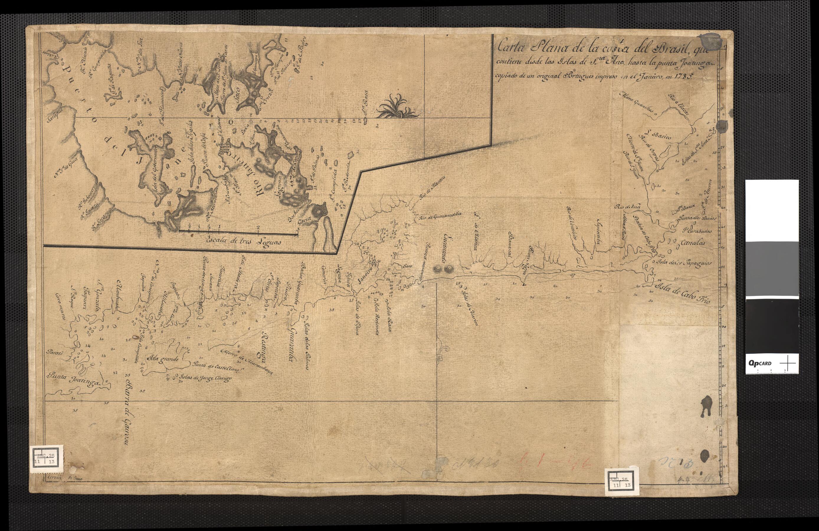
Map of the Brazilian Coast, Which Goes from Santa Ana Island to the Joatinga, Copied from a Portuguese Map and Printed On January, 1785. (Carta Plana De La Costa Del Brasil, Que Contiene Desde Las Islas De Sta. Ana Hasta La Punta Joatinga, Copiado De ...
- Regular price
-
$54.95 - Regular price
-
$38.95 - Sale price
-
$54.95
Buy one map, get any other map in our collection for 50% OFF! Add to cart to see discount.
Couldn't load pickup availability
About This Map
Discover the timeless beauty of our fine art quality printed reproduction of this antique map. Perfect for history enthusiasts, collectors, and interior decorators.
Restored with meticulous attention to detail by our team with over a decade of experience, this stunning reproduction captures the intricate artistry and historical significance of the original map.
Whether you're a collector or seeking a unique decor piece, this archival-quality map reproduction is a timeless addition to any space. Order now to bring history to life!
Old map of Brazil, Rio De Janeiro.This Spanish map showing part of the Brazilian coast is a copy of an earlier Portuguese map. The inset map in the upper left shows the harbor of Rio de Janeiro.
Created by Pedro Antonio Cerviño in 1800.
- Title devised, in English, by Library staff.
- Original resource extent: 1 manuscript map ; 35 x 52 centimeters.
- Original resource at: National Library of Brazil.
- Content in Spanish.
- Description based on data extracted from World Digital Library, which may be extracted from partner institutions.
- For the best legibility, order your map in the original size or larger. Most maps have intricate detail and small text that is best appreciated when the print size hasn't been reduced.
- Sizes labeled "Fits a Standard Frame" will drop right into any frame that you purchase in that size. The sizes that we offer are commonly available online and at most retail stores.
- Our standard sizes are recommendations based on the aspect ratio of the original map, but still may require some added "white space" in one dimension to fit.
- Non-standard sizes will require custom framing, and we suggest taking your print to the frame shop of your choice after you receive it for the best results.
- Custom sizes are available, simply contact us for a quote.
Below is an approximation of the scale of a few standard sizes, and how they might appear in your space.
