
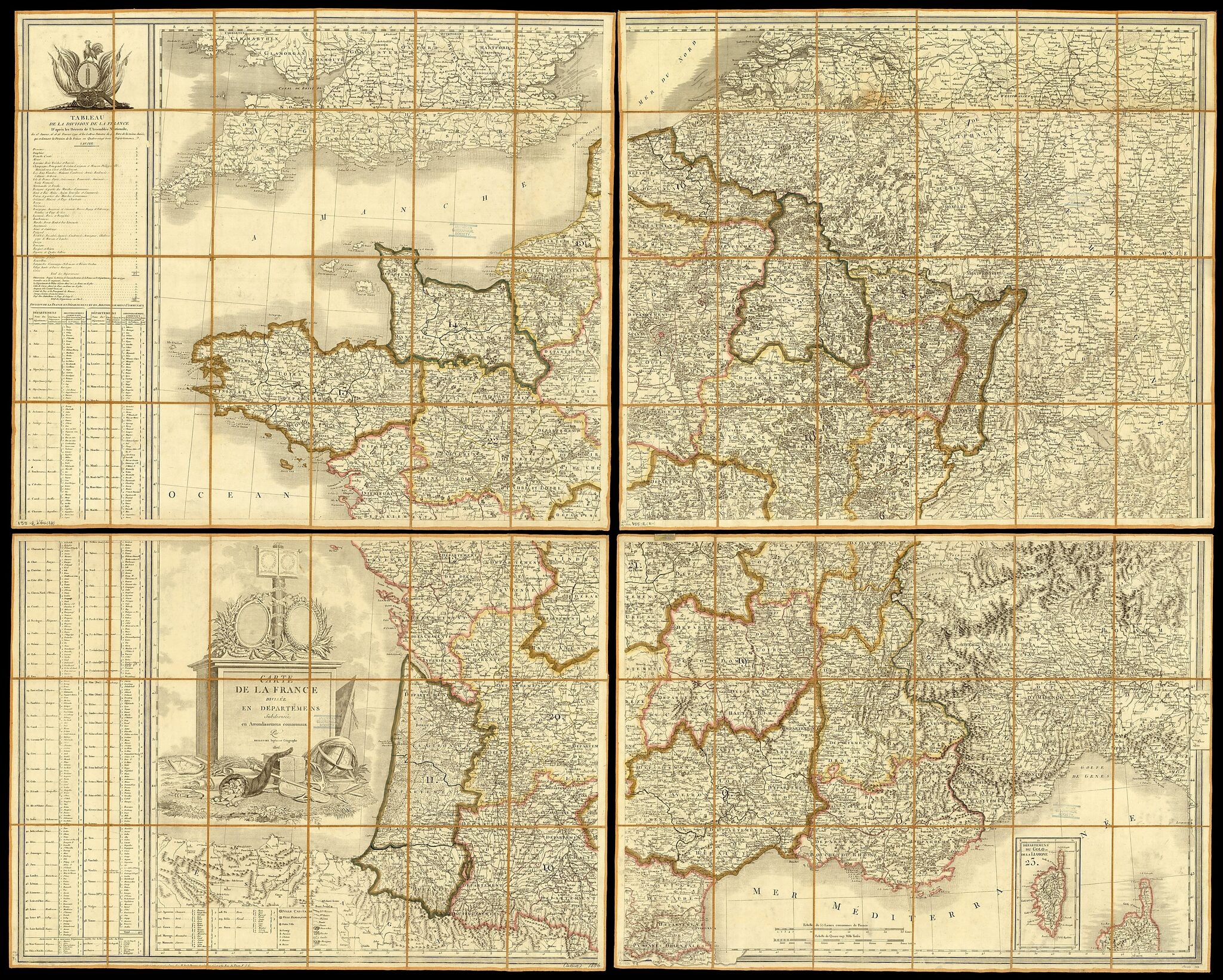
Map of France Divided Into Départements, Subdivided Into Arrondissements. (Carte De La France Divisée En Départemens, Subdivisée En Arrondissemens Communaux) 1806
- Regular price
-
$221.95 - Regular price
-
$216.95 - Sale price
-
$221.95
Buy one map, get any other map in our collection for 50% OFF! Add to cart to see discount.
Couldn't load pickup availability
About This Map
Discover the timeless beauty of our fine art quality printed reproduction of this antique map. Perfect for history enthusiasts, collectors, and interior decorators.
Restored with meticulous attention to detail by our team with over a decade of experience, this stunning reproduction captures the intricate artistry and historical significance of the original map.
Whether you're a collector or seeking a unique decor piece, this archival-quality map reproduction is a timeless addition to any space. Order now to bring history to life!
Old map of France.This 1806 map of France shows the division of the country into départements (regions) and arrondissements (districts). The modern départements were created in 1790, following the outbreak of the French Revolution in 1789, by the National Constituent Assembly, partly to weaken the old military and historical loyalties of the provinces and create a more coherent and loyal national system. Each département was run by an elected general council, presided over by a commissioner representing the central government. The départements were subdivided into arrondissements, each of which was under the administration of a subprefect. Arrondissements were also further subdivided. They were created in 1800 and took the place of the earlier districts.
Created by Le Père Barrière, Pierre De Belleyme in 1806.
- Title devised, in English, by Library staff.
- "Relief shown pictorially. Scale 1:880 000."--Note extracted from World Digital Library.
- Original resource extent: 1 maps on 4 sheets : color, dissected and mounted on linen ; on sheets 72 x 82 centimeters or smaller.
- Original resource at: University of Wisconsin-Milwaukee Libraries.
- Content in French.
- Description based on data extracted from World Digital Library, which may be extracted from partner institutions.
Map Subjects
1790 To 1806
France
Le Père Barrière
Pierre De Belleyme
1806
- For the best legibility, order your map in the original size or larger. Most maps have intricate detail and small text that is best appreciated when the print size hasn't been reduced.
- Sizes labeled "Fits a Standard Frame" will drop right into any frame that you purchase in that size. The sizes that we offer are commonly available online and at most retail stores.
- Our standard sizes are recommendations based on the aspect ratio of the original map, but still may require some added "white space" in one dimension to fit.
- Non-standard sizes will require custom framing, and we suggest taking your print to the frame shop of your choice after you receive it for the best results.
- Custom sizes are available, simply contact us for a quote.
Below is an approximation of the scale of a few standard sizes, and how they might appear in your space.

