
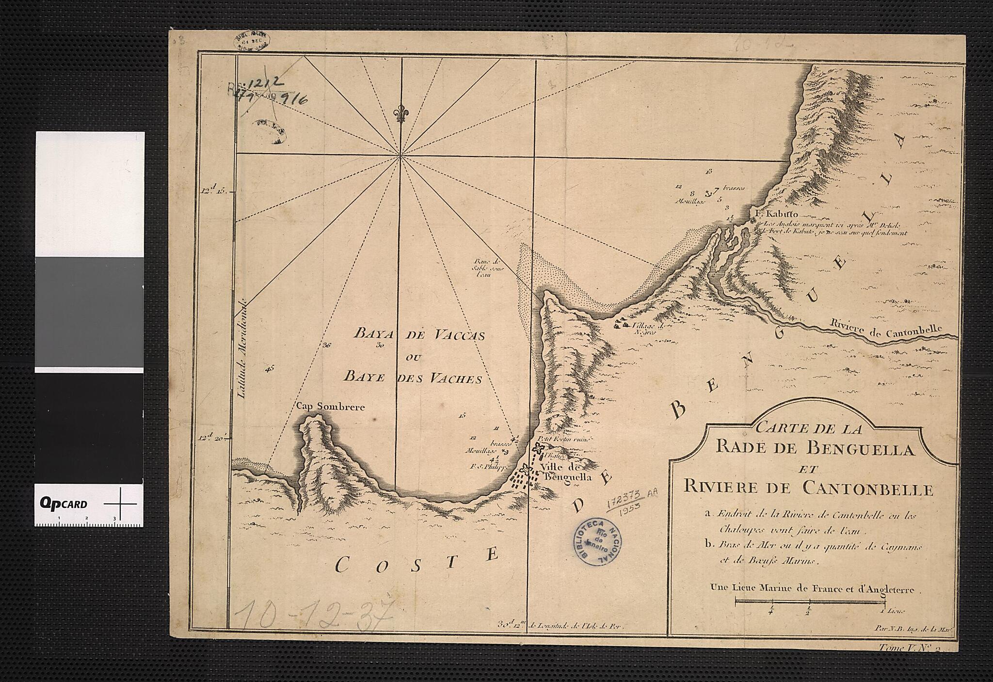
Map of the Bay of Benguela and the Cantonbelle River. (Carte De La Rade De Benguela Et Riviere De Cantonbelle) 1700
- Regular price
-
$54.95 - Regular price
-
$49.95 - Sale price
-
$54.95
Buy one map, get any other map in our collection for 50% OFF! Add to cart to see discount.
Couldn't load pickup availability
About This Map
Discover the timeless beauty of our fine art quality printed reproduction of this antique map. Perfect for history enthusiasts, collectors, and interior decorators.
Restored with meticulous attention to detail by our team with over a decade of experience, this stunning reproduction captures the intricate artistry and historical significance of the original map.
Whether you're a collector or seeking a unique decor piece, this archival-quality map reproduction is a timeless addition to any space. Order now to bring history to life!
Old map of Angola, Benguela.day Angola, is by the French cartographer Jacques-Nicolas Bellin (1703-72). Trained as a hydrographer, Bellin was attached to the French Marine Office and specialized in producing maritime maps showing coastlines. In 1764, he published Le Petit Atlas Maritime (Small maritime atlas), a work in five volumes containing 581 maps. Bellin's maps were in the tradition of Sanson and de L'Isle, and placed great emphasis on scientific accuracy rather than on artistic beauty for its own sake.
Created by Nicolas in 1700.
- Title devised, in English, by Library staff.
- Original resource extent: 1 map ; 22 x 35 centimeters.
- Original resource at: National Library of Brazil.
- Content in French.
- Description based on data extracted from World Digital Library, which may be extracted from partner institutions.
Map Subjects
Angola
Benguela
Coasts
Rivers
Nicolas
1700
- For the best legibility, order your map in the original size or larger. Most maps have intricate detail and small text that is best appreciated when the print size hasn't been reduced.
- Sizes labeled "Fits a Standard Frame" will drop right into any frame that you purchase in that size. The sizes that we offer are commonly available online and at most retail stores.
- Our standard sizes are recommendations based on the aspect ratio of the original map, but still may require some added "white space" in one dimension to fit.
- Non-standard sizes will require custom framing, and we suggest taking your print to the frame shop of your choice after you receive it for the best results.
- Custom sizes are available, simply contact us for a quote.
Below is an approximation of the scale of a few standard sizes, and how they might appear in your space.
