


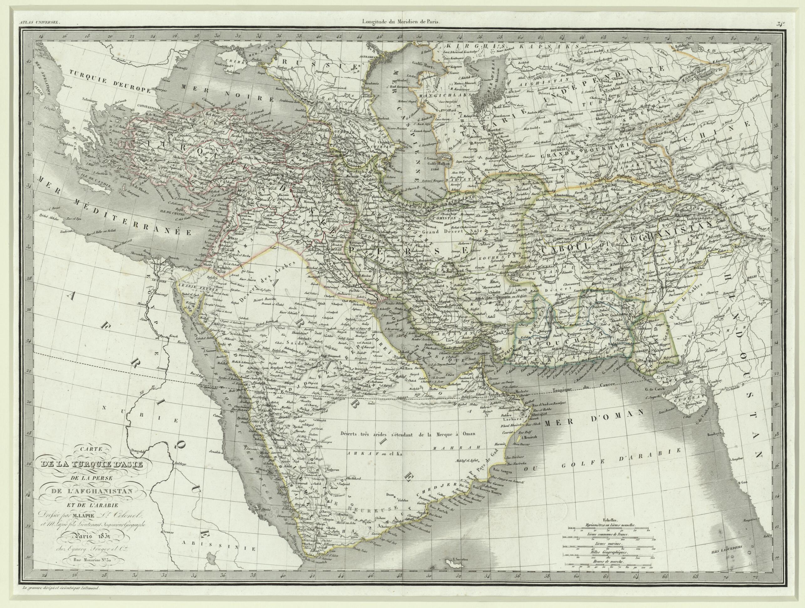
Map of Asiatic Turkey, Persia, Afghanistan, and Arabia. (Carte De La Turquie D'Asie, De La Perse, De L'Afghanistan Et De L'Arabie) 1831
- Regular price
-
$78.95 - Regular price
-
$73.95 - Sale price
-
$78.95
Buy one map, get any other map in our collection for 50% OFF! Add to cart to see discount.
Couldn't load pickup availability
About This Map
Discover the timeless beauty of our fine art quality printed reproduction of this antique map. Perfect for history enthusiasts, collectors, and interior decorators.
Restored with meticulous attention to detail by our team with over a decade of experience, this stunning reproduction captures the intricate artistry and historical significance of the original map.
Whether you're a collector or seeking a unique decor piece, this archival-quality map reproduction is a timeless addition to any space. Order now to bring history to life!
day Iran), Afghanistan, and the Arabian Peninsula. The map appeared in the Atlas universel de géographie ancienne et moderne (Universal atlas of ancient and modern geography) by the cartographer and engraver Pierre M. Lapie (1779--1850). Lapie was a member of the corps of topographical engineers in the French army, where he rose to the rank of colonel. He eventually became head of the topographical section in the Ministry of War. He was assisted by his son Alexandre Emile Lapie (flourished 1809--50), also a French military cartographer, who worked with his father over a period of many years. The map dates from the time when Qatar was beginning to be shown as a clearly delineated peninsular formation. Before 1827-35 the northern coast of Arabia was little explored and was shown as a smooth curve, although occasionally the island of Bahrain was depicted. Here Qatar begins to emerge as a peninsula, although it would be a few years before its true shape was depicted on maps. The map shows the pearling banks around Qatar and marks the location of the famous pearling town of Zubarah (labeled Zebarra) in Qatar as well as Ra's Rakan (Ras Reccan). Major towns and caravan routes are shown throughout. The desert of the Empty Quarter is shown as genuinely empty rather than filled with fanciful places as with earlier 17th and 18th century maps of Arabia. Relief is shown by hachures. The map provides scales of distance in five different units: myriameters (10,000 meters), leagues, nautical leagues, miles, and, curiously, hours of walking or marching required to cover a given distance. Paris is given as the prime meridian.Created by Lallemand, Alexandre Émile Lapie, M. (Pierre) Lapie in 1831.
- Title devised, in English, by Library staff.
- Original resource extent: 1 map ; 54 x 39 centimeters.
- Original resource at: Qatar National Library.
- Content in French.
- Description based on data extracted from World Digital Library, which may be extracted from partner institutions.
- For the best legibility, order your map in the original size or larger. Most maps have intricate detail and small text that is best appreciated when the print size hasn't been reduced.
- Sizes labeled "Fits a Standard Frame" will drop right into any frame that you purchase in that size. The sizes that we offer are commonly available online and at most retail stores.
- Our standard sizes are recommendations based on the aspect ratio of the original map, but still may require some added "white space" in one dimension to fit.
- Non-standard sizes will require custom framing, and we suggest taking your print to the frame shop of your choice after you receive it for the best results.
- Custom sizes are available, simply contact us for a quote.
Below is an approximation of the scale of a few standard sizes, and how they might appear in your space.

