
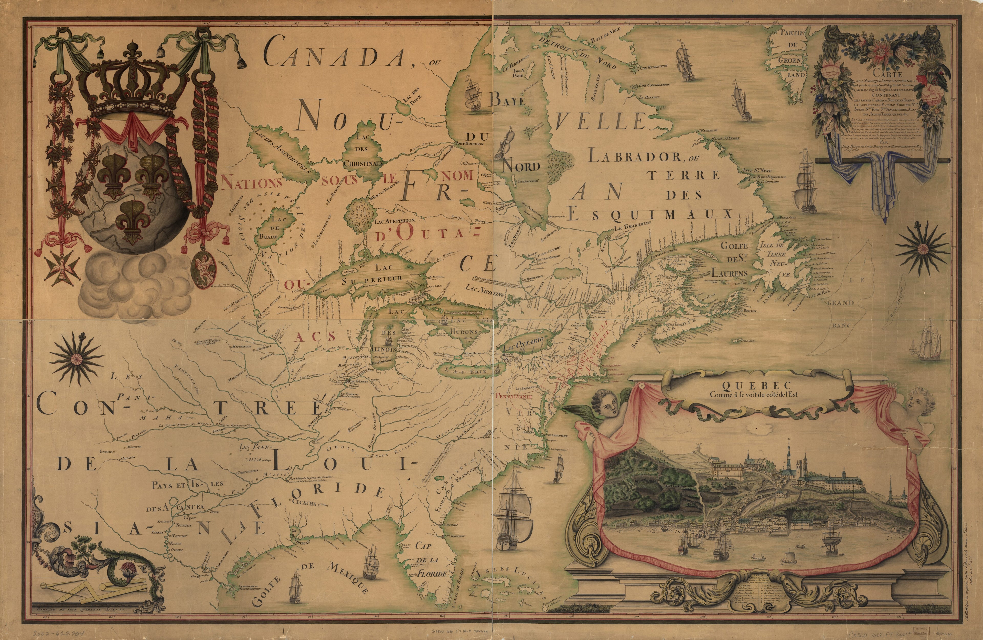
Carte De L'Amerique Septentrionnale : Depuis Le 25, Jusqu'au 65⁰ Deg. De Latt. & Environ 140, & 235 Deg. De Longitude / Par Iean Baptiste Louis Franquelin, Hydrographe Du Roy, à Québec En Canada in 1688
- Regular price
-
$255.95 - Regular price
-
$250.95 - Sale price
-
$255.95
Buy one map, get any other map in our collection for 50% OFF! Add to cart to see discount.
Couldn't load pickup availability
About This Map
Discover the timeless beauty of our fine art quality printed reproduction of this antique map. Perfect for history enthusiasts, collectors, and interior decorators.
Restored with meticulous attention to detail by our team with over a decade of experience, this stunning reproduction captures the intricate artistry and historical significance of the original map.
Whether you're a collector or seeking a unique decor piece, this archival-quality map reproduction is a timeless addition to any space. Order now to bring history to life!
Old map of Canada, North America, Québec.Created by Jean Baptiste Louis Franquelin in 1688.
- Copied between 1909 and 1910 from the original 1688 ms. in the Archives du dépôt des cartes et plans de la marine.
- Pen-and-ink and watercolor.
- In margin: Bibliotheque du Depot des cartes et plans de la Marina, Paris, Atlas 4040B, piece n. 3.
- Includes indexed inset of view "Quebec comme il se voit du cóté de l'est."
- For the best legibility, order your map in the original size or larger. Most maps have intricate detail and small text that is best appreciated when the print size hasn't been reduced.
- Sizes labeled "Fits a Standard Frame" will drop right into any frame that you purchase in that size. The sizes that we offer are commonly available online and at most retail stores.
- Our standard sizes are recommendations based on the aspect ratio of the original map, but still may require some added "white space" in one dimension to fit.
- Non-standard sizes will require custom framing, and we suggest taking your print to the frame shop of your choice after you receive it for the best results.
- Custom sizes are available, simply contact us for a quote.
Below is an approximation of the scale of a few standard sizes, and how they might appear in your space.
