


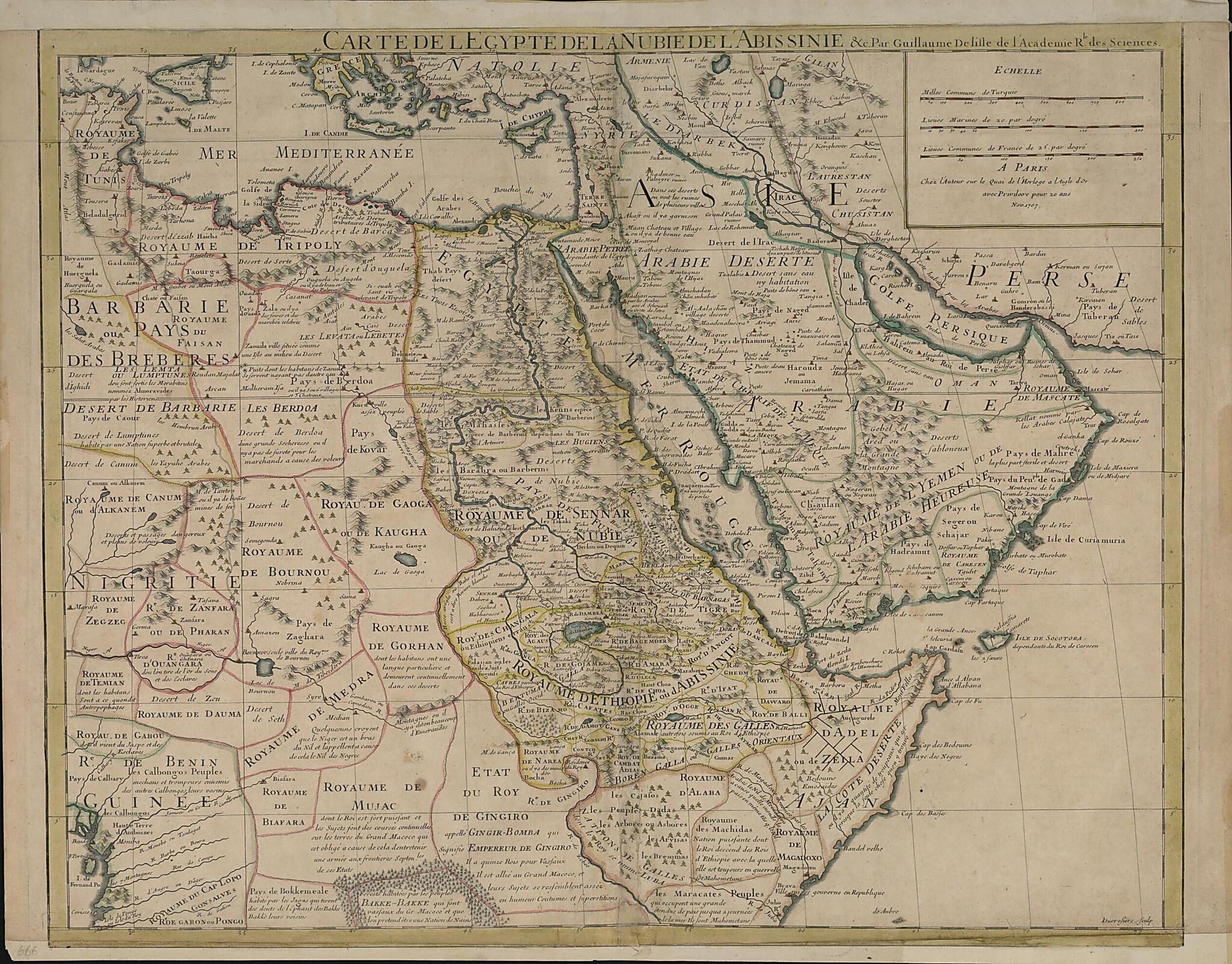
Map of Egypt, Nubia, Abyssinia, Etc.. (Carte De L'Egypte, De La Nubie, De L'Abissinie &c) 1707
- Regular price
-
$100.95 - Regular price
-
$95.95 - Sale price
-
$100.95
Buy one map, get any other map in our collection for 50% OFF! Add to cart to see discount.
Couldn't load pickup availability
About This Map
Discover the timeless beauty of our fine art quality printed reproduction of this antique map. Perfect for history enthusiasts, collectors, and interior decorators.
Restored with meticulous attention to detail by our team with over a decade of experience, this stunning reproduction captures the intricate artistry and historical significance of the original map.
Whether you're a collector or seeking a unique decor piece, this archival-quality map reproduction is a timeless addition to any space. Order now to bring history to life!
1726) was admitted into the Royal Academy of Sciences when he was 27 years old and subsequently became the first person to receive the title Premier Géographe du Roi (principal geographer to the king). He was one of the most important cartographers of the early 18th century and a major figure in making Paris a center of cartographic science. At the time de L'Isle was engaged in cartographic research, the prestige of a cartographer and the authority of his maps were generally gauged by the veracity of his sources, which were based on reporting by explorers and travelers. The map by de L'Isle shown here was published in 1707 and indicates the various kingdoms in northwest Africa and Arabia, with their borders clearly demarcated. Some of the discursive labels on the African peoples are interesting: the inhabitants of the Lumptunes Desert (in present-day Nigeria) are described as "superb and brutal;" "Falasian or Exiled Fugitive Jews" live in the Kingdom of Changala; and toward the lower left are the Bokkemeale who trade "elephant teeth" with their neighbors, the Bakké-Bakké. Towns, oases, and settlements are noted. In the area of Qatar is a town labeled "Catema." The pearl banks of the Red Sea and Arabian Gulf are also shown. Scale is indicated in three measures: Turkish common miles, nautical leagues, and French common leagues.Created by Active Desrosiers, Guillaume De L'isle in 1707.
- Title devised, in English, by Library staff.
- "Map scale approximately 1:9,200,000"--Note extracted from World Digital Library.
- Original resource extent: 1 map : hand colored ; 48 x 59 centimeters.
- Original resource at: Qatar National Library.
- Content in French.
- Description based on data extracted from World Digital Library, which may be extracted from partner institutions.
Map Subjects
Arabian Gulf
Arabian Peninsula
Persian Gulf
Red Sea
Active Desrosiers
Guillaume De L'isle
1707
- For the best legibility, order your map in the original size or larger. Most maps have intricate detail and small text that is best appreciated when the print size hasn't been reduced.
- Sizes labeled "Fits a Standard Frame" will drop right into any frame that you purchase in that size. The sizes that we offer are commonly available online and at most retail stores.
- Our standard sizes are recommendations based on the aspect ratio of the original map, but still may require some added "white space" in one dimension to fit.
- Non-standard sizes will require custom framing, and we suggest taking your print to the frame shop of your choice after you receive it for the best results.
- Custom sizes are available, simply contact us for a quote.
Below is an approximation of the scale of a few standard sizes, and how they might appear in your space.

