
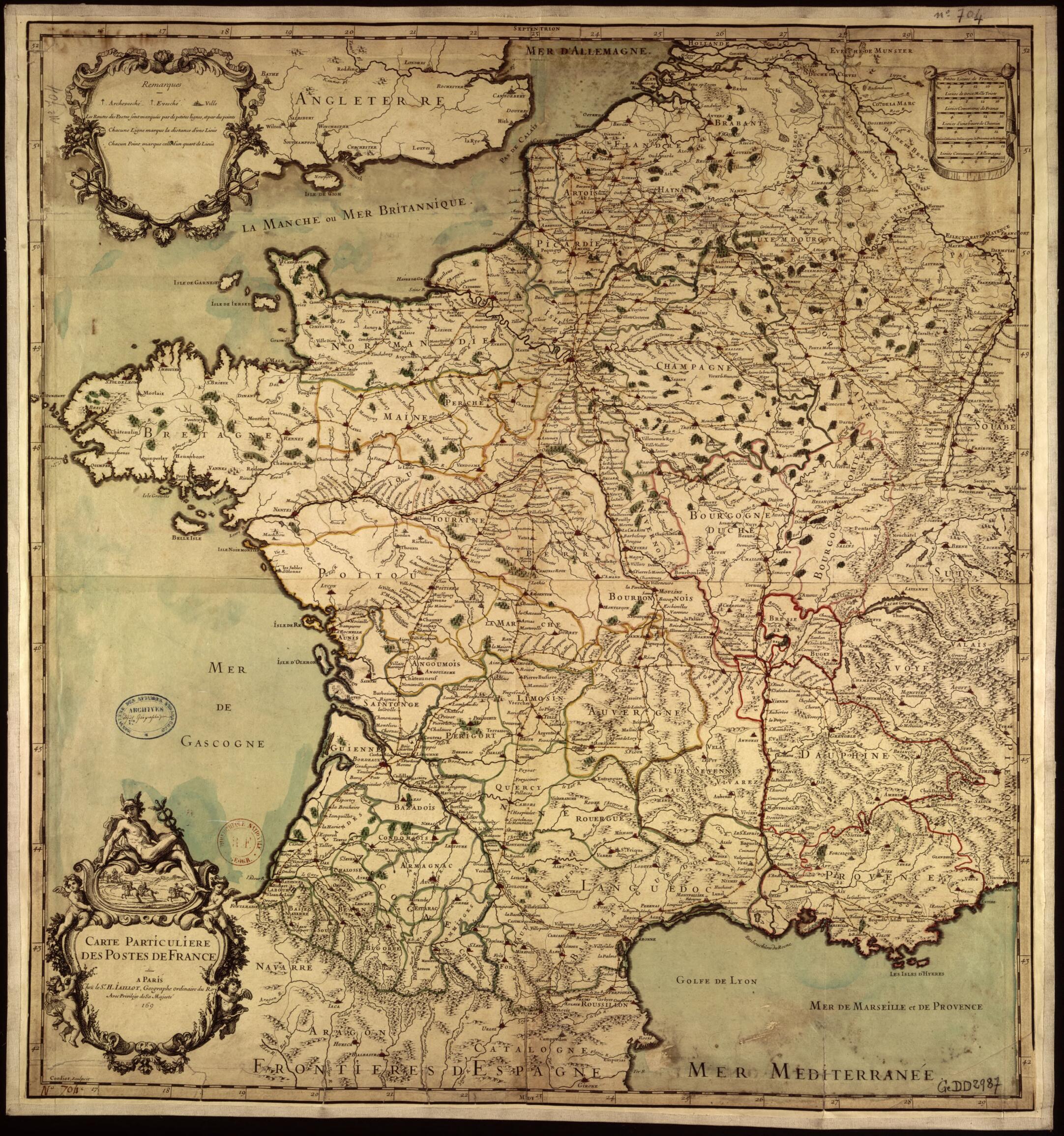
Map of France's Post Offices. (Carte Particulière Des Postes De France) 1690
- Regular price
-
$49.95 - Regular price
-
$34.95 - Sale price
-
$49.95
Buy one map, get any other map in our collection for 50% OFF! Add to cart to see discount.
Couldn't load pickup availability
About This Map
Discover the timeless beauty of our fine art quality printed reproduction of this antique map. Perfect for history enthusiasts, collectors, and interior decorators.
Restored with meticulous attention to detail by our team with over a decade of experience, this stunning reproduction captures the intricate artistry and historical significance of the original map.
Whether you're a collector or seeking a unique decor piece, this archival-quality map reproduction is a timeless addition to any space. Order now to bring history to life!
Old map of France, Germany, Luxembourg, Netherlands.Hubert Jaillot (circa 1632-1712) in 1690, the Carte particulière des postes de France (Particular map of the post offices of France) was preceded by the work of geographer Nicolas Sanson (1600--67), including his 1632 Carte géographique des Postes qui traversent la France (Geographical map of post offices throughout France). The evolution of the mapping of the postal network sheds light on various territorial choices stemming from political or economic requirements. This postal network was the first exchange system managed by the French monarchy within the boundaries of the territory of France. With the Edict of Luxies in 1464, Louis XI created relais de poste (roadhouse postal offices) and divided the horseback couriers of the king's stables into two groups: the courriers du cabinet, who were in charge of royal mail, and the postes assises, who later would become post masters, in charge of providing the horses. Depending on the roads, terrain, and topographical demands, the offices were between four and five leagues apart (16 to 20 kilometers). The network was made available to travelers in 1506 during the reign of Louis XII. Under Louis XIV, king of France in 1643-1715, centralization increased and the king sought to exercise greater control over the postal service for political and financial reasons. In 1672 he created the Ferme générale des Postes (General postal farm). The speed of the postal service was about seven kilometers per hour at the beginning of the 18th century. The relais de poste were done away with in 1873.
Created by Louis Cordier, Hubert in 1690.
- Title devised, in English, by Library staff.
- Original resource extent: 1 map : colored tracing ; 67 x 62 centimeters.
- Original resource at: National Library of France.
- Content in French.
- Description based on data extracted from World Digital Library, which may be extracted from partner institutions.
- For the best legibility, order your map in the original size or larger. Most maps have intricate detail and small text that is best appreciated when the print size hasn't been reduced.
- Sizes labeled "Fits a Standard Frame" will drop right into any frame that you purchase in that size. The sizes that we offer are commonly available online and at most retail stores.
- Our standard sizes are recommendations based on the aspect ratio of the original map, but still may require some added "white space" in one dimension to fit.
- Non-standard sizes will require custom framing, and we suggest taking your print to the frame shop of your choice after you receive it for the best results.
- Custom sizes are available, simply contact us for a quote.
Below is an approximation of the scale of a few standard sizes, and how they might appear in your space.

