
Central Virginia 1864
- Regular price
-
$101.95 - Regular price
-
$96.95 - Sale price
-
$101.95
Buy one map, get any other map in our collection for 50% OFF! Add to cart to see discount.
Couldn't load pickup availability
About This Map
Discover the timeless beauty of our fine art quality printed reproduction of this antique map. Perfect for history enthusiasts, collectors, and interior decorators.
Restored with meticulous attention to detail by our team with over a decade of experience, this stunning reproduction captures the intricate artistry and historical significance of the original map.
Whether you're a collector or seeking a unique decor piece, this archival-quality map reproduction is a timeless addition to any space. Order now to bring history to life!
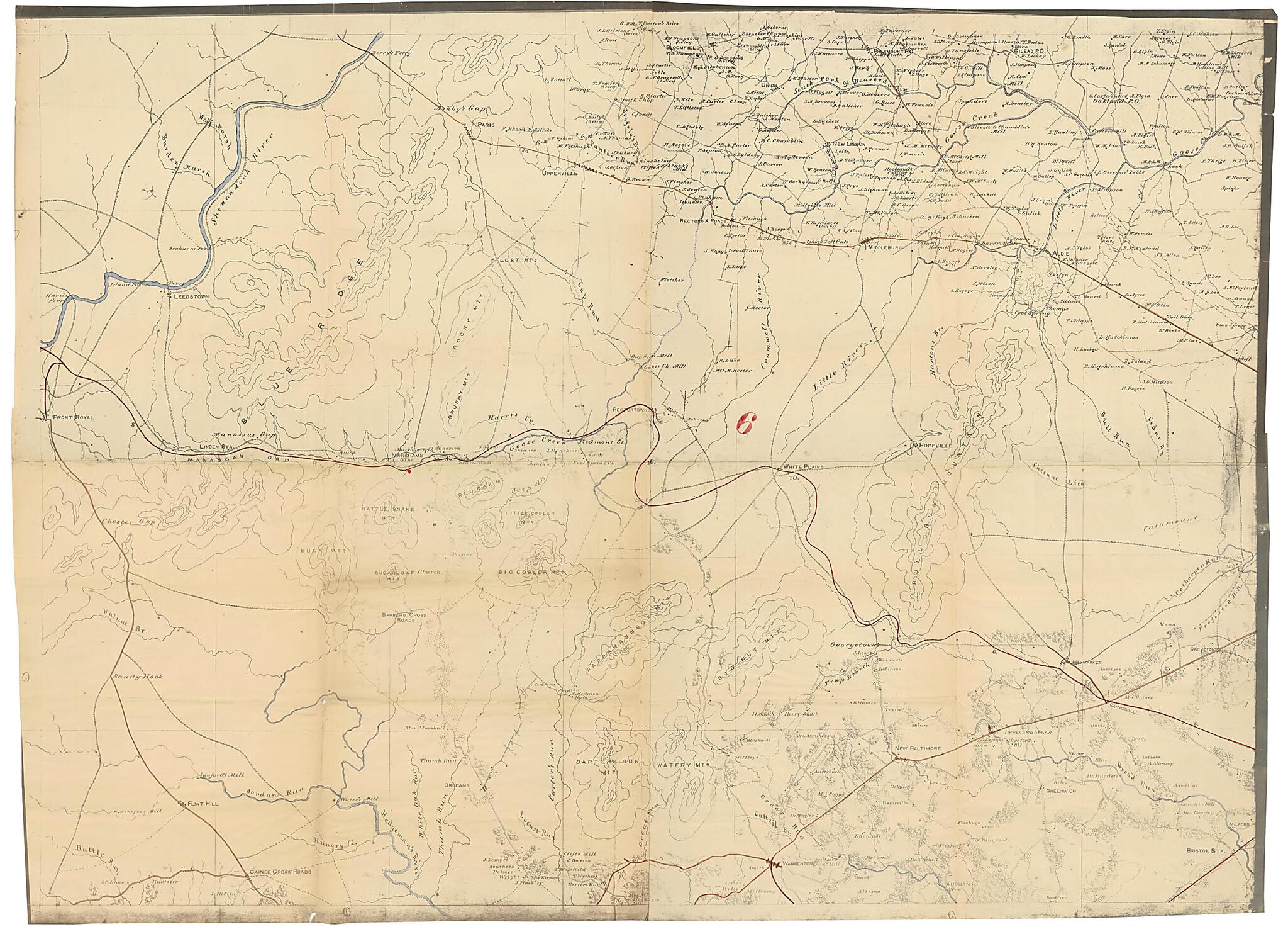
Old map of United States, Virginia.Created by J. F. Gedney, J. Schedler, United States. Army of the Potomac. Engineer Dept, United States. Army. Corps of Topographical Engineers in 1864.
- Relief shown by hachures.
- Some sheets consist of two parts joined in the middle showing towns and villages, roads and railroads, rivers and streams, and houses and names of residents.
- The index map is a printed map entitled "Central Virginia, compiled in the Bureau of Topographl. Engrs. of the War Department for military purposes. July 1862" (entry no. 465.9)
- This item is in the Map Collection of the Library of Virginia; please contact the Library's Archives Research Services department for more information.
- Title from R.W. Stephenson's: Civil War maps, 2nd ed., 1989.
- Civil War Map
- Sheet 6 (lva00104), c. 1, source unknown, Aug. 1968; sheet 8 (lva00105), c. 1, source unknown, Aug. 1968, c. 2 negative photocopy, LVA; sheet 9, c. 1 (lva00106), c. 2 (lva00107), c. 3 (lva00108), source unknown, Aug. 1968, c. 4-5, source unknown, c. 6, photocopy, LVA, c. 7, negative photocopy, LVA; sheet 10, c. 1 (lva00139), R & M Books, March 1967, bcf, c. 2, negative photocopy, LVA; sheet 11 (lva00140), c. 1, source unknown, Aug. 1968, c. 2, negative photocopy, LVA; sheet 12, map 1, c. 1 (lva00141), source unknown, Aug. 1968, c. 2, negative photocopy, LVA; map 2, c. 1 (lva00142), source unknown, Aug. 1968; c. 2 (lva00143), photocopy, source unknown, Aug. 1968; sheet 16, map 1, c. 1 (lva00144), Jan. 1954, Argosy Books, i, c. 2 negative photocopy, LVA; map 2, c. 1 (lva00145), source unknown; sheet 17 (lva00146), c. 1, source unknown, Aug. 1968, c. 2, negative photocopy, LVA; sheet 21, map 1, c. 1 (lva00147), c. 2 (lva00148), c. 3 (lva00149), source unknown, Aug. 1968, c. 4, negative photocopy, LVA; map 2, c. 1 (lva00150), source unknown, Aug. 1968; map 3, c. 1 (lva00151), source unknown, Aug. 1968.
- Conservation: restored 1954, June 1967 or Nov. 1968; all maps conserved by Etherington Conservation Center, 2003.
- Digital image available: 26 x 40.25 in. or smaller.
- Library also has a photocopy of the index map annoted to show sheet lines and numbers.
- Library has sheets 6, 8-12, 16, 17, and 21.
- Map sheets cover central Virginia.
- Previously filed as: 755 M6 1861-1865 1864.
- Sheet 6 map accession no. 2618 (1968); sheet 8 map accession no. 2616 (1968); sheet 9, c. 1 map accession no. 2615 (1968), c. 2 5261X, c. 3 5262X, c. 4 5263X, c. 5 5264X; sheet 10 map accession no. 2613 (1968); sheet 11 map accession no. 2611 (1968); sheet 12, map 1, c. 1 map accession no. 2609 (1968), c. 2 2610 (1968) (neg. photostat, LVA); map 2, c. 1 map accession no. 5259X, c. 2 5260X; sheet 16, map 1 map accession no. 1523 (1954), map 2 map accession no. 5265X; sheet 17 map accession no. 2607 (1968); sheet 21, map 1, c. 1 map accession no. 2605 (1968), c. 2 5256X, c. 3 5257X; map 2 map accession no. 5258X; map 3 map accession no. 5266X.
- Some maps have titles written in manuscript on verso.
Map Subjects
Civil War
History
Maps Topographic
Military Topography
United States
Virginia
J. F. Gedney
J. Schedler
United States. Army Of The Potomac. Engineer Dept
United States. Army. Corps Of Topographical Engineers
1864
- For the best legibility, order your map in the original size or larger. Most maps have intricate detail and small text that is best appreciated when the print size hasn't been reduced.
- Sizes labeled "Fits a Standard Frame" will drop right into any frame that you purchase in that size. The sizes that we offer are commonly available online and at most retail stores.
- Our standard sizes are recommendations based on the aspect ratio of the original map, but still may require some added "white space" in one dimension to fit.
- Non-standard sizes will require custom framing, and we suggest taking your print to the frame shop of your choice after you receive it for the best results.
- Custom sizes are available, simply contact us for a quote.
Below is an approximation of the scale of a few standard sizes, and how they might appear in your space.

