
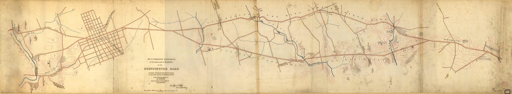
Chester Road : Including the Section from Newtown Square to the East Branch of the Brandywine Creek 1863
- Regular price
-
$204.95 - Regular price
-
$199.95 - Sale price
-
$204.95
Buy one map, get any other map in our collection for 50% OFF! Add to cart to see discount.
Couldn't load pickup availability
About This Map
Discover the timeless beauty of our fine art quality printed reproduction of this antique map. Perfect for history enthusiasts, collectors, and interior decorators.
Restored with meticulous attention to detail by our team with over a decade of experience, this stunning reproduction captures the intricate artistry and historical significance of the original map.
Whether you're a collector or seeking a unique decor piece, this archival-quality map reproduction is a timeless addition to any space. Order now to bring history to life!
Old topographic map / manuscript map of Pennsylvania, Philadelphia, Philadelphia Region, United States, West Chester Pike.Created by A. D. (Alexander Dallas) Bache, United States Coast Survey, Henry L. Whiting in 1863.
- Topographic map showing Civil War earthworks and batteries.
- Relief shown by contours and spot heights.
- Authorship statement citing Whiting's name is in handwriting (black ink).
- Pen-and-ink, red ink (contours), and watercolors.
- "No. 2863X" and "854W" (former Coast Survey numbers) are handwritten in ink on sheet and on adhesive label at lower right.
- This map has some imperfections: fold-lined. We'll do our best to restore the image before printing.
- Originally drawn on 3 sheets.
- Includes notes.
- Civil War Map
Map Subjects
Civil War
Defenses
Fortification
History
Manuscript Maps
Pennsylvania
Philadelphia
Philadelphia (Pa.)
Philadelphia Region
Philadelphia Region (Pa.)
Topographic Maps
United States
West Chester Pike
West Chester Pike (Pa.)
Topographic Maps
Manuscript Maps
A. D. (Alexander Dallas) Bache
United States Coast Survey
Henry L. Whiting
1863
- For the best legibility, order your map in the original size or larger. Most maps have intricate detail and small text that is best appreciated when the print size hasn't been reduced.
- Sizes labeled "Fits a Standard Frame" will drop right into any frame that you purchase in that size. The sizes that we offer are commonly available online and at most retail stores.
- Our standard sizes are recommendations based on the aspect ratio of the original map, but still may require some added "white space" in one dimension to fit.
- Non-standard sizes will require custom framing, and we suggest taking your print to the frame shop of your choice after you receive it for the best results.
- Custom sizes are available, simply contact us for a quote.
Below is an approximation of the scale of a few standard sizes, and how they might appear in your space.
