
Chickamauga Battlefield, Georgia 1864
- Regular price
-
$68.95 - Regular price
-
$63.95 - Sale price
-
$68.95
Buy one map, get any other map in our collection for 50% OFF! Add to cart to see discount.
Couldn't load pickup availability
About This Map
Discover the timeless beauty of our fine art quality printed reproduction of this antique map. Perfect for history enthusiasts, collectors, and interior decorators.
Restored with meticulous attention to detail by our team with over a decade of experience, this stunning reproduction captures the intricate artistry and historical significance of the original map.
Whether you're a collector or seeking a unique decor piece, this archival-quality map reproduction is a timeless addition to any space. Order now to bring history to life!
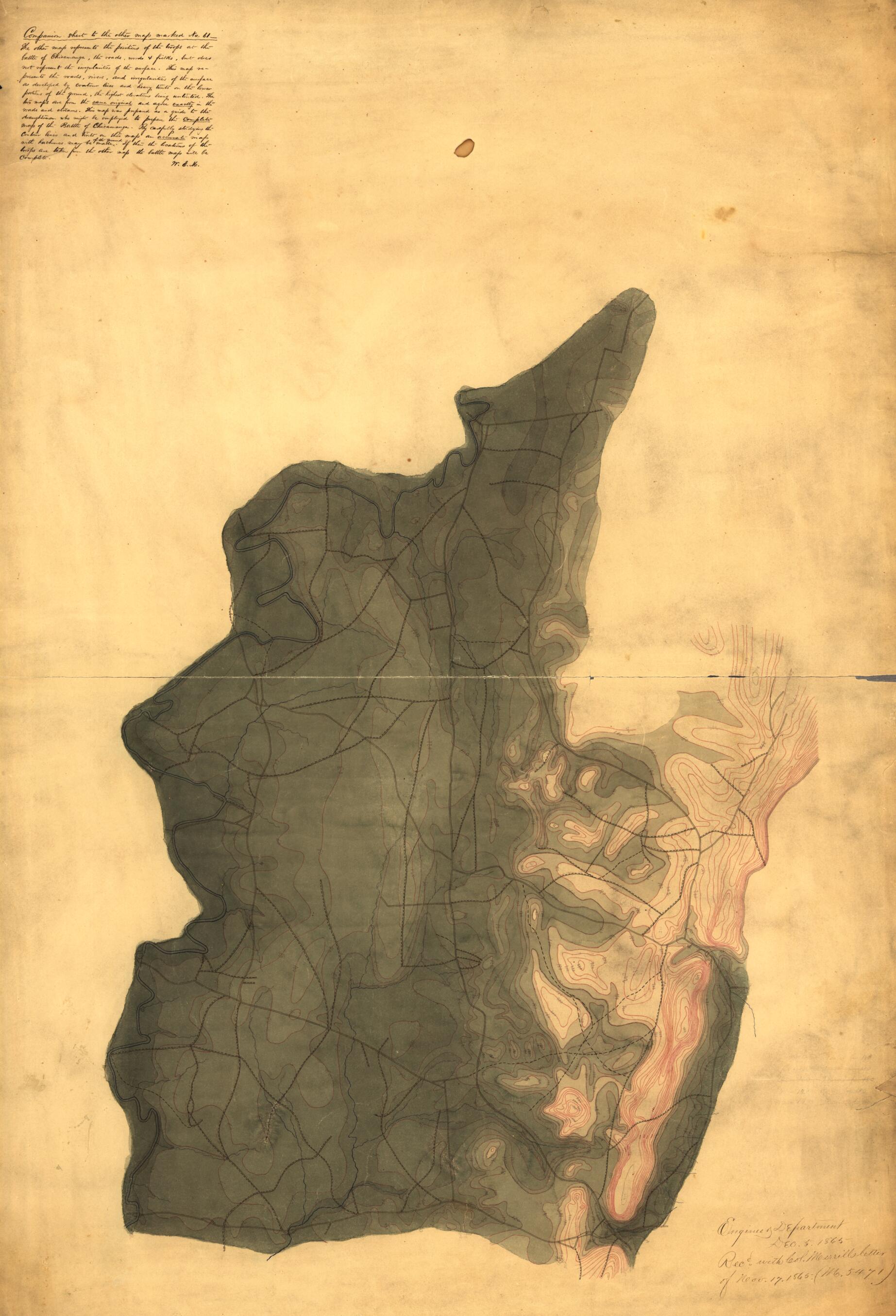
Old manuscript map / topographic map of Chickamauga Battlefield, Georgia, United States.Created by W. E. (William Emery) Merrill in 1864.
- Relief shown by contours, spot heights, and gradient tints.
- Shows roads, rivers, and streams. Does not show troop positions.
- Title from verso.
- At head of title: N.61.
- For printed version of this map, see Civil War Maps entry no. 154.
- Oriented with north to the bottom.
- Pen-and-ink, pencil, and watercolors.
- Watermark: J. Whatman, Turkey M[i?]ll.
- Civil War Map
- Note at upper left: Companion sheet to the other map marked No. 61--The other map represents the positions of the troops at the battle of Chicamauga [sic], the roads, woods & fields, but does not represent the irregularities of the surface. This map represents the roads, rivers, and irregularities of the surface as developed by contour lines and heavy tints on the lower portions of the ground, the highest elevations being untinted. The two maps are from the same original and agree exactly in the roads and streams. This map was prepared as a guide to the draughtsman who might be employed to prepare the complete map of the Battle of Chicamauga [sic]. By carefully studying the contour lines and tints on this map an accurate map with hachures may be made of the ground. If then the locations of the troops are taken from the other map the battle map will be complete. W. E. M. [i.e., William E. Merrill].
- Note added to map at lower right after it was drawn: Engineer Department Dec. 5, 1865. Recd. with Col. Merrills letter of Nov. 17, 1865. (M. 5471).
- Copy This map has some imperfections: soiled, stained, creased, small sections missing along edges of sheet. We'll do our best to restore the image before printing.
- For the best legibility, order your map in the original size or larger. Most maps have intricate detail and small text that is best appreciated when the print size hasn't been reduced.
- Sizes labeled "Fits a Standard Frame" will drop right into any frame that you purchase in that size. The sizes that we offer are commonly available online and at most retail stores.
- Our standard sizes are recommendations based on the aspect ratio of the original map, but still may require some added "white space" in one dimension to fit.
- Non-standard sizes will require custom framing, and we suggest taking your print to the frame shop of your choice after you receive it for the best results.
- Custom sizes are available, simply contact us for a quote.
Below is an approximation of the scale of a few standard sizes, and how they might appear in your space.

