
Ch'ŏnha Chido (天下 地啚) 1800
- Regular price
-
$49.95 - Regular price
-
$29.95 - Sale price
-
$49.95
Buy one map, get any other map in our collection for 50% OFF! Add to cart to see discount.
Couldn't load pickup availability
About This Map
Discover the timeless beauty of our fine art quality printed reproduction of this antique map. Perfect for history enthusiasts, collectors, and interior decorators.
Restored with meticulous attention to detail by our team with over a decade of experience, this stunning reproduction captures the intricate artistry and historical significance of the original map.
Whether you're a collector or seeking a unique decor piece, this archival-quality map reproduction is a timeless addition to any space. Order now to bring history to life!
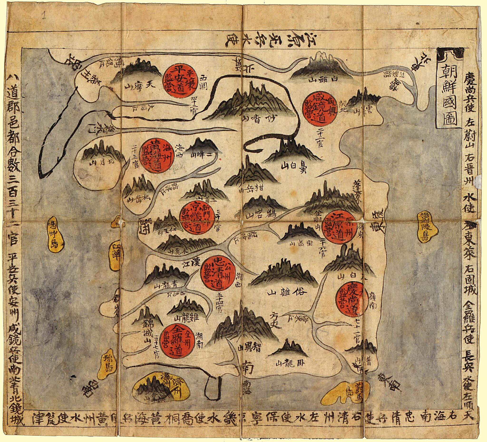
Old map of Korea.1910). One of the maps in the atlas, "Ch'ŏnhado" (Map of the world), is a unique and popular China-centered world map seen in Korean perspective. The typical contents of the traditional Korean atlases during this period consist of the following: a world map bearing the title Ch'ŏnhado, a map of Korea, maps of the eight provinces of Korea, and maps of neighboring countries--China, Japan, and the Ryukyu Islands. Various scholars have attributed the imaginary place names in Ch'ŏnhado to Shanghaijing. Shanghaijing (Classic of mountains and seas) is a compilation of the descriptions of the ancient world of China, written during the Chin dynasty in the 3rd century B.C. The map of China in this atlas prominently depicts the Great Wall and the Yellow and Yangtze rivers. This map may have been derived from a map produced during the Chinese Ming Empire (1368-1644)." World Digital Library.
- Disbound.
- Pen-and-ink and watercolor.
- Printed text on verso of each sheet unrelated to maps.
- Relief shown pictorially.
- Title from label on cover.
Map Subjects
Administrative And Political Divisions
Early Works To 1800
Korea
1800
- For the best legibility, order your map in the original size or larger. Most maps have intricate detail and small text that is best appreciated when the print size hasn't been reduced.
- Sizes labeled "Fits a Standard Frame" will drop right into any frame that you purchase in that size. The sizes that we offer are commonly available online and at most retail stores.
- Our standard sizes are recommendations based on the aspect ratio of the original map, but still may require some added "white space" in one dimension to fit.
- Non-standard sizes will require custom framing, and we suggest taking your print to the frame shop of your choice after you receive it for the best results.
- Custom sizes are available, simply contact us for a quote.
Below is an approximation of the scale of a few standard sizes, and how they might appear in your space.

