
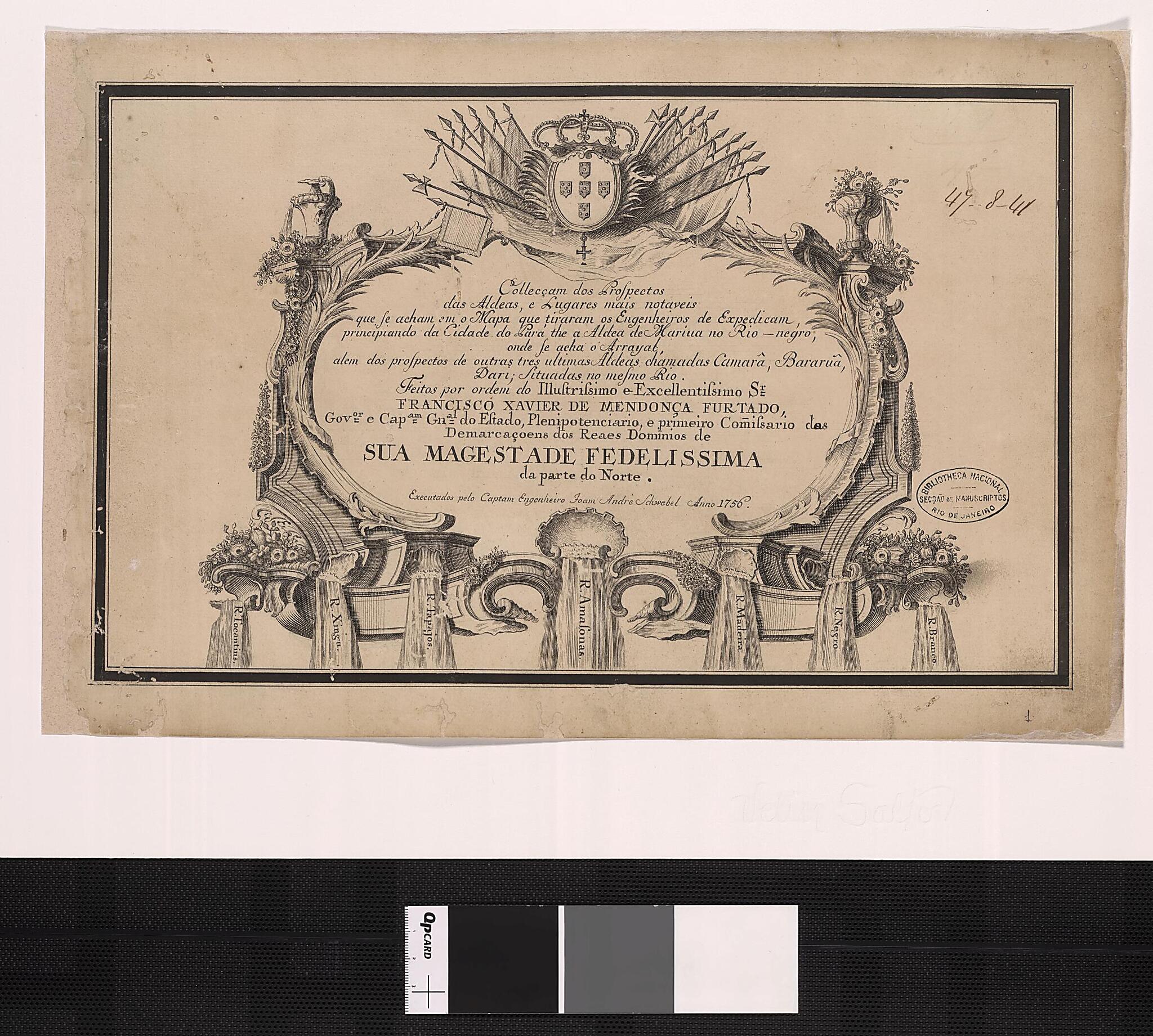
Collection of the Prospects of the Villages, Remarkable Places and People Who Are Depicted In the Map Drawn by the Engineers During Their Expedition That Began from the City of Pará to the Village of Mariua On the Negro River. (Negro) 1756
- Regular price
-
$49.95 - Regular price
-
$34.95 - Sale price
-
$49.95
Buy one map, get any other map in our collection for 50% OFF! Add to cart to see discount.
Couldn't load pickup availability
About This Map
Discover the timeless beauty of our fine art quality printed reproduction of this antique map. Perfect for history enthusiasts, collectors, and interior decorators.
Restored with meticulous attention to detail by our team with over a decade of experience, this stunning reproduction captures the intricate artistry and historical significance of the original map.
Whether you're a collector or seeking a unique decor piece, this archival-quality map reproduction is a timeless addition to any space. Order now to bring history to life!
Old map of Brazil, Pará.This collection of maps shows villages along the Rio Negro and the Amazon. They are the product of an expedition undertaken by a group of engineers tracing the route of the Negro from Pará to Mariua. The drawings mostly feature local houses, churches, and other buildings along the banks of the river. The maps are attributed to the German engineer João André Schwebel, who was a partner of Mendonça Furtado on this expedition.
Created by Joan Andre Schwebel in 1756.
- Title devised, in English, by Library staff.
- Original resource extent: 1 atlas : 26 views ; 13 x 22 centimeters.
- Original resource at: National Library of Brazil.
- Content in Portuguese.
- Description based on data extracted from World Digital Library, which may be extracted from partner institutions.
Map Subjects
Amazon River
Brazil
Pará
Joan Andre Schwebel
1756
- For the best legibility, order your map in the original size or larger. Most maps have intricate detail and small text that is best appreciated when the print size hasn't been reduced.
- Sizes labeled "Fits a Standard Frame" will drop right into any frame that you purchase in that size. The sizes that we offer are commonly available online and at most retail stores.
- Our standard sizes are recommendations based on the aspect ratio of the original map, but still may require some added "white space" in one dimension to fit.
- Non-standard sizes will require custom framing, and we suggest taking your print to the frame shop of your choice after you receive it for the best results.
- Custom sizes are available, simply contact us for a quote.
Below is an approximation of the scale of a few standard sizes, and how they might appear in your space.

