
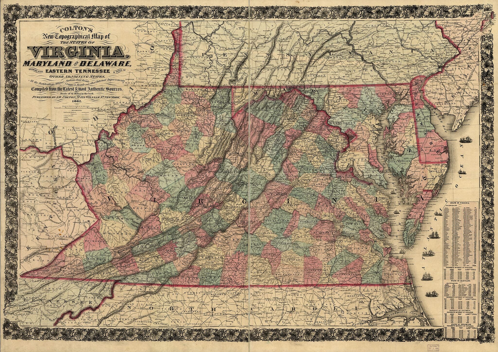
Colton's New Topographical Map of the States of Virginia, Maryland and Delaware, Showing Also Eastern Tennessee & Parts of Other Adjoining States, All the Fortifications, Military Stations, Rail Roads, Common Roads and Other Internal Improvements 1862
- Regular price
-
$150.95 - Regular price
-
$145.95 - Sale price
-
$150.95
Buy one map, get any other map in our collection for 50% OFF! Add to cart to see discount.
Couldn't load pickup availability
About This Map
Discover the timeless beauty of our fine art quality printed reproduction of this antique map. Perfect for history enthusiasts, collectors, and interior decorators.
Restored with meticulous attention to detail by our team with over a decade of experience, this stunning reproduction captures the intricate artistry and historical significance of the original map.
Whether you're a collector or seeking a unique decor piece, this archival-quality map reproduction is a timeless addition to any space. Order now to bring history to life!
Old map of Middle Atlantic States, United States.Created by J. H. (Joseph Hutchins) Colton in 1862.
- Scale 1:760,320.
- Civil War Map
- Another issue.
- Lang & Laing Lith, N.Y.
- "Entered according to Act of Congress in the year 1862 by J. H. Colton."
- 1864 edition listed as Civil War Maps entry no. 48.2
- Additional place names associated with the Civil War have been added, such as Stone Bridge on Bull Run, and Fort Darling, Fair Oaks, and Chickahominy in the environs of Richmond.
- "No. 9" is dropped from the upper left corner.
- Description derived from published bibliography.
Map Subjects
Middle Atlantic States
United States
J. H. (Joseph Hutchins) Colton
1862
- For the best legibility, order your map in the original size or larger. Most maps have intricate detail and small text that is best appreciated when the print size hasn't been reduced.
- Sizes labeled "Fits a Standard Frame" will drop right into any frame that you purchase in that size. The sizes that we offer are commonly available online and at most retail stores.
- Our standard sizes are recommendations based on the aspect ratio of the original map, but still may require some added "white space" in one dimension to fit.
- Non-standard sizes will require custom framing, and we suggest taking your print to the frame shop of your choice after you receive it for the best results.
- Custom sizes are available, simply contact us for a quote.
Below is an approximation of the scale of a few standard sizes, and how they might appear in your space.

