
Comparative View of the Extent and Population of the Colonial Possessions of Great Britain and Other Powers 1829
- Regular price
-
$65.95 - Regular price
-
$60.95 - Sale price
-
$65.95
Buy one map, get any other map in our collection for 50% OFF! Add to cart to see discount.
Couldn't load pickup availability
About This Map
Discover the timeless beauty of our fine art quality printed reproduction of this antique map. Perfect for history enthusiasts, collectors, and interior decorators.
Restored with meticulous attention to detail by our team with over a decade of experience, this stunning reproduction captures the intricate artistry and historical significance of the original map.
Whether you're a collector or seeking a unique decor piece, this archival-quality map reproduction is a timeless addition to any space. Order now to bring history to life!
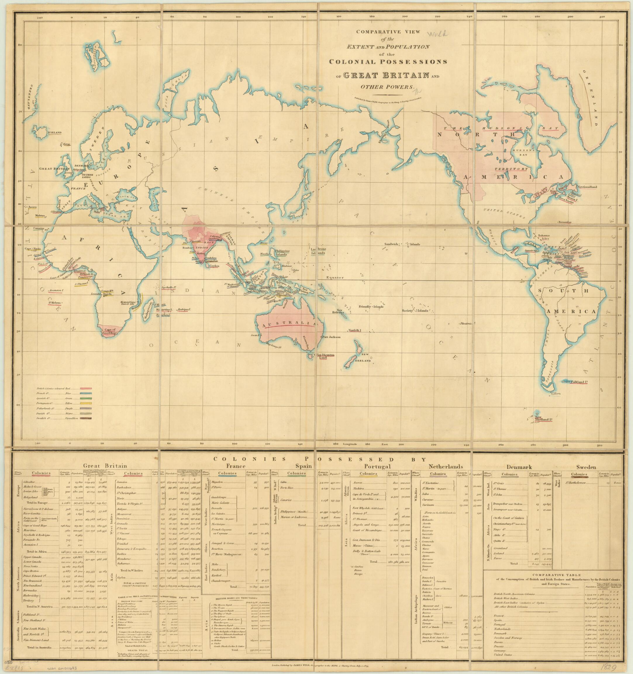
day South Africa), little more than coastal outposts. The Hudson's Bay Territory (much of present-day Canada) is shown as extending into several states of the American Pacific Northwest, reflecting British claims to this territory that were not abandoned until 1846, when the U.S.-- Canada border was set by treaty at 49° North. The map was produced by James Wyld (1790--1836), geographer to the king and founder of a map-publishing firm that was carried on by his son, James Wyld the Younger (1812--87).Created by James Wyld in 1829.
- Title devised, in English, by Library staff.
- Original resource extent: 1 map : dissected and mounted on linen, color ; 39 x 55 centimeters.
- Original resource at: University of Wisconsin-Milwaukee Libraries.
- Content in English.
- Description based on data extracted from World Digital Library, which may be extracted from partner institutions.
- For the best legibility, order your map in the original size or larger. Most maps have intricate detail and small text that is best appreciated when the print size hasn't been reduced.
- Sizes labeled "Fits a Standard Frame" will drop right into any frame that you purchase in that size. The sizes that we offer are commonly available online and at most retail stores.
- Our standard sizes are recommendations based on the aspect ratio of the original map, but still may require some added "white space" in one dimension to fit.
- Non-standard sizes will require custom framing, and we suggest taking your print to the frame shop of your choice after you receive it for the best results.
- Custom sizes are available, simply contact us for a quote.
Below is an approximation of the scale of a few standard sizes, and how they might appear in your space.

