
Zhili Shandong Liang Sheng Di Yu Quan Tu. (直隷山東兩省地與全圖, Complete Map of Zhili and Shandong) 1855
- Regular price
-
$205.95 - Regular price
-
$200.95 - Sale price
-
$205.95
Buy one map, get any other map in our collection for 50% OFF! Add to cart to see discount.
Couldn't load pickup availability
About This Map
Discover the timeless beauty of our fine art quality printed reproduction of this antique map. Perfect for history enthusiasts, collectors, and interior decorators.
Restored with meticulous attention to detail by our team with over a decade of experience, this stunning reproduction captures the intricate artistry and historical significance of the original map.
Whether you're a collector or seeking a unique decor piece, this archival-quality map reproduction is a timeless addition to any space. Order now to bring history to life!
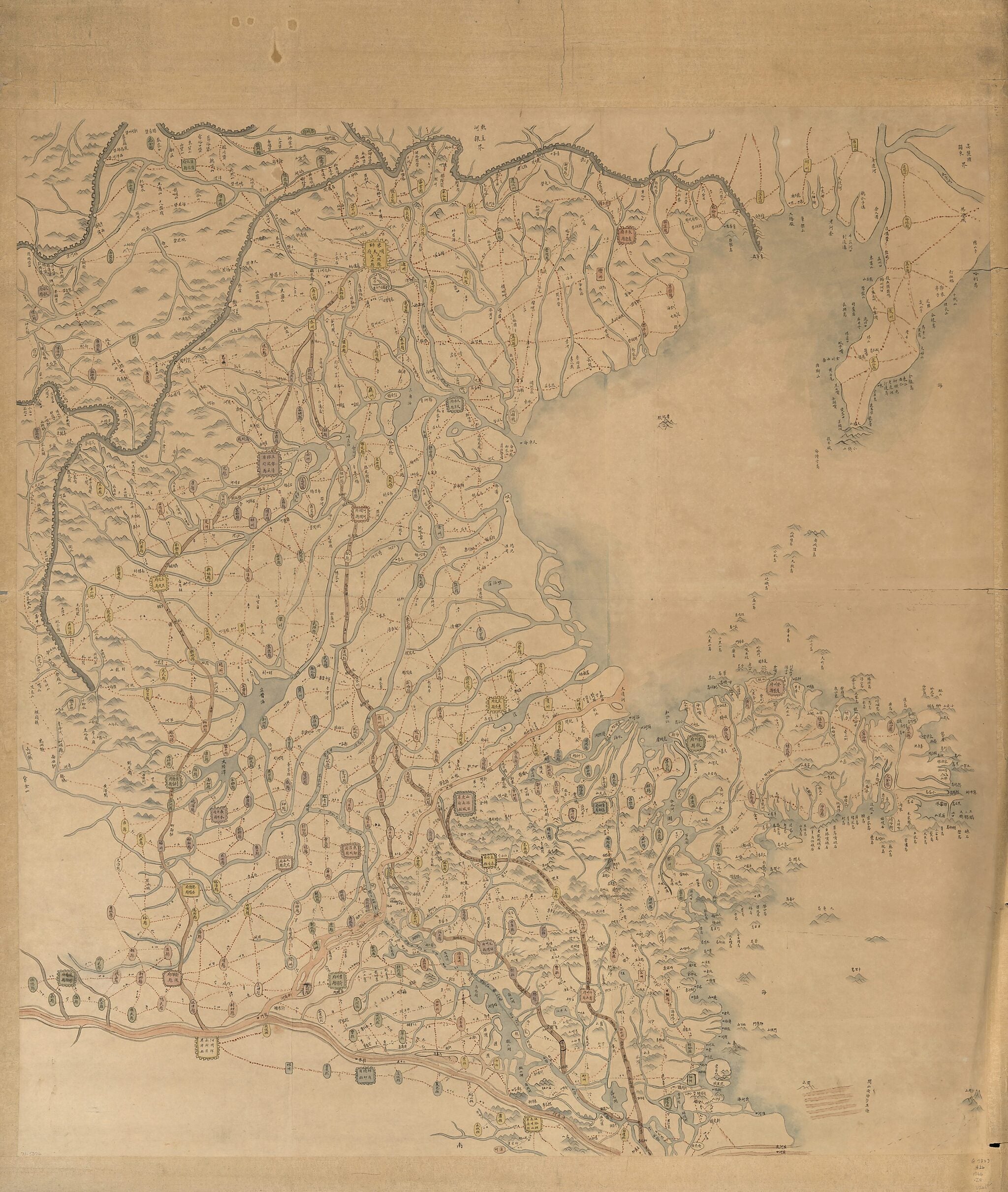
Old map of China, Hebei Sheng, Shandong Sheng.Created by Arthur W. (Arthur William) Hummel in 1855.
- Scale ca. 1:650,000.
- Title from verso.
- Covers Hebei and Shandong provinces.
- Shows course changes of the Yellow River at the time, and through northern Shandong section is labelled as the New Yellow River.
- Relief shown pictorially.
- The old Yellow River's course is shaded with dark beige, and the new Yellow River is light beige, and the other rivers are light blue.
- Hummel purchase 1934, no. 17.
- Previous call number: G7823.H26 1866 .Z4 Vault Oversize
Map Subjects
China
Hebei Sheng
Hebei Sheng (China)
Maps Manuscript
Shandong Sheng
Shandong Sheng (China)
Arthur W. (Arthur William) Hummel
1855
- For the best legibility, order your map in the original size or larger. Most maps have intricate detail and small text that is best appreciated when the print size hasn't been reduced.
- Sizes labeled "Fits a Standard Frame" will drop right into any frame that you purchase in that size. The sizes that we offer are commonly available online and at most retail stores.
- Our standard sizes are recommendations based on the aspect ratio of the original map, but still may require some added "white space" in one dimension to fit.
- Non-standard sizes will require custom framing, and we suggest taking your print to the frame shop of your choice after you receive it for the best results.
- Custom sizes are available, simply contact us for a quote.
Below is an approximation of the scale of a few standard sizes, and how they might appear in your space.

