
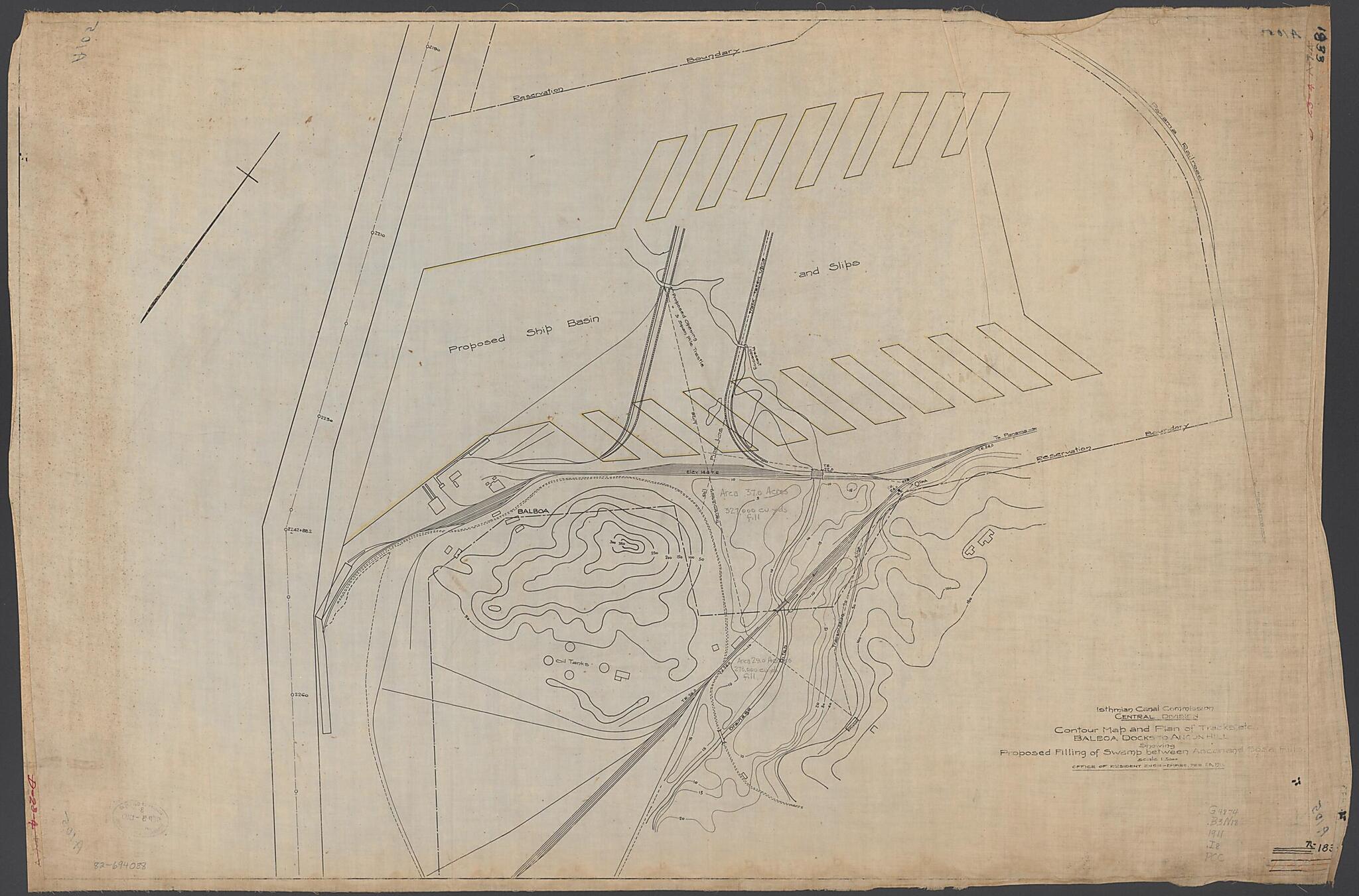
Contour Map and Plan of Tracks, Etc., Balboa Docks to Ancon Hill Showing Proposed Filling of Swamp Between Ancon and Sosa Hills : Scale 1.5000 1911
- Regular price
-
$137.95 - Regular price
-
$132.95 - Sale price
-
$137.95
Buy one map, get any other map in our collection for 50% OFF! Add to cart to see discount.
Couldn't load pickup availability
About This Map
Discover the timeless beauty of our fine art quality printed reproduction of this antique map. Perfect for history enthusiasts, collectors, and interior decorators.
Restored with meticulous attention to detail by our team with over a decade of experience, this stunning reproduction captures the intricate artistry and historical significance of the original map.
Whether you're a collector or seeking a unique decor piece, this archival-quality map reproduction is a timeless addition to any space. Order now to bring history to life!
Old topographic map / manuscript map of Balboa, Panama.Created by Isthiman Canal Commission (U.S.). Central Division, Isthmian Canal Commission (U.S.). Office of the Resident Engineer in 1911.
- Relief shown by contours. Depths shown by contours.
- At head of title: Isthmian Canal Commission, Central Division.
- Transferred from the collection of the Canal Zone Library-Museum, 1980.
- Oriented with north toward the lower left.
- Pen-and-ink.
- "74-1833."
- Map no. A105.
- Annotated in yellow ink to indicate proposed ship basin and slips.
- Annotated in pencil to indicate area total of acres and cubic yards for fill.
Map Subjects
Balboa
Balboa (Panama)
Engineering
Manuscript Maps
Panama
Topographic Maps
Topographic Maps
Manuscript Maps
Isthiman Canal Commission (U.S.). Central Division
Isthmian Canal Commission (U.S.). Office Of The Resident Engineer
1911
- For the best legibility, order your map in the original size or larger. Most maps have intricate detail and small text that is best appreciated when the print size hasn't been reduced.
- Sizes labeled "Fits a Standard Frame" will drop right into any frame that you purchase in that size. The sizes that we offer are commonly available online and at most retail stores.
- Our standard sizes are recommendations based on the aspect ratio of the original map, but still may require some added "white space" in one dimension to fit.
- Non-standard sizes will require custom framing, and we suggest taking your print to the frame shop of your choice after you receive it for the best results.
- Custom sizes are available, simply contact us for a quote.
Below is an approximation of the scale of a few standard sizes, and how they might appear in your space.
