
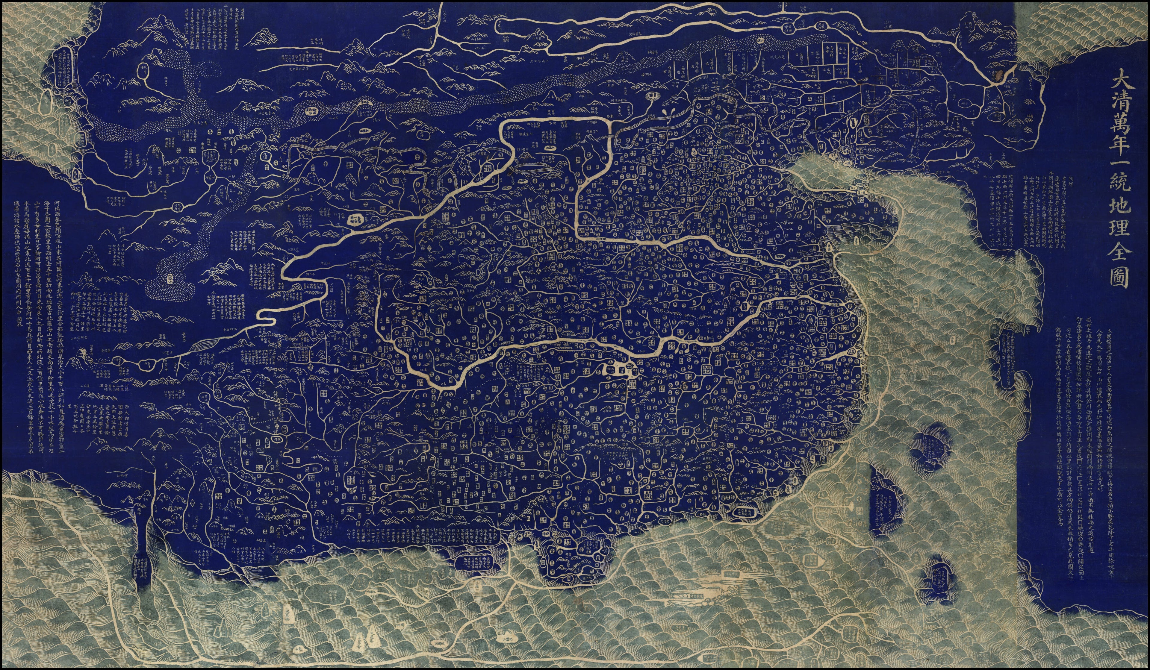
Da Qing Wan Nian Yi Tong Di Li Quan Tu in 1796
- Regular price
-
$302.95 - Regular price
-
$297.95 - Sale price
-
$302.95
Buy one map, get any other map in our collection for 50% OFF! Add to cart to see discount.
Couldn't load pickup availability
About This Map
Discover the timeless beauty of our fine art quality printed reproduction of this antique map. Perfect for history enthusiasts, collectors, and interior decorators.
Restored with meticulous attention to detail by our team with over a decade of experience, this stunning reproduction captures the intricate artistry and historical significance of the original map.
Whether you're a collector or seeking a unique decor piece, this archival-quality map reproduction is a timeless addition to any space. Order now to bring history to life!
Old map of China.1771) in the 32nd year (1767) of the Qianlong reign. The new material is shown in blue and green. Information has been added relating to all the newly established prefectures, sub-prefectures, departments, and districts from the end of the Kangxi reign in 1722 to the beginning of Jiaqing in 1796. The annotations on the map mention the usefulness of marking every 100 square li (a Chinese unit of distance; one li equals about 0.5 kilometer), but such a scale is not shown on the map. The mapmaker's original intention was to create eight vertical scrolls that could be seen hanging on a wall, allowing the viewer to see a representation of the rivers and mountains of China. However, in order to make the map easier to fold and store, during the mounting of the scrolls the map was cut into 24 sheets, which then were combined into a single map.
Created by Qianren Huang in 1796.
- Title devised, in English, by Library staff.
- Original resource extent: 1 map (24 sheets) ; 135 x 236 centimeters.
- Original resource at: National Library of China.
- Content in Chinese.
- Description based on data extracted from World Digital Library, which may be extracted from partner institutions.
- Title revised per Asian Division.--cc28 2023-01-06
- For the best legibility, order your map in the original size or larger. Most maps have intricate detail and small text that is best appreciated when the print size hasn't been reduced.
- Sizes labeled "Fits a Standard Frame" will drop right into any frame that you purchase in that size. The sizes that we offer are commonly available online and at most retail stores.
- Our standard sizes are recommendations based on the aspect ratio of the original map, but still may require some added "white space" in one dimension to fit.
- Non-standard sizes will require custom framing, and we suggest taking your print to the frame shop of your choice after you receive it for the best results.
- Custom sizes are available, simply contact us for a quote.
Below is an approximation of the scale of a few standard sizes, and how they might appear in your space.
