
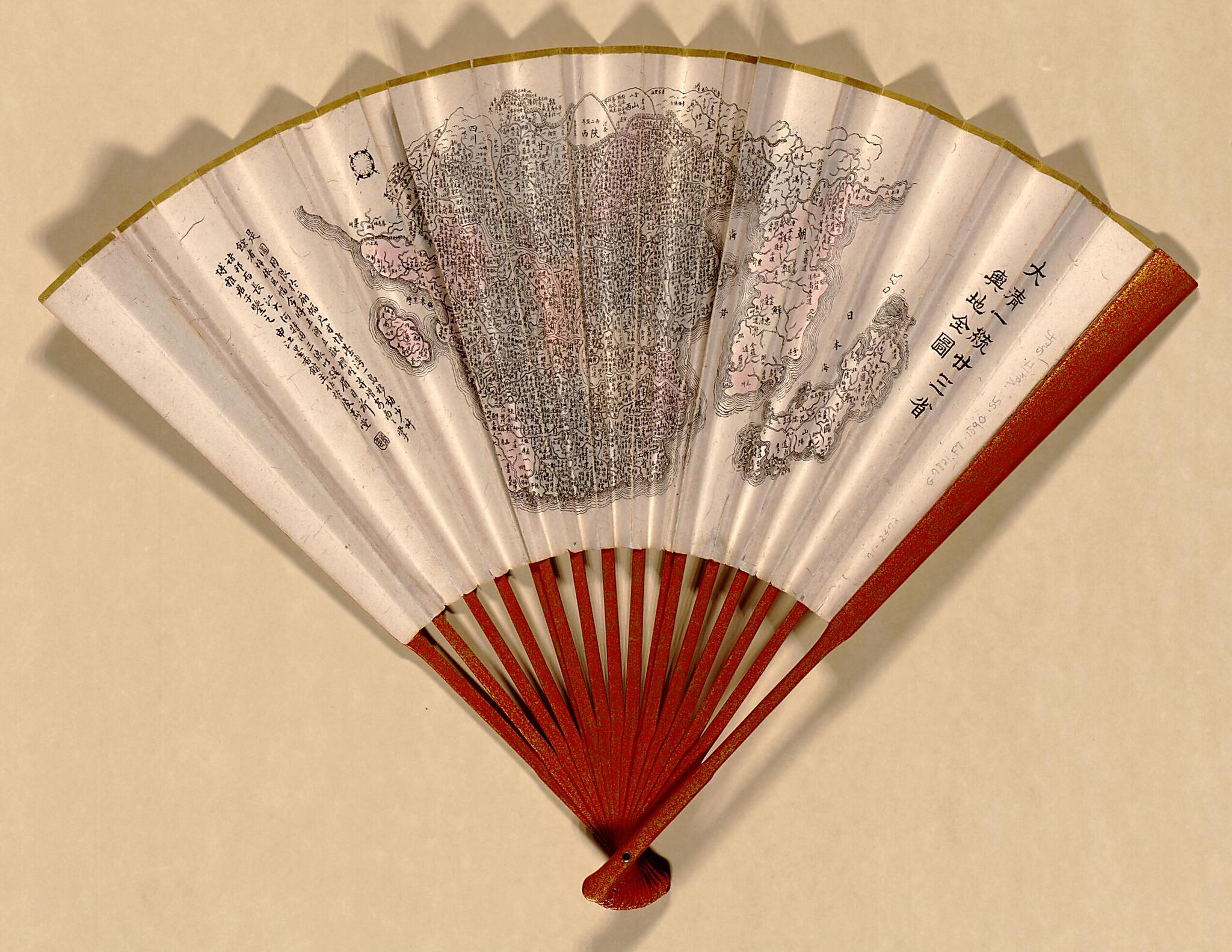
Da Qing Yi Tong Er Shi San Sheng Yu Di Quan Tu. (大清一统二十三省舆地全图, Da Qing Yi Tong Nian San Sheng Yu Di Quan Tu, Three Provinces of the Great Qing Dynasty) 1890
- Regular price
-
$49.95 - Regular price
-
$34.95 - Sale price
-
$49.95
Buy one map, get any other map in our collection for 50% OFF! Add to cart to see discount.
Couldn't load pickup availability
About This Map
Discover the timeless beauty of our fine art quality printed reproduction of this antique map. Perfect for history enthusiasts, collectors, and interior decorators.
Restored with meticulous attention to detail by our team with over a decade of experience, this stunning reproduction captures the intricate artistry and historical significance of the original map.
Whether you're a collector or seeking a unique decor piece, this archival-quality map reproduction is a timeless addition to any space. Order now to bring history to life!
Old map of China, Japan, Korea.Created by Shenjiang Mo Shu Guan in 1890.
- Not drawn to scale.
- Shows 23 provinces of China, including Taiwan. Also shows Korea, and Japan.
- Pictorial map.
- Wood block print.
- Relief shown pictorially.
- Oriented with north toward the upper right.
- Title in alternate reading: Da Qing yi tong er shi san sheng yu di quan tu.
- List of administrative subdivisions of each province on verso.
- Previous call no.: G7821.S37 1890 .S5
Map Subjects
Administrative And Political Divisions
China
Japan
Korea
Shenjiang Mo Shu Guan
1890
- For the best legibility, order your map in the original size or larger. Most maps have intricate detail and small text that is best appreciated when the print size hasn't been reduced.
- Sizes labeled "Fits a Standard Frame" will drop right into any frame that you purchase in that size. The sizes that we offer are commonly available online and at most retail stores.
- Our standard sizes are recommendations based on the aspect ratio of the original map, but still may require some added "white space" in one dimension to fit.
- Non-standard sizes will require custom framing, and we suggest taking your print to the frame shop of your choice after you receive it for the best results.
- Custom sizes are available, simply contact us for a quote.
Below is an approximation of the scale of a few standard sizes, and how they might appear in your space.

