
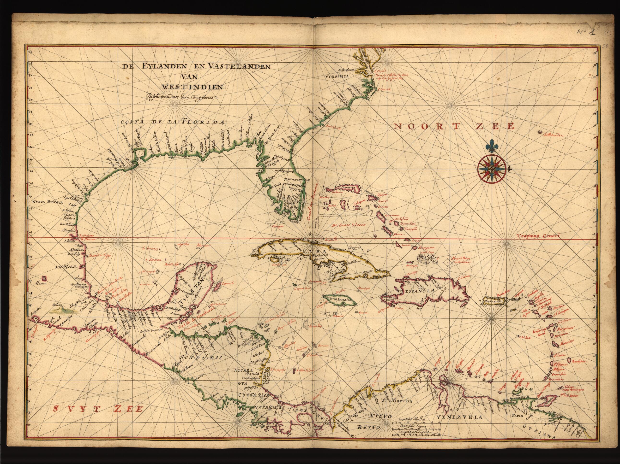
De Eylanden En Vastelanden Van Westindien 1639
- Regular price
-
$75.95 - Regular price
-
$70.95 - Sale price
-
$75.95
Buy one map, get any other map in our collection for 50% OFF! Add to cart to see discount.
Couldn't load pickup availability
About This Map
Discover the timeless beauty of our fine art quality printed reproduction of this antique map. Perfect for history enthusiasts, collectors, and interior decorators.
Restored with meticulous attention to detail by our team with over a decade of experience, this stunning reproduction captures the intricate artistry and historical significance of the original map.
Whether you're a collector or seeking a unique decor piece, this archival-quality map reproduction is a timeless addition to any space. Order now to bring history to life!
Old map of Atlantic Coast, North America, South America.Created by Joan Vinckeboons in 1639.
- Relief shown pictorially.
- Shows the coasts of North America and South America from Virginia through the Yucatan Peninsula in Mexico to Guiana in South America highlighting Cuba, the island of Hispaniola and the West Indies.
- Pen-and-ink and watercolor.
- Described in Terrae incognitae, v. xvi, 1984. Richard W. Stephenson's The Henry Harrisse collection ... , p. 40; the first volume has binder's title "Manuscript maps of the West-Indies drawn by Joan Vingboons in 1639."
- No. 190 in Quatrième centenaire de la découverte de l'Amérique. Catalogue des documents géographique exposés à ... la Bibliothèque nationale. Paris, 1802.
- For the best legibility, order your map in the original size or larger. Most maps have intricate detail and small text that is best appreciated when the print size hasn't been reduced.
- Sizes labeled "Fits a Standard Frame" will drop right into any frame that you purchase in that size. The sizes that we offer are commonly available online and at most retail stores.
- Our standard sizes are recommendations based on the aspect ratio of the original map, but still may require some added "white space" in one dimension to fit.
- Non-standard sizes will require custom framing, and we suggest taking your print to the frame shop of your choice after you receive it for the best results.
- Custom sizes are available, simply contact us for a quote.
Below is an approximation of the scale of a few standard sizes, and how they might appear in your space.

