
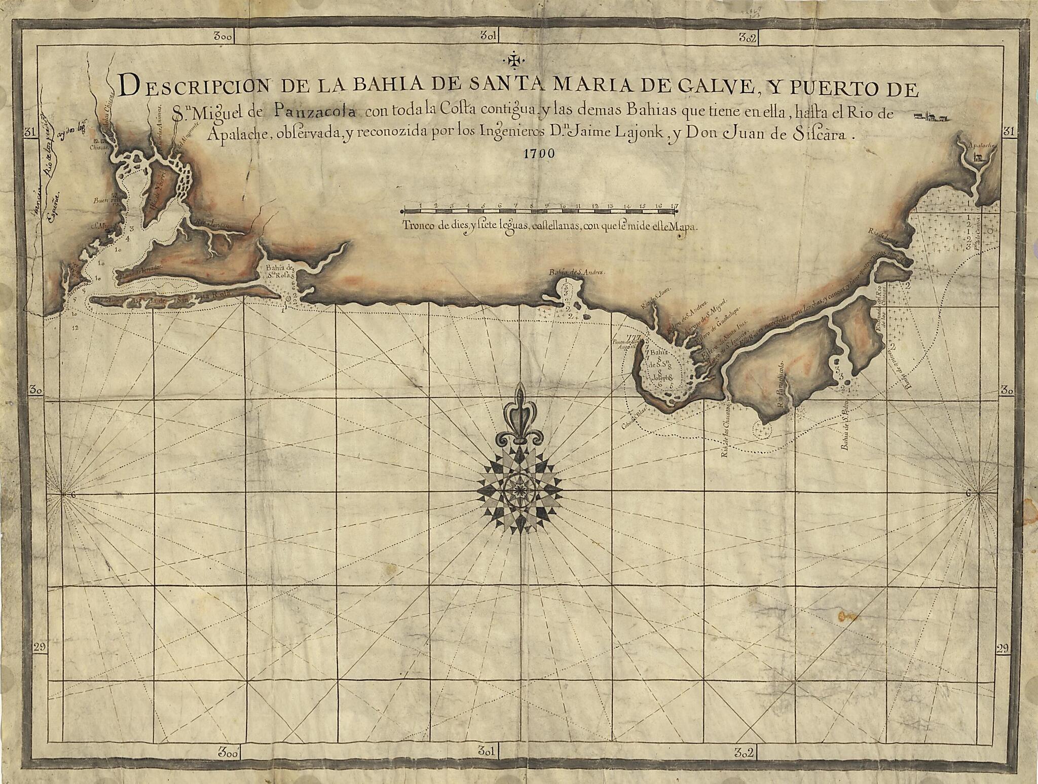
Descripcion De La Bahia De Santa Maria De Galve, Y Puerto De Sn. Miguel De Panzacola Con Toda La Costa Contigua Y Las Demas Bahias Que Tiene En Ella, Hasta El Rio De Apalache 1700
- Regular price
-
$56.95 - Regular price
-
$39.95 - Sale price
-
$56.95
Buy one map, get any other map in our collection for 50% OFF! Add to cart to see discount.
Couldn't load pickup availability
About This Map
Discover the timeless beauty of our fine art quality printed reproduction of this antique map. Perfect for history enthusiasts, collectors, and interior decorators.
Restored with meticulous attention to detail by our team with over a decade of experience, this stunning reproduction captures the intricate artistry and historical significance of the original map.
Whether you're a collector or seeking a unique decor piece, this archival-quality map reproduction is a timeless addition to any space. Order now to bring history to life!
Old manuscript map / portolan chart / early map of Apalachicola Region, Florida, Florida Panhandle, Pensacola Region, United States.Created by Jaime Lajonk, Juan De Siscara in 1700.
- Covers coast of western Florida Panhandle from Pensacola to Apalachicola.
- Depths shown by soundings.
- Prime meridian: Terceira Island, Azores [?].
- Pen-and-ink and orange watercolor.
- Includes notes.
- This map has some imperfections: wrinkled, stained, and creased. We'll do our best to restore the image before printing.
Map Subjects
Apalachicola Region
Apalachicola Region (Fla.)
Coasts
Early Maps
Early Works To 1800
Florida
Florida Panhandle
Florida Panhandle (Fla.)
Manuscript Maps
Pensacola Region
Pensacola Region (Fla.)
Portolan Charts
United States
Jaime Lajonk
Juan De Siscara
1700
- For the best legibility, order your map in the original size or larger. Most maps have intricate detail and small text that is best appreciated when the print size hasn't been reduced.
- Sizes labeled "Fits a Standard Frame" will drop right into any frame that you purchase in that size. The sizes that we offer are commonly available online and at most retail stores.
- Our standard sizes are recommendations based on the aspect ratio of the original map, but still may require some added "white space" in one dimension to fit.
- Non-standard sizes will require custom framing, and we suggest taking your print to the frame shop of your choice after you receive it for the best results.
- Custom sizes are available, simply contact us for a quote.
Below is an approximation of the scale of a few standard sizes, and how they might appear in your space.

