
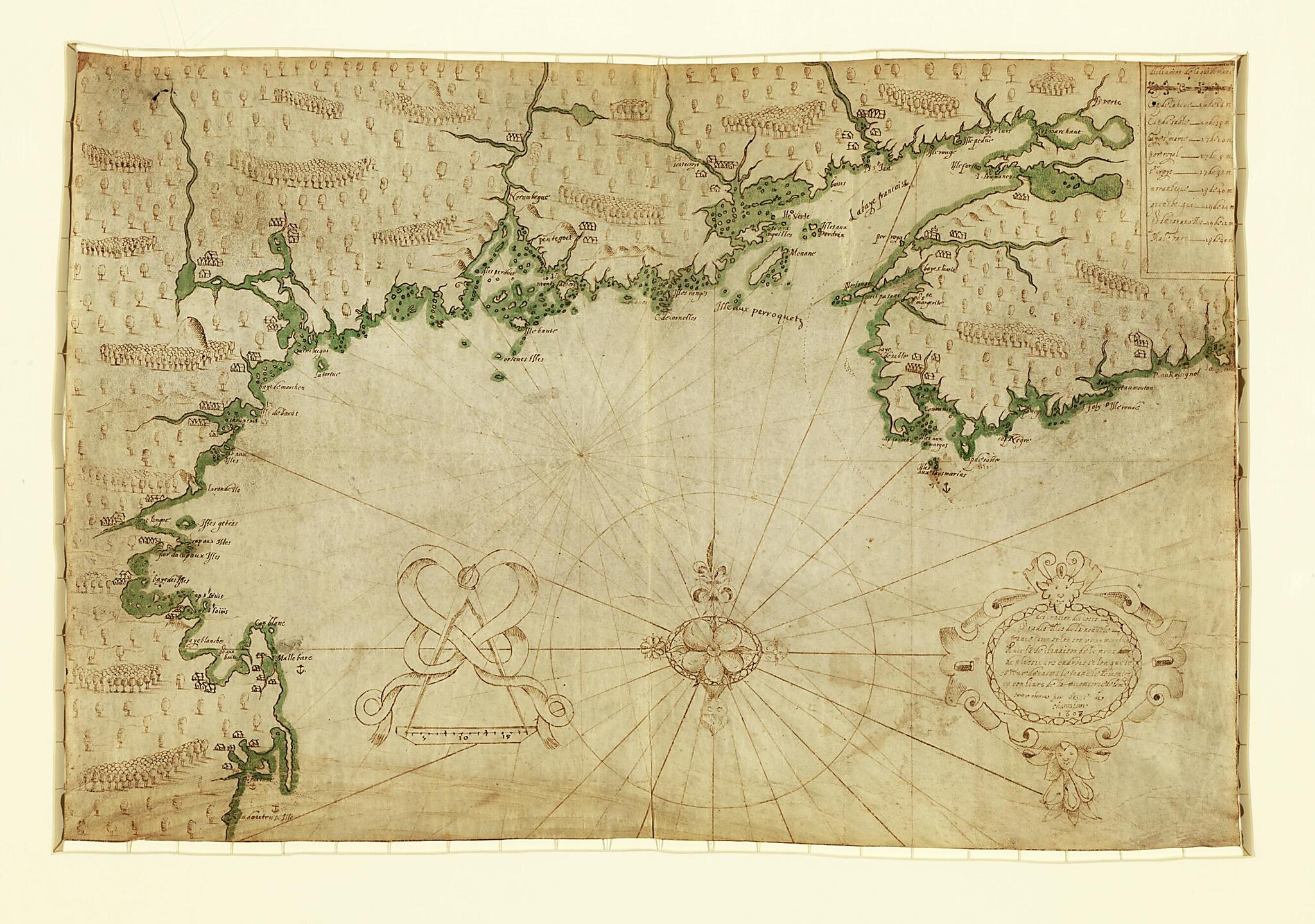
Descripsion Des Costs, Pts., Rades, Illes De La Nouuele France Faict Selon Son Vray Méridien : Avec La Déclinaison De La Ment De Plussieurs Endrois Selon Que Le Sieur De Castes Le Franc Le Démontre En Son Liure De La Mécométrie De L'emnt 1607
- Regular price
-
$84.95 - Regular price
-
$79.95 - Sale price
-
$84.95
Buy one map, get any other map in our collection for 50% OFF! Add to cart to see discount.
Couldn't load pickup availability
About This Map
Discover the timeless beauty of our fine art quality printed reproduction of this antique map. Perfect for history enthusiasts, collectors, and interior decorators.
Restored with meticulous attention to detail by our team with over a decade of experience, this stunning reproduction captures the intricate artistry and historical significance of the original map.
Whether you're a collector or seeking a unique decor piece, this archival-quality map reproduction is a timeless addition to any space. Order now to bring history to life!
Old manuscript map / portolan chart / early map of Atlantic Coast, North America.Created by Samuel De Champlain in 1607.
- Shows coast of North America from western Nova Scotia to Cape Cod.
- Relief shown pictorially.
- Pen-and-ink with green wash.
- Vellum chart collection, no. 15.
- Includes table of longitude calculations in upper right corner, title cartouche, and decorative scale not specifying measurement.
- This map has some imperfections: vertically fold-lined at center; small holes at upper left and upper right. We'll do our best to restore the image before printing.
- Gift; Henry Harrisse; 1910.
Map Subjects
Atlantic Coast
Atlantic Coast (North America)
Early Maps
Early Works To 1800
Manuscript Maps
North America
Portolan Charts
Samuel De Champlain
1607
- For the best legibility, order your map in the original size or larger. Most maps have intricate detail and small text that is best appreciated when the print size hasn't been reduced.
- Sizes labeled "Fits a Standard Frame" will drop right into any frame that you purchase in that size. The sizes that we offer are commonly available online and at most retail stores.
- Our standard sizes are recommendations based on the aspect ratio of the original map, but still may require some added "white space" in one dimension to fit.
- Non-standard sizes will require custom framing, and we suggest taking your print to the frame shop of your choice after you receive it for the best results.
- Custom sizes are available, simply contact us for a quote.
Below is an approximation of the scale of a few standard sizes, and how they might appear in your space.

