


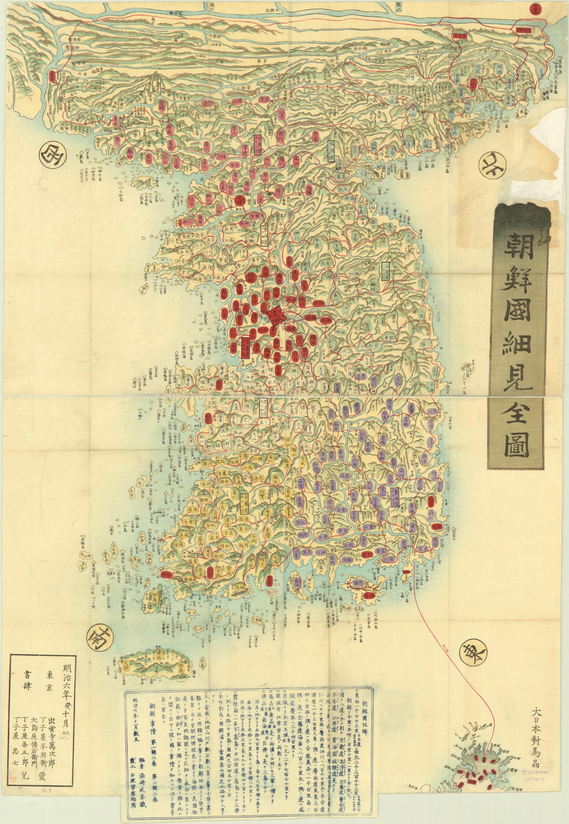
Detailed Map of the Country of Chōsen 1873
- Regular price
-
$120.95 - Regular price
-
$115.95 - Sale price
-
$120.95
Buy one map, get any other map in our collection for 50% OFF! Add to cart to see discount.
Couldn't load pickup availability
About This Map
Discover the timeless beauty of our fine art quality printed reproduction of this antique map. Perfect for history enthusiasts, collectors, and interior decorators.
Restored with meticulous attention to detail by our team with over a decade of experience, this stunning reproduction captures the intricate artistry and historical significance of the original map.
Whether you're a collector or seeking a unique decor piece, this archival-quality map reproduction is a timeless addition to any space. Order now to bring history to life!
Old map of Democratic People's Republic of Korea, Republic of Korea.1912). It draws on earlier maps and was edited by Nobufusa Somezaki (1818-86), also known as Shunsui Tamenaga, Junior, a gesakusha (writer of entertaining fiction) and journalist. The map appears to have been included in Tamenaga's two-volume Chōsen jijō (Korean affairs) published in 1874, for which Neisai Ishizuka is credited as a co-author. Chōsen and Chosŏn are, respectively, the Japanese and Korean names for Korea. The book includes more detail than appears on the map, for example concerning numbers of houses and population, as well as information about Korean history, the system of government, laws, the types of weapons produced in Korea, and the daily lives of the people. It cites references for this information. On the map, the small scripts next to the sentences of text indicate how Chinese characters can be easily read. Scale on the map is marked in ri, a unit of measurement that has varied historically and was used in China, Japan, and Korea. The red diamond shape marks Keijō, the Japanese name for present-day Seoul, and the red circle denotes P'yongyang. The large river at the north of the peninsula is the Yalu (also called the Amnok).
Created by Neisai Ishizuka, Shunsui Tamenaga in 1873.
- Title devised, in English, by Library staff.
- Original resource extent: 1 map : color ; 104 x 71 centimeters.
- Reference extracted from World Digital Library: Charles Dallet, Histoire de l'Église de Corée, précédée d'une introduction sur l'histoire, les institutions, la langue, les moeurs et coutumes coréennes (Paris: V. Palmé, 1874).|Charles Dallet, Johannes Lydius Catharinus Pompe van Meerdervoort, and Enomoto Takeaki, Chōsen jijō [Korean affairs] (Tokyo: Ukichi Yuzo, 1876).
- Original resource at: University of Wisconsin-Milwaukee Libraries.
- Content in Japanese.
- Description based on data extracted from World Digital Library, which may be extracted from partner institutions.
- For the best legibility, order your map in the original size or larger. Most maps have intricate detail and small text that is best appreciated when the print size hasn't been reduced.
- Sizes labeled "Fits a Standard Frame" will drop right into any frame that you purchase in that size. The sizes that we offer are commonly available online and at most retail stores.
- Our standard sizes are recommendations based on the aspect ratio of the original map, but still may require some added "white space" in one dimension to fit.
- Non-standard sizes will require custom framing, and we suggest taking your print to the frame shop of your choice after you receive it for the best results.
- Custom sizes are available, simply contact us for a quote.
Below is an approximation of the scale of a few standard sizes, and how they might appear in your space.

