
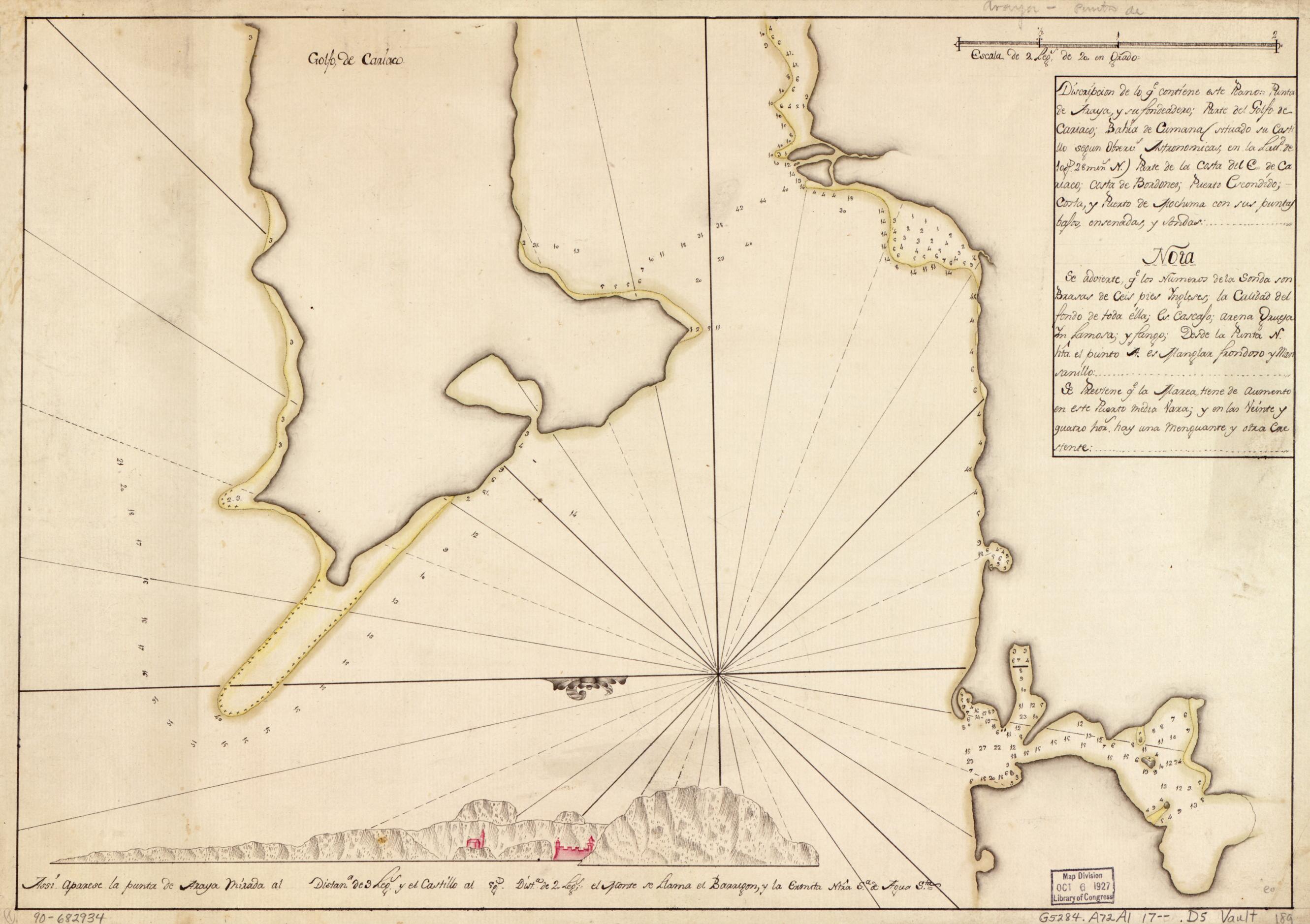
Discripción De Lo Qe. Contiene Este Plano Punta De Araya Y Su Fondeadero, Parte Del Golfo De Cariaco, Bahía De Cumana (situado Su Castillo Segun Observs. Astronómicas, En La Lattd. De 10 Gs. 28 Mins. N.), Parte De La Costa Del E. De Cariaco, Costa ...
- Regular price
-
$70.95 - Regular price
-
$65.95 - Sale price
-
$70.95
Shipping calculated at checkout.
Buy one map, get one map 50% off!
Couldn't load pickup availability
About This Map
Discover the timeless beauty of our fine art quality printed reproduction of this antique map. Perfect for history enthusiasts, collectors, and interior decorators.
Restored with meticulous attention to detail by our team with over a decade of experience, this stunning reproduction captures the intricate artistry and historical significance of the original map.
Whether you're a collector or seeking a unique decor piece, this archival-quality map reproduction is a timeless addition to any space. Order now to bring history to life!
Old map of Araya Region, Atlantic Coast, Venezuela.- Shows coast of Venezuela in the region of Araya.
- Depths shown by soundings.
- Oriented with north toward the lower left.
- Watermark: IV. Watermark dated from 1668-1812.
- Pen-and-ink and watercolor.
- Mounted on cloth backing.
- Includes note and view.
- Maggs number annotated in pencil in lower right margin: 189.
Map Sizing Information
- For the best legibility, order your map in the original size or larger. Most maps have intricate detail and small text that is best appreciated when the print size hasn't been reduced.
- Sizes labeled "Fits a Standard Frame" will drop right into any frame that you purchase in that size. The sizes that we offer are commonly available online and at most retail stores.
- Our standard sizes are recommendations based on the aspect ratio of the original map, but still may require some added "white space" in one dimension to fit.
- Non-standard sizes will require custom framing, and we suggest taking your print to the frame shop of your choice after you receive it for the best results.
- Custom sizes are available, simply contact us for a quote.
Below is an approximation of the scale of a few standard sizes, and how they might appear in your space.

