
District of Columbia 1892
- Regular price
-
$49.95 - Regular price
-
$29.95 - Sale price
-
$49.95
Buy one map, get any other map in our collection for 50% OFF! Add to cart to see discount.
Couldn't load pickup availability
About This Map
Discover the timeless beauty of our fine art quality printed reproduction of this antique map. Perfect for history enthusiasts, collectors, and interior decorators.
Restored with meticulous attention to detail by our team with over a decade of experience, this stunning reproduction captures the intricate artistry and historical significance of the original map.
Whether you're a collector or seeking a unique decor piece, this archival-quality map reproduction is a timeless addition to any space. Order now to bring history to life!
Old topographic map of District of Columbia, United States, Washington, Washington D.C..Created by Evans & Bartle, U.S. Coast and Geodetic Survey in 1892.
- Topographic map showing lot lines, buildings, and woods.
- Covers District of Columbia outside former Washington city limits (Florida Avenue).
- Relief shown by contours and hachures.
- Engraver's statement does not appear on some maps.
- Oriented with north toward the upper left.
- Sheets numbered 1 thru 90 and No. 3101 thru No. 3190 with unused numbers.
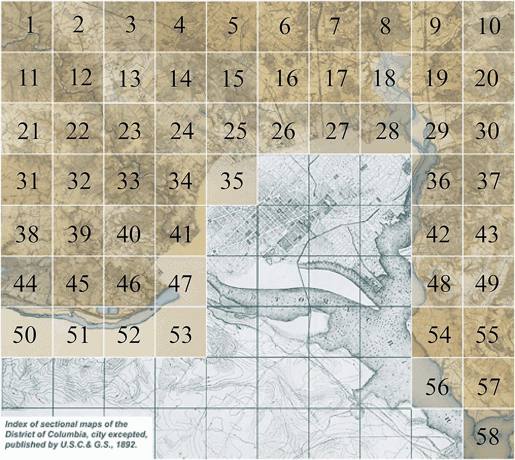
- Accompanied by sheet index map: Index of sectional maps of the District of Columbia, city excepted, published by U.S.C. & G.S. (58 sheets). 1 sheet : neg. photocopy ; 36 x 36 cm.
- Includes note.
- Laminated and mounted on cloth backing.
Map Subjects
District Of Columbia
Topographic Maps
United States
Washington
Washington (D.C.)
Washington D.C.
Topographic Maps
Evans & Bartle
U.S. Coast And Geodetic Survey
1892
- For the best legibility, order your map in the original size or larger. Most maps have intricate detail and small text that is best appreciated when the print size hasn't been reduced.
- Sizes labeled "Fits a Standard Frame" will drop right into any frame that you purchase in that size. The sizes that we offer are commonly available online and at most retail stores.
- Our standard sizes are recommendations based on the aspect ratio of the original map, but still may require some added "white space" in one dimension to fit.
- Non-standard sizes will require custom framing, and we suggest taking your print to the frame shop of your choice after you receive it for the best results.
- Custom sizes are available, simply contact us for a quote.
Below is an approximation of the scale of a few standard sizes, and how they might appear in your space.

