
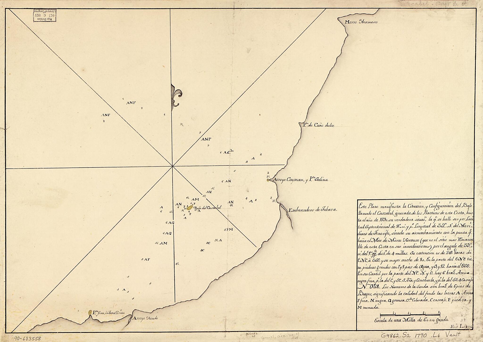
Este Plano Manifiesta La Cituación Y Configuración Del Bajo Llamado El Cascabel, Ignorada De Los Practicos De Esta Costa, Hasta El Año 1790, Su Verdadera Situacn. La Qe. Se Hallo Ser Por Latitud Septentrional De 11⁰00ʹ Y Pr. Longitud De 302⁰01...
- Regular price
-
$54.95 - Regular price
-
$33.95 - Sale price
-
$54.95
Buy one map, get any other map in our collection for 50% OFF! Add to cart to see discount.
Couldn't load pickup availability
About This Map
Discover the timeless beauty of our fine art quality printed reproduction of this antique map. Perfect for history enthusiasts, collectors, and interior decorators.
Restored with meticulous attention to detail by our team with over a decade of experience, this stunning reproduction captures the intricate artistry and historical significance of the original map.
Whether you're a collector or seeking a unique decor piece, this archival-quality map reproduction is a timeless addition to any space. Order now to bring history to life!
Old map of Central America, Costa Rica, Nicaragua, Pacific Coast, Salinas Bay.Created by Lopez in 1790.
- Shows a portion of the Salinas Bay and associated coast between Morro Hermoso and Arroyo Hondo.
- Depths shown by soundings.
- Prime meridian: Tenerife.
- Watermark: Van der Ley.
- Pen-and-ink and yellow watercolor.
- Mounted on cloth backing.
- Maggs number annotated in pencil in lower right corner: 39.
Map Subjects
Central America
Coasts
Costa Rica
Early Works To 1800
Manuscript Maps
Maps Manuscript
Nicaragua
Pacific Coast
Pacific Coast (Central America)
Salinas Bay
Salinas Bay (Costa Rica And Nicaragua)
Lopez
1790
- For the best legibility, order your map in the original size or larger. Most maps have intricate detail and small text that is best appreciated when the print size hasn't been reduced.
- Sizes labeled "Fits a Standard Frame" will drop right into any frame that you purchase in that size. The sizes that we offer are commonly available online and at most retail stores.
- Our standard sizes are recommendations based on the aspect ratio of the original map, but still may require some added "white space" in one dimension to fit.
- Non-standard sizes will require custom framing, and we suggest taking your print to the frame shop of your choice after you receive it for the best results.
- Custom sizes are available, simply contact us for a quote.
Below is an approximation of the scale of a few standard sizes, and how they might appear in your space.

