


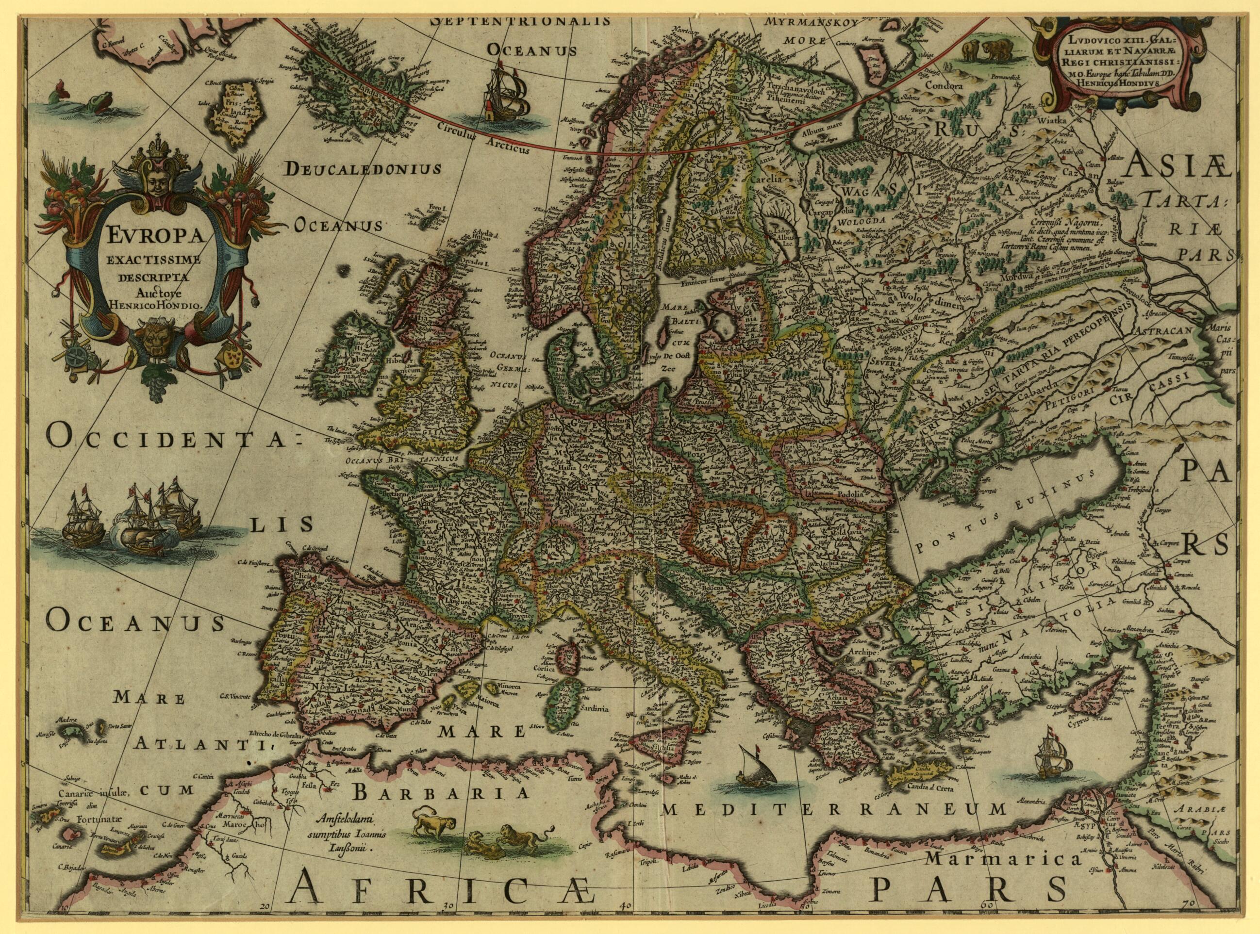
Europe, Very Precisely Represented. (Europa Exactissime Descripta) 1620
- Regular price
-
$63.95 - Regular price
-
$58.95 - Sale price
-
$63.95
Buy one map, get any other map in our collection for 50% OFF! Add to cart to see discount.
Couldn't load pickup availability
About This Map
Discover the timeless beauty of our fine art quality printed reproduction of this antique map. Perfect for history enthusiasts, collectors, and interior decorators.
Restored with meticulous attention to detail by our team with over a decade of experience, this stunning reproduction captures the intricate artistry and historical significance of the original map.
Whether you're a collector or seeking a unique decor piece, this archival-quality map reproduction is a timeless addition to any space. Order now to bring history to life!
-1651). Hondius was the son of Jodocus Hondius (1563--1612), a Flemish cartographer and engraver who settled in Amsterdam around 1593 and established a business producing maps and atlases. He is known for reestablishing the rightful famous reputation of Gerardus Mercator. In 1604 Hondius acquired the plates for Mercator's world atlas and in 1606 published a new edition of this famous work. After their father's death in 1612, Henricus and his brother Jodocus carried on the family business. With his brother-in-law Johann Jansson, Henricus continued publication of what became known as the Mercator-Hondius atlas. Frisland, a mythical island near Iceland, appears on this and most charts of the North Atlantic from the 1560s until the 1660s. The map of Europe was completely redrawn and updated in later editions. It is decorated with two cartouches, pictures of animals including a pride of Barbary lions in North Africa, sailing ships, a sea monster, and trees. The cartouche at top right dedicates the map to "Ludovico XIII Galliarum et Navarrae Regi Christianissimo Europe hanc Tabulam" (The most Christian king of France and Navarre, Louis XIII).Created by Hendrik Hondius, King of France Louis XIII in 1620.
- Title devised, in English, by Library staff.
- "Scale approximately 1:13,215,000"--Note extracted from World Digital Library.
- Original resource extent: 1 map : color ; 36 x 49 centimeters.
- Original resource at: Qatar National Library.
- Content in Latin.
- Description based on data extracted from World Digital Library, which may be extracted from partner institutions.
- For the best legibility, order your map in the original size or larger. Most maps have intricate detail and small text that is best appreciated when the print size hasn't been reduced.
- Sizes labeled "Fits a Standard Frame" will drop right into any frame that you purchase in that size. The sizes that we offer are commonly available online and at most retail stores.
- Our standard sizes are recommendations based on the aspect ratio of the original map, but still may require some added "white space" in one dimension to fit.
- Non-standard sizes will require custom framing, and we suggest taking your print to the frame shop of your choice after you receive it for the best results.
- Custom sizes are available, simply contact us for a quote.
Below is an approximation of the scale of a few standard sizes, and how they might appear in your space.

