
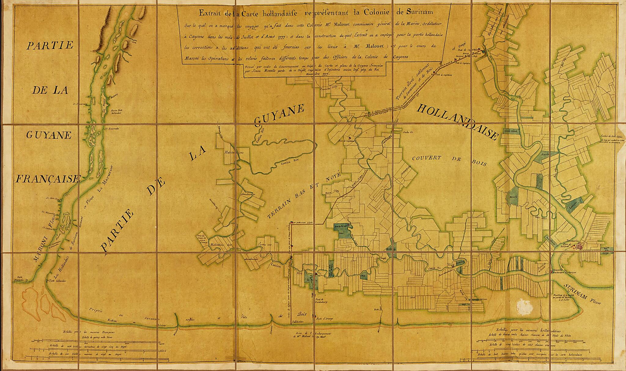
Extrait De La Carte Hollandise Representant La Colonie De Surinam : Sur Le Quel On a Marque Les Voyages Qu'a Fait Dans Cette Colonie Mr. Malonet, Commissaire Général De La Marine, Ordonateur à Cayenne Dans Les Mois De Juillet Et D'aoust 1777 Et Dan...
- Regular price
-
$104.95 - Regular price
-
$99.95 - Sale price
-
$104.95
Buy one map, get any other map in our collection for 50% OFF! Add to cart to see discount.
Couldn't load pickup availability
About This Map
Discover the timeless beauty of our fine art quality printed reproduction of this antique map. Perfect for history enthusiasts, collectors, and interior decorators.
Restored with meticulous attention to detail by our team with over a decade of experience, this stunning reproduction captures the intricate artistry and historical significance of the original map.
Whether you're a collector or seeking a unique decor piece, this archival-quality map reproduction is a timeless addition to any space. Order now to bring history to life!
Old map of Atlantic Coast, Suriname.Created by Simon M. Mentelle in 1777.
- Cadastral map of eastern coast of Suriname.
- Relief shown by shading.
- Printed label with tab mounted on verso: Ch. Picquet, géographe ordinaire du roi et S.A.S. Monseigr. le Duc d'Orléans. A Paris Quai de Conti no. 17, entre l'Hôtel des Monnaies et le Pont des Arts. Annotated in black ink on label: Colonie de Surinam. Annotated in black ink on tab: Côte de la Guyane.
- Oriented with north to the bottom.
- Pen-and-ink and watercolors.
Map Subjects
Atlantic Coast
Early Works To 1800
Manuscript Maps
Real Property
Suriname
Simon M. Mentelle
1777
- For the best legibility, order your map in the original size or larger. Most maps have intricate detail and small text that is best appreciated when the print size hasn't been reduced.
- Sizes labeled "Fits a Standard Frame" will drop right into any frame that you purchase in that size. The sizes that we offer are commonly available online and at most retail stores.
- Our standard sizes are recommendations based on the aspect ratio of the original map, but still may require some added "white space" in one dimension to fit.
- Non-standard sizes will require custom framing, and we suggest taking your print to the frame shop of your choice after you receive it for the best results.
- Custom sizes are available, simply contact us for a quote.
Below is an approximation of the scale of a few standard sizes, and how they might appear in your space.
