Skip to product information
1 of 1

Field of Shiloh. April 6-7, 1862 1886

Regular price
$41.95
Regular price
$64.95
Sale price
$41.95
Help with Choosing a Map Size

90-Day Satisfaction Guarantee & Free Returns

About This Map

Discover the timeless beauty of our fine art quality printed reproduction of this antique map. Perfect for history enthusiasts, collectors, and interior decorators.

Restored with meticulous attention to detail by our team with over a decade of experience, this stunning reproduction captures the intricate artistry and historical significance of the original map.

Whether you're a collector or seeking a unique decor piece, this archival-quality map reproduction is a timeless addition to any space. Order now to bring history to life!

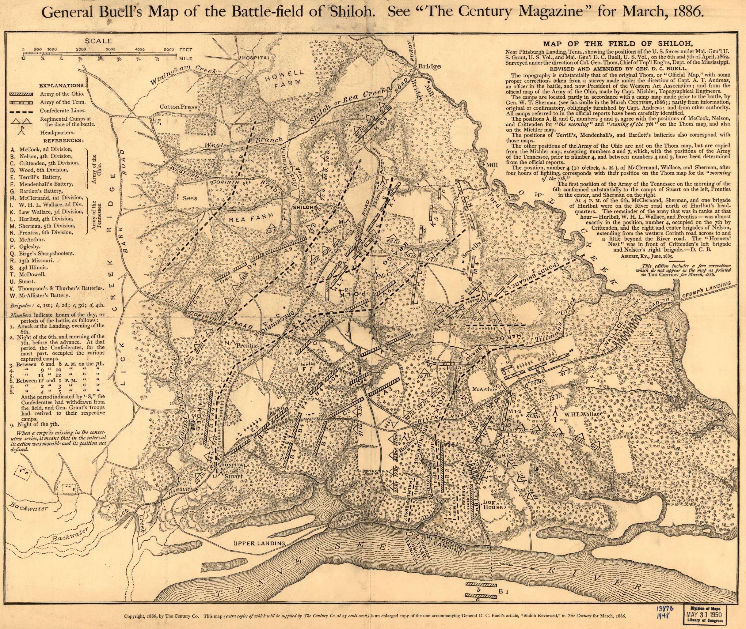
Old map of Shiloh, Tennessee, United States.

Created by Don Carlos Buell in 1886.
  • Scale ca. 1:14,500.
  • Civil War Map
  • "This map is an enlarged copy of the one accompanying General D. C. Buell's article, 'Shiloh Reviewed,' in The Century for March, 1886."
  • "This edition includes a few corrections which do not appear in the map as printed in The Century for March, 1886."
  • Detailed map showing the positions of the armies of the Ohio and Tennessee, Confederate lines, headquarters, "regimental camps at the date of the battle," roads, houses, drainage, vegetation, fields, and relief by hachures. The letters A-W identify Union divisions and batteries. "Numbers indicate hours of the day, or periods of the battles . . . "
  • Description derived from published bibliography.

Map Tags

1886

Don Carlos Buell

Map

Maps

Shiloh

Shiloh Battle Of Tenn

Tennessee

United States

Secure Checkout
Lifetime Warranty
Money-Back Guarantee
This old map of Field of Shiloh. April 6-7, 1862 from 1886 was created by Don Carlos Buell in 1886