

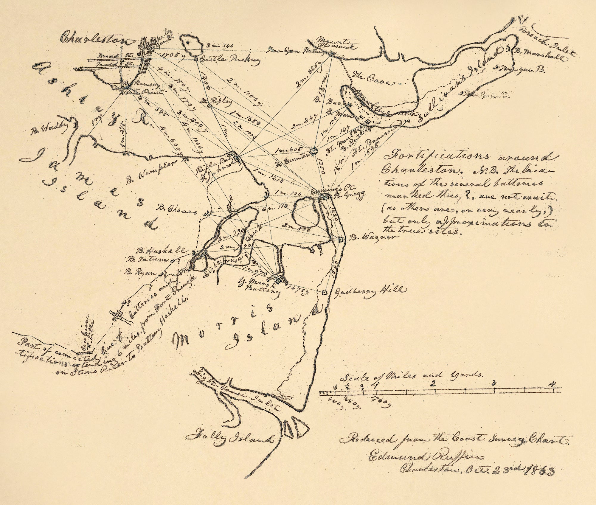
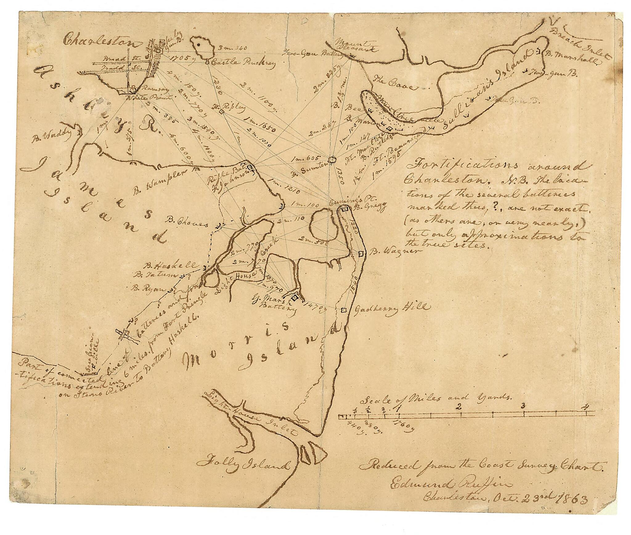
Fortifications Around Charleston, H.B. 1863
- Regular price
-
$49.95 - Regular price
-
$29.95 - Sale price
-
$49.95
Buy one map, get any other map in our collection for 50% OFF! Add to cart to see discount.
Couldn't load pickup availability
About This Map
Discover the timeless beauty of our fine art quality printed reproduction of this antique map. Perfect for history enthusiasts, collectors, and interior decorators.
Restored with meticulous attention to detail by our team with over a decade of experience, this stunning reproduction captures the intricate artistry and historical significance of the original map.
Whether you're a collector or seeking a unique decor piece, this archival-quality map reproduction is a timeless addition to any space. Order now to bring history to life!
Old map of Charleston Harbor, Charleston Region, South Carolina, United States.Created by Edmund Ruffin in 1863.
- "Reduced from the Coast Survey Chart."
- Dated: "Charleston, Oct 23rd, 1863."
- Shows approximate distances between batteries.
- This item is in the Map Collection of the Library of Virginia; please contact the Library's Archives Research Services department for more information.
- Source unknown; Oct. 2003, Map Cataloging Team.
- Civil War project no.: lva00154.
- Conservation: restored Aug. 1965; Etherington Conservation Center, Oct. 2003.
- Digital image available: 8.5 x 10.25 in.
- Map accession no. 5221 (2003).
- Previously filed as: MS 757 M6 1861-1865 1863.
Map Subjects
Charleston Harbor
Charleston Harbor (S.C.)
Charleston Region
Charleston Region (S.C.)
Civil War
History
Maps Manuscript
South Carolina
United States
Edmund Ruffin
1863
- For the best legibility, order your map in the original size or larger. Most maps have intricate detail and small text that is best appreciated when the print size hasn't been reduced.
- Sizes labeled "Fits a Standard Frame" will drop right into any frame that you purchase in that size. The sizes that we offer are commonly available online and at most retail stores.
- Our standard sizes are recommendations based on the aspect ratio of the original map, but still may require some added "white space" in one dimension to fit.
- Non-standard sizes will require custom framing, and we suggest taking your print to the frame shop of your choice after you receive it for the best results.
- Custom sizes are available, simply contact us for a quote.
Below is an approximation of the scale of a few standard sizes, and how they might appear in your space.

