
Geographical Chart of the Valleys of Andorra. (Carte Geographique De La Vallée D'Andorra) 1777
- Regular price
-
$89.95 - Regular price
-
$84.95 - Sale price
-
$89.95
Buy one map, get any other map in our collection for 50% OFF! Add to cart to see discount.
Couldn't load pickup availability
About This Map
Discover the timeless beauty of our fine art quality printed reproduction of this antique map. Perfect for history enthusiasts, collectors, and interior decorators.
Restored with meticulous attention to detail by our team with over a decade of experience, this stunning reproduction captures the intricate artistry and historical significance of the original map.
Whether you're a collector or seeking a unique decor piece, this archival-quality map reproduction is a timeless addition to any space. Order now to bring history to life!
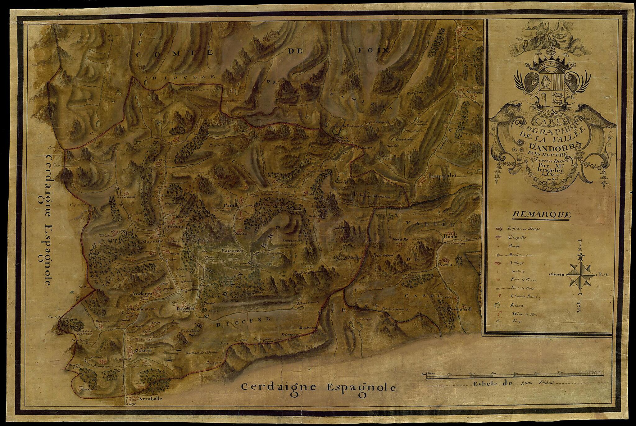
Old map of Andorra, France, Roussillon-Midi-Pyrénées.Dominique Cassini (1748-1845), one of a family of cartographers. The map shows the borders of Andorra with Spain, and the gates into the principality. The map indicates villages and their names, roads, and rivers and streams. Other features shown, as identified by the key on the lower right, include churches and chapels, water mills, roads, stone and wooden bridges, ponds, an iron mine and a forge, and the ruins of chateaux. Trees are used to show wooded areas. Relief is shown pictorially. Scale on the map is given in toises; one toise equals about 1.95 meters.
Created by Andorra. General Council of the Valleys, Nicolas Lengelée in 1777.
- Title devised, in English, by Library staff.
- "Map scale 1:62,000"--Note extracted from World Digital Library.
- Original resource extent: 1 map : color ; 55.5 x 84.5 centimeters.
- Original resource at: National Library and National Archives of Andorra.
- Content in Catalan and French.
- Description based on data extracted from World Digital Library, which may be extracted from partner institutions.
Map Subjects
Andorra
France
Roussillon-Midi-Pyrénées
Topographic Maps
Andorra. General Council Of The Valleys
Nicolas Lengelée
1777
- For the best legibility, order your map in the original size or larger. Most maps have intricate detail and small text that is best appreciated when the print size hasn't been reduced.
- Sizes labeled "Fits a Standard Frame" will drop right into any frame that you purchase in that size. The sizes that we offer are commonly available online and at most retail stores.
- Our standard sizes are recommendations based on the aspect ratio of the original map, but still may require some added "white space" in one dimension to fit.
- Non-standard sizes will require custom framing, and we suggest taking your print to the frame shop of your choice after you receive it for the best results.
- Custom sizes are available, simply contact us for a quote.
Below is an approximation of the scale of a few standard sizes, and how they might appear in your space.
